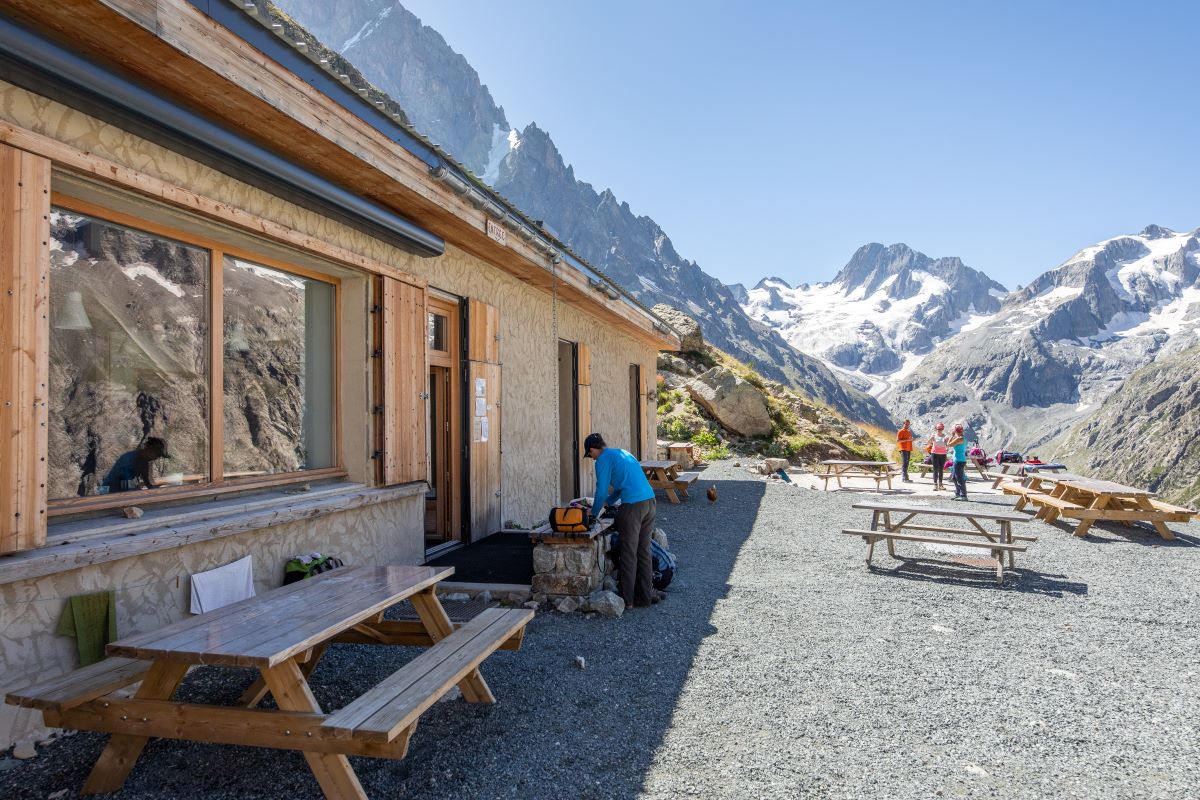
The Refuge Temple Écrins
An excursion with a near-Himalayan backdrop, which hugs the Vénon and climbs up through the pines to the Refuge Temple-Écrins, which stands at the foot of the Pilatte glacier.
Important information
Dans le Parc national des Écrins, les sentiers sont généralement praticables de la mi-juin à fin septembre.
Toutefois, les périodes d'accessibilité des itinéraires et les dates de pose des passerelles varient d’une année à l’autre en fonction de l’enneigement, des dégâts survenus en hiver et des conditions météorologiques. Par ailleurs, l’état des sentiers n’est pas contrôlé quotidiennement et peut évoluer rapidement après un évènement météorologique (orage, crue...). Il est nécessaire de se renseigner auprès des maisons du parc national et des offices de tourisme du territoire avant votre sortie. Pendant la randonnée, en cas de passage dégradé ou dangereux, faites demi-tour et signalez-le.
Description
- From the FFCAM buildings and the Mountain Centre ("Maison de la Montagne"), join the path running along the Vénéon towards the Refuge de Temple-Écrins (sign). The path gradually rises along the left-hand bank of the Vénéon, running for 4 kilometres along the valley bottom.
- Continue past the Refuge du Carrelet and after a short distance, turn left towards the Refuge de Temple-Écrins (sign). You rise steadily through the woods of Le Carrelet, with some large stone steps.
- As you emerge from the forest onto grassy slopes, the landscape opens up before you and the refuge is just 15 minutes away.
- To return, follow the outward route in reverse.
- Departure : La Bérarde
- Arrival : La Bérarde
- Towns crossed : Saint-Christophe-en-Oisans
7 points of interest
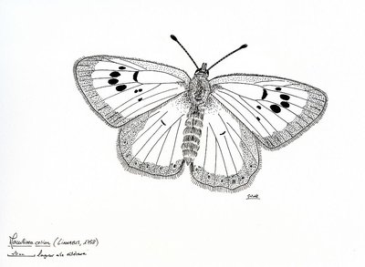
Azuré du serpolet - PNE - Grosselet Olivier  Fauna
FaunaLarge Blue Butterfly
This butterfly with blue wings spotted with black frequents the mountain grasslands and entrusts the ants with rearing its caterpillars... It lays its eggs on the host plant, the Breckland Thyme, whose flower buds feed the caterpillar until it lets itself fall to the ground. The Fire Ants take over. They are attracted by the honeydew produced by the caterpillar and they transport it to their anthill to milk it. . The caterpillar becomes carnivorous and eats the young ant larvae without being disturbed. It hibernates until the Spring. When it reaches maturity, it creates a chrysalis in the anthill. The butterfly hatches and quickly goes out in to the open air to carry out the reproduction of the species.
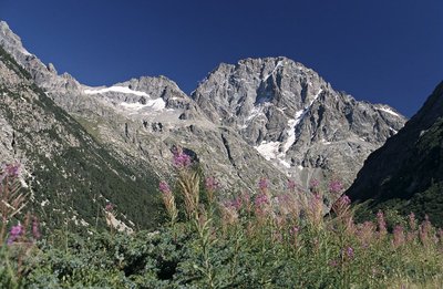
Versant nord ouest d'Ailefroide - PNE - Roche Daniel  Panorama
Conquest of the Ailefroide
By its magnitude, its height, its steepness, the conquest of the North-West face of the Ailefroide (impressive view of the North-West face of the Ailefroide which dominates Carrelet plain at an altitude of 3954 m) it is comparable with the famous Northern face of the Grandes Jorasses by Devies. The first ascent carried out by the corded team Devies and Gervasutti on the 23rd and 24th July 1936. On the approach from the Temple-Ecrins refuge Gervasutti broke a rib which did not stop him from carrying out this prestigious first.
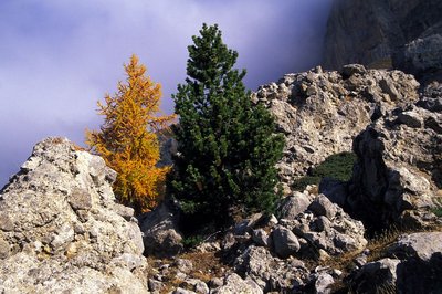
Pin à crochet (arbre de droite) - PNE - Nicollet Bernard  Flora
FloraMountain Pine pinewood
The pinewood of Mountain Pines at Carrelet is rightly considered to be the highest in Europe. In fact, it occupies a slope at an altitude of 2400 m. It is also developing downwards due to the end of pastoral bovine activity at the beginning of the 1970s. Progressively, the grassland has been colonized by the juniper heath which encourages the implantation of Mountain Pine.
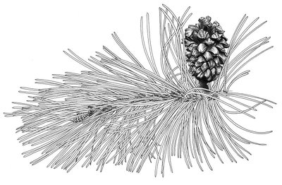
Pin à crochets - PNE - Lévy Frédérique FloraMountain Pine
The Mountain Pine is a high altitude species. This tree can be seen on the sunny slopes up to an altitude of 2450 m. If it can reach a height of 15 m locally it becomes much shorter and crooked even bushy when conditions are difficult... Its roots are solid, it is a frugal species that can support a very short vegetative period, extreme cold, snow, drought, the alpine brightness, the wind and the black ice,. It can be used as a species for reafforestation at altitude with a view to protecting certain soils and to fight against the beginning of avalanches...
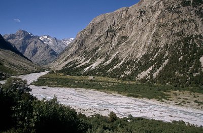
Le Plan du Carrelet - © Parc national des Ecrins - Cyril Couriser PanoramaPlan du Carrelet
At the meeting point of the Vénéon and Chardon valleys, the Plan du Carrelet is a vast plateau of glacial origin. It was originally a lake, after the glaciers withdrew, and was then gradually blocked by sediment coming down from the slopes all around, forming the vast plateau that can be seen today. Fed by the many mountain streams flowing into it, it is exceptionally rich in plant life, particularly species that are at home in wet and turbulent environments, like the banks of a mountain stream. In early summer, the plants bloom, providing an impressive sight , in the midst of the mountain pines, replanted at the beginning of the 20th century by the foresters, and which are now the prevailing species.
The Carrelet Refuge standing in the middle of the plateau was one of the oldest refuges set up by the Club Alpin Français, and dates from 1879. It is now a private residence and closed to the public.
 Know-how
Upkeep of the slopes and paths
The Restauration des Terrains en Montagne (RTM, "Restoration of Mountain Land") service, now part of the ONF, has been carrying out civil engineering work to combat erosion in the ravines near the path leading to the Temple-Ecrins refuge since 1882. Permanent monitoring and major annual maintenance work are needed to maintain thresholds, wire-mesh fencing, planting indigenous species and laying turf. Each year, the park rangers set up temporary walkways across the mountain streams.
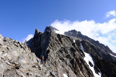
Col de la Temple - Mireille Coulon - Parc national des Ecrins  Pass
PassHigh attitude passages
The Col de la Temple (to the east of this trail), at an altitude of 3,322 m, constitutes a relatively easy passage between the Vallouise and the Vénéon. The last access slope to the pass is occupied by a small glacier that has greatly diminished in size in recent decades. The pass seems to be free of ice, but the ice is actually hidden by the stones. The story goes that once, a priest managed to go through the pass from the Vallouise to say mass at La Bérarde. Today, the pass is mainly peopled by mountain-climbers on their way to Pic Coolidge, standing at 3,774 m.
Forecast
Altimetric profile
Sensitive areas
Golden eagle
- Impacted practices:
- Aerial, , Vertical
- Sensitivity periods:
- JanFebMarAprMayJunJulAug
- Contact:
- Parc National des Écrins
Julien Charron
julien.charron@ecrins-parcnational.fr
Golden eagle
- Impacted practices:
- Aerial, , Vertical
- Sensitivity periods:
- JanFebMarAprMayJunJulAug
- Contact:
- Parc National des Écrins
Julien Charron
julien.charron@ecrins-parcnational.fr
Recommandations

Information desks

Oisans Park house
45 avenue de la République, 38520 Le Bourg d'Oisans
Video presentation of the natural resources of the Oisans mountain and its crafts. Information, documentation about the Park, projections, reading space for children. Accessible to people with reduced mobility. Free admission. All animations of the Park are free unless otherwise stated.

, 38520 Saint-Christophe-en-Oisans - La Bérarde
Transport
Grenoble bus station: +33 (0)4 76 87 90 31
Transisère: +33 (0)820 08 38 38 / http://www.transisere.fr/
Lines 3000 & 3030 run between Grenoble and Bourg d'Oisans. Then, line 3040 links Bourg d'Oisans and La Bérarde.
Access and parking
From Bourg d'Oisans or from La Grave, take the D1091 and then the D530 following signs to Vénosc. Continue straight on until you reach La Bérarde. During the winter, the road is closed to traffic between Champhorent and La Bérarde. The hamlets of Les Étages and La Bérarde are therefore cut off during this period, the duration of which varies according to snow conditions. To contact the Departmental Council: +33 (0)4 76 80 03 48.
Parking :
Source

Report a problem or an error
If you have found an error on this page or if you have noticed any problems during your hike, please report them to us here: