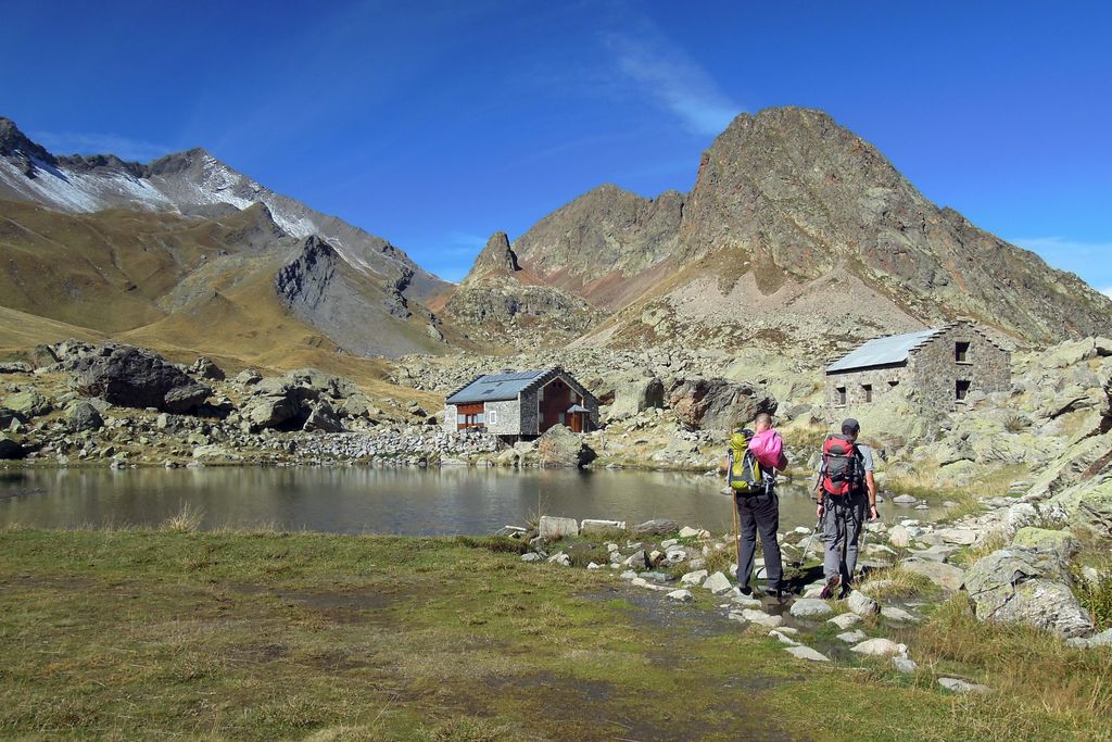
From Chabournéou to Vallonpierre on the Minister's footpath
"From Le Crépon, the Sirac catches the eye. It is there like an insurmountable barrier that the sun hopelessly tries to straddle. This summit draws us to it. Before heading to brush up against it by walking at its feet, you will be absorbed by the large variety of flora, and carried along by the song of birds from up there. North, South, East, West. This accessible walk covers all directions to ensure delight with every step. "
Régis Jordana, warden in the Valgaudemar area
Description
From the car park, take the footpath that goes down the Gioberney stream and cross the bridge. From there, follow the signs for "Refuge du Chabournéou". It is situated at an altitude of 1998 m, and takes about two hours to walk to. Behind the building, you will find the start of the footpath leading to the Vallonpierre refuge (1-hour walk). The now rocky path leads across the foot of the Sirac mountain, amidst silky alpine grey willows. After a short steep stretch, where you will need to be careful, you will reach a grassy plateau "Le Pré" on which you will find the Vallonpierre refuge at an altitude of 2271 m. Once you have made the most of the place, the return trip will take about an hour 45 minutes. To do so, go back slightly to join up with the GR54 trail. After going round the bends of the glacial cross-cliff on the way down, you will get to the "Pré de Surette" and its hut where a footbridge will take you across the Séveraisse stream. Cross another footbridge over the Pis stream. 300 m from here, you will reach the Minister's footpath that leads back to the car park directly.
- Departure : Crépon car park, La Chapelle-en-Valgaudemar
- Towns crossed : La Chapelle-en-Valgaudemar
12 points of interest
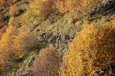
Randonneur sur le sentier du Ministre - Dominique Vincent - PNE  History
The Minister's footpath
A strange name for a footpath... Two explanations are given. The first, simply suggests that a minister inaugurated, or at least used, the footpath. The second, which is more likely, explains that donkeys were also known as ministers. Indeed, these animals were priceless to peasants of the time and they were pampered and treated accordingly. This path, which is mostly flat would have been well suited for them, and it would seem logical that it was given this name.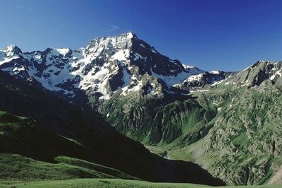
Le vallon de Surette et le Sirac - Olivier Warluzelle - PNE  Flora
FloraVariety of the natural environment
During this walk, you will face all four directions at some point. This feature gives a surprising variety of plant species, from almost Mediterranean vegetation to subalpine species on the north slopes, such as alpine grey willow (see description below). You will walk for some time in scree, then tread on short alpine prairies and its cushion-like plants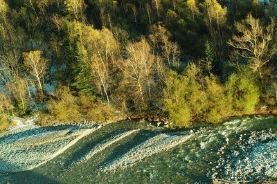
La Séveraisse et sa ripisylve - Ludovic Imberdis - PNE  Water
WaterStreams
Water is also omnipresent on this circuit. You will successively cross the Gioberney stream, the Pis stream, the Vallonpierre stream and the Sirac. They constitute a watershed that the Séveraisse absorbs to become the sometimes capricious stream that flows from one end of the Valgaudemar valley to the other.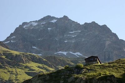
Le refuge de Chabournéou - Dominique Vincent - PNE  Hut
HutThe Chabourneou refuge
After 1 hour and forty-five minutes walking, you will come across the charming mountain refuge that is at an altitude of 2000 m. It is guarded in spring and is the starting point for ski touring routes such as the Jocelme or the Brèche en V. In the summer, backing onto the Sirac, it is at the limit between hiking and mountaineering: a first-rate location. You might be lucky enough to spot chamois that loiter on the neighbouring slopes at the end of the day, as the sun takes its time to leave.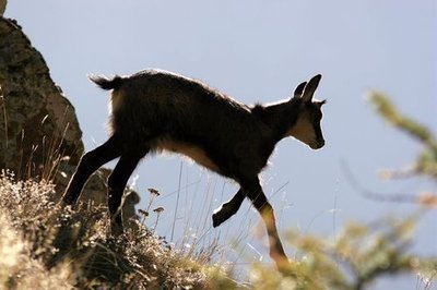
Jeune chamois - Robert Chevalier - PNE  Fauna
FaunaChamois
The chamois is an emblematic animal of the Alps and is at home anywhere in the mountains be it in the forests or rocky areas. It has short curved black horns and is a close relative of the antelope. It has particularly well developed sense of smell and hearing. It is consequently difficult to approach. However, near to the Chabournéou mountain refuge, and on the route towards that of Vallonpierre, it will be quite easy to enjoy the antics of the young kids on the névés that are still present. Did you know? While a walker is capable of climbing 400 m in an hour, the chamois is capable of climbing up 1000 m in ten minutes! This physical capacity is very useful for escaping danger.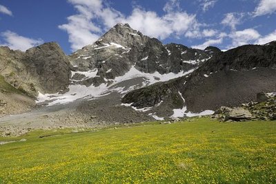
Le Sirac depuis Vallonpierre - Mireille Coulon - PNE  Top
TopThe Sirac
To the south of the Ecrins massif, the Sirac is the last high summit at an altitude of 3441 m. It stands at the end of the Séveraisse valley, proudly showing off it best side: its 1500-metre high north face. During this walk, you will regularly raise you amazed eyes as if to salute this Lord and its crown. You will walk at its feet whilst being overlooked by its hanging glaciers. Simply magic!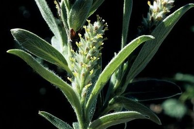
Chatons femelles du saule glauque et soyeux - Bernard Nicollet - PNE  Flora
FloraAlpine grey willow
At the subalpine level, above the highest limit of the forests, only bushes such as the alpine grey willow can be found. It is possible to find it on the north slopes of the Sirac, on the route between Chabournéou and Vallonpierre. It's milky green colour can be spotted from afar. If you look closer, you will notice its main characteristic, which is a silky hair that is on both sides of the leaves. One reasons for this peculiarity might be to store as much moisture as possible to avoid desiccation. Despite its abundance here, it should not be forgotten that it is not such a common species!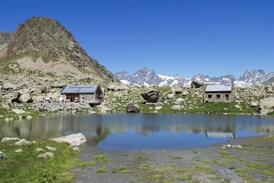
Le refuge de Vallonpierre - Dominique vincent - PNE  Hut
HutThe Vallonpierre refuge
A small lake, pretty meadows and the benevolent Sirac... This magical setting would lead to the construction of a refuge at an altitude of 2270 m in 1942. However, it was a victim of its own success and in 2000 the decision was made to build a second, bigger one. It can accommodate 37 instead of 22. This new building was the first modern mountain refuge to be built using stones on site rather than imported materials. It copies the simplicity and the crow-stepped gable from the "small refuge" which has been kept as lodgings for a warden's helper.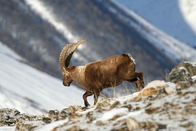
Bouquetin des Alpes - mâle - Jean-Philippe Telmon - PNE  Fauna
FaunaAlpine ibex
The species had almost completely disappeared from the French Alpine regions, and they survived thanks to our Italian neighbours, the kings of Savoy. Until the mid-15th century, they were still to be seen, but they were not wary of mankind and were hunted for their meat. Superstitious medical practice at the period also hastened their decline: their horns were ground into powder and used as a remedy for impotence, while the cross-shaped bone over their hearts was thought to ward off sudden death.
Successfully reintroduced into the Vanoise area in 1960, they were also brought back into the Champoléon valley over 20 years ago.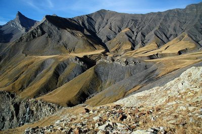
Vallon Plat, Col de Vallonpierre, Aiguille de Morges - Bernard Guidoni - PNE  Geology and geography
Impressive geology
From chabournéite, the native mineral of Valgaudemar, to the crystalline rock from the Sirac's gneiss, from the hollow of Vallonpierre made in sedimentary rock to the show that is given by the shale and tuffs on the Chevrettes pass, this circuit will take you back in time. The folds and the colours appear before you like an impressionist’s work of art.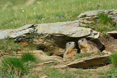
Marmottes à leur terrier - Mireille Coulon - PNE  Fauna
FaunaMarmot
A high-pitched whistle sounds in the mountain pastures it is the cry of the marmot on guard, warning its companions of the arrival of imminent danger from the sky. Any inattentive creature failing to take note should beware a golden eagle will carry them away in its talons to feed its young.
Native to the Alpine grassland, colonies of marmots live with their young until their third year. Gnawing and digging are their favourite pastimes, along with rolling down the slopes. And not forgetting an afternoon nap on a nice, warm rock and their long hibernation between October and March.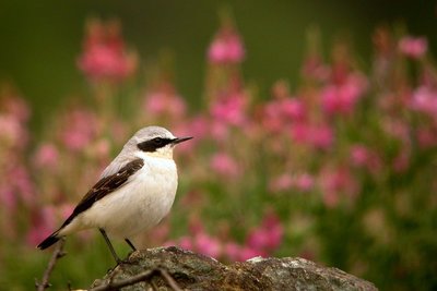
Traquet motteux - Damien Combrisson - PNE  Fauna
FaunaHigh altitude birds
Autumn is migration season. The mountains, which are too harsh in winter, loses their inhabitants. Some opt for a change in altitude and go lower down the valley or to the coast. This is the case for the alpine accentor, the redstart, the redpoll, or the Eurasian linette. Others head off on a long journey to warmer countries. The Sahara offers a milder winter to the common rock thrush, whinchat and wheatear. The lesser whitethroat will head to the east. In the summer, this fine bunch will meet up again in the mountains. It finds a sanctuary where the diversity of plants and invertebrates is preserved. The alpine pastures seem to be favourable for the reproduction of all of these species that are diminishing and need to be protected.
Forecast
Altimetric profile
Recommandations
The last 15 metres or so before reaching the plateau where the Vallonpierre is situated are somewhat high but this is the only difficulty on the walk. NB. It is also possible to do the return walk by continuing along the GR54 up to the old hamlet of Clot and its pastoral hut. You will then need to climb back 80 m up the glacial cross-cliff to easily reach the car park.
 In mountain pastures, protection dogs are there to protect the herds from predators (wolves, etc.).
When I hike I adapt my behavior by going around the herd and pausing for the dog to identify me.
Find out more about the actions to adopt with the article "Protection dogs: a context and actions to adopt".
Tell us about your meeting by answering this survey.
Information desks
Valgaudemar Park house
Ancien Asile Saint-Paul, 05800 La Chapelle-en-Valgaudemar
Information, documentation and a reception area with permanent and temporary exhibitions. La Maison du Parc is labeled "Tourism and Disability". Free admission. All animations of the Park are free unless otherwise stated.
Transport
Shuttle possible from St Firmin (reservation 36 hours in advance through Voyageurs 05) Connection with buses coming from Gap or Grenoble.
Access and parking
26 km from Saint Firmin, take the D58 and the D958a as far as La Chapelle en Valgaudemar. Then follow the D480a until you reach the Crépon car park, 800 m before the Gioberney refuge.
Parking :
More information
Source

Report a problem or an error
If you have found an error on this page or if you have noticed any problems during your hike, please report them to us here:


