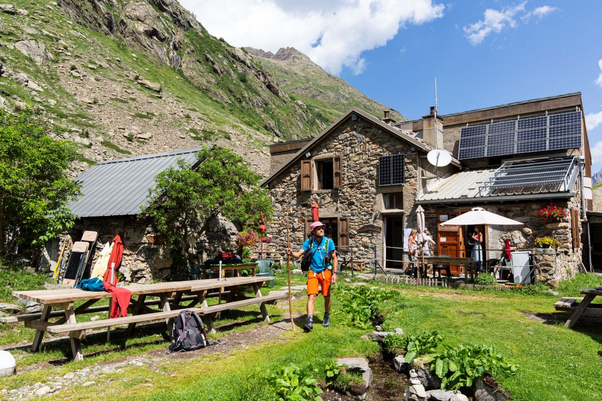
Lavey Refuge, Muande Valley
The Vénéon valley contains several smaller valleys, such as the Lavey valley, which is one of the most prestigious. It opens the way towards such famous summits as Les Rouies, La Tête des Fétoules, L’Aiguille de l'Olan and the Pointe Maximin corridor.
Description
From the car park, take the path marked "Vallon de la Lavey" near the signs marking the Ecrins National Park entrance.
Walk below the village as far as the River Vénéon, then cross the magnificent stone bridge over the torrent (remember to close the barrier behind you). With the Lavey waterfall to your left, take the winding path leading up to the Raya chalets.
Continue along the right bank of the Muande torrent as far as the new arched stone bridge. The route continues along the left bank as far as the Lavey refuge. The way back is through the villages of Le Souchey and Le Clot (in dry weather): 50 m before the stone bridge as you come down from the refuge, stay on the left bank of the Muande torrent. The path rises slightly before arriving at the village of Le Souchey. Then go down towards the Vénéon and Le Clot, and then cross a large wooden footbridge over the Vénéon. Go up the path and, just before the village of Le Clot, take the path leading to the Champhorent car park.
- Departure : Champhorent car park
- Arrival : Lavey refuge
- Towns crossed : Saint-Christophe-en-Oisans
14 points of interest
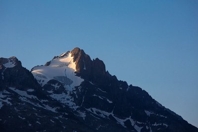
Le glacier et la Tête des Fétoules - Thierry Maillet - Parc national des Ecrins  Top
TopView over Tête des Fétoules
The Tête des Fétoules, a summit in the Ecrins mountains, rises to an altitude of 3,459 metres. Along with the Tête de l'Etret, among others, it is one of a series of peaks separating the Vallon des Etages (to the east) from the Vallon de la Lavey (to the west).
It was first climbed on 29 August 1876 by Emmanuel Boileau de Castelmau with Pierre Gaspard and his son.
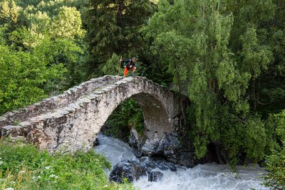
Pont de Pierre sur le Vénéon - Parc national des Ecrins - Thierry Maillet  Vernacular heritage
Pont du Vénéon
Crossing the Vénéon, this superb stone humpback bridge dates back to the seventeenth century. It is an example of the know-how of our forebears, and the fact that this substantial project was undertaken at all is an indication of the importance of this valley. This bridge also constitutes built evidence of the age-old human occupation of the La Lavey valley. The arch of this bridge was restored in 1972. The structure was decrepit and the joints were completely re-grouted. As you cross the bridge, note the colour of the water of the Vénéon. This is due to fine particles in suspension, the result of erosion of the glaciers in the upper reaches of the Vénéon and dissolved silica from the feldspars contained in the crystalline rocks.
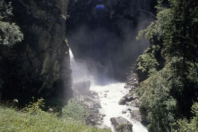
Cascade de la Lavey - Daniel Roche - PNE  Water
WaterLa Lavey waterfall
The valley of La Lavey is crossed by the mountain stream La Muande. One hundred and fifty metres upstream from the confluence of this mountain stream with that of the Vénéon, the valley culminates at a gorge and the La Lavey waterfall.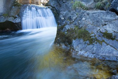
Torrent de montagne - © Parc national des Ecrins - Thierry Maillet  Water
WaterMountain streams
Mountain streams are characterised by a sometimes very steep slope and a tumultuous current. Due to the continual intermingling of elements, the water is highly oxygenated and favourable to certain animal species (brown trout, water invertebrates, etc.) that are adapted to the ecological conditions of these ecosystems (even when the water turns to ice !). Mountains streams are also a major factor in erosion due to their role in crushing elements and transporting sediment from the upper slope pools to the large rivers. They represent a very fragile and threatened environment, particularly due to human development, and are among the ecosystems needing to be protected !
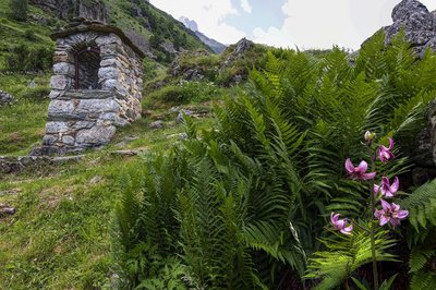
Oratoire de la Raja - Parc national des Ecrins - Thierry Maillet  Vernacular heritage
Oratory of the Virgin and Child in Raja.
In the mountains where the villages are sometimes isolated from each other and too small to have a chapel, oratories were often built. They are mainly small and made of local stone, with an alcove at the centre where a small statue, a plaque or a holy image is placed, representing an important element in religious life. A local place of worship, they are often dedicated to the Virgin Mary or to a saint. They become the goal of a procession or a votive festival for the local population.
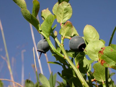
Vaccinium myrtillus - © Parc national des Ecrins - Christophe Albert  Flora
FloraBilberry
Just like the bearberry, the cranberry, the lingonberry and the European blueberry, the bilberry belongs to the Ericaceae family. It is a thick shrub, 20 to 60 cm high, with small leaves that are soft, alternating, oval and finely serrated. From August, the edible berries with their reddish blue flesh - hence their local nickname of gueule noire (black face) - provide a fine reddish colour to the sub-Alpine prairie slopes at the end of summer. It can grow beside the European blueberry (Vaccinium myrtillus) with its white pulp and non-serrated leaves.
Berry-picking is subject to specific regulations : In the Ecrins National Park, a maximum of 1 kg can be picked per person per day, and the use of a berry-picking comb is forbidden.
In the partnership zone of the Ecrins National Park and throughout the Isère department : 1 kg per person per day, with the use of a berry-picking comb forbidden before 15 August.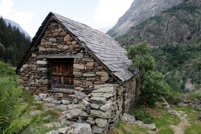
Maison en pierre et toit en ardoise au hameau de la Raja - Cyril Coursier - Parc national des Ecrins  History
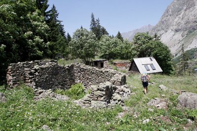
The deserted habitat of the Muande valley
The Lavey valley has a dozen deserted high-altitude habitats, including the Raja and Le Souchet. An analysis of charcoals has brought to light a probable habitation of the valley in the 13th century.
The present-day buildings in the valley date from the 18th and 19th centuries.
A number of elements are shared by all the deserted dwellings around St-Christophe en Oisans : high altitude (1,900 to 2,000 m on average), an original architecture made exclusively of dry stone with materials found onsite, and that is very robust, and has a small indoor area (from 8 to 40 m2)
They reveal the existence not only of buildings (houses and outbuildings), but also of an intricate series of walls, terraces and enclosures, dividing the land and corresponding perhaps to older agricultural divisions or to the material form of a complex distribution of land.
They show, above all, the tenacious, exceptional and hard-working presence of human beings who, at the cost of considerable labour, colonised and worked on the smallest parcel of land all the way up to the foot of the rocks and the glaciers.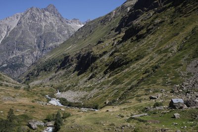
Pastoralisme dans le vallon de la Muande - © Parc national des Ecrins - Mathias Magen  Pastoralism
Pastoralism in the valley
Today, each year, in mid-June, some 800 sheep go up towards the Lavey valley. They are divided into flocks of about 400 animals each, and belong to two Oisans breeders. During the summer, they each occupy one of the slopes, and then return to the valley around 10 October each year. To make sure the two flocks do not mix, the Pierre bridge across the Vénéon has a wooden barrier that must be carefully closed each time visitors go through it. The flock currently grazing on the left bank of the valley has been going up each summer to this Alpine pasture for 35 years was previously led up by a local breeder.
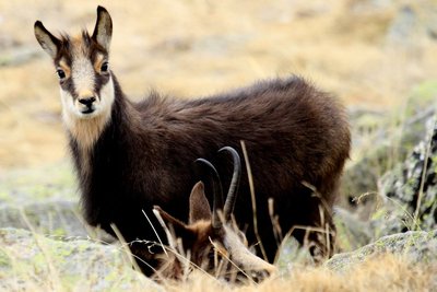
Un chamois - Jean-Philippe Telmon  Fauna
FaunaChamois
An animal symbolising the Alps, the chamois or "goat of the rocks", as it is nicknamed, has short black, hooked horns. Like the Alpine ibex, it is easier to observe with binoculars. The females and young males like to group together in large herds; the older male goats, however, are more solitary and only join the females during the mating season. In winter, the chamois are keen to preserve their tranquillity, since they can only survive by preserving their reserves of fat.
In the Lavey valley, the chamois are most easily seen in spring, when they come down from the high altitudes, attracted by the grass growing, and in autumn, during the breeding season, when it is quite common to see a male chasing another away from one slope to the next.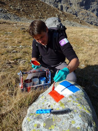
Garde moniteur peignant les limites de la zone coeur du Parc - Cyril Coursier  History
A flag on the rock: the central area of the National Park.
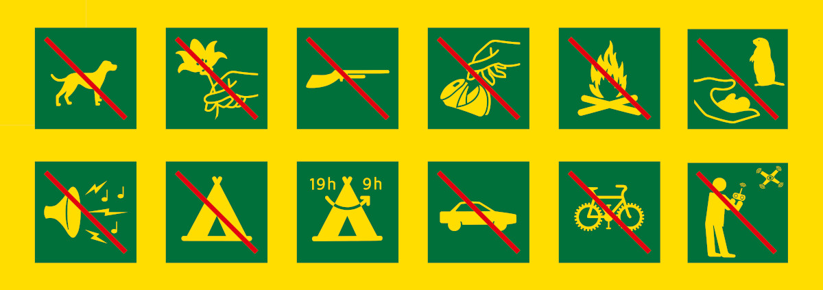
At the entrance of the Mariande valley, and in the Lavey valley, you can see red, white and blue flags, marking the limits of the central area of the Ecrins National Park, where the regulations apply to protect the natural heritage. The limitation area is regularly maintained by the rangers of the National Park.
 History
The chalets of Le Souchey
The birth of Alexandre EYMARD in Le Souchet in July 1881 shows that these summer pasture chalets were lived in at that time. Back then, every year, from mid-June to mid-September, the village of Le Souchet was the home of four families. Every summer, the women went with their children up to Le Souchet, while the men stayed in the villages in the valley.
The animals (sheep, goats and cattle) joined in the summer journey. The prairies around the village were mown, the hay gathered in and taken down to the valley in autumn, with the help of a cable running to Champhorent.
The families' livestock included, in general, about two cows, a dozen goats and fifty or so sheep.
In summer, the cows and goats were milked in the morning and evening to make cheese.
In the valley, the men collected the fodder, and some worked as mountain guides, an important extra source of income in the Alps.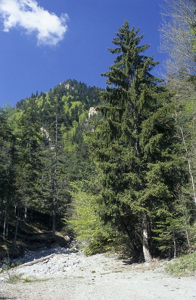
Epicéa - © Parc national des Ecrins - Bernard Nicollet  Flora
FloraNorway spruce
The cones of the fir tree, firmly fixed on the branches and standing like large candles, are hard to spot since they grow right at the summit of the tree. But the cones of the spruce hang from the end of the branches and fall to the ground when ripe. As for the leaves, the spruce's needles are slightly prickly, but not the fir tree's, which retain a characteristic deep green colour to the point of featuring on colour palettes as "pine green".
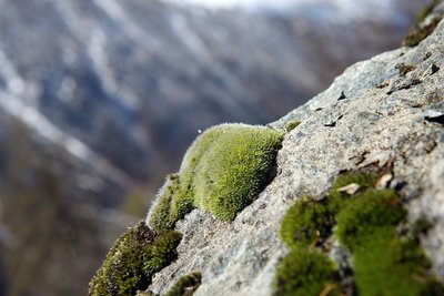
Grimmia alpestris sur un rocher - © Parc national des Ecrins - Cédric Dentant  Flora
FloraMosses
Bryophytes, more commonly known as mosses, are perfectly adapted to humid woodland environments, and are a vital component in the forest eco-system. A very ancient plant family, they reproduce through an archaic system of spores, and water is needed for their gametes to meet. They do not have roots, strictly speaking, but a system of rhizomes enabling them to be fixed to the soil, to a tree or a rock. They have the particularity of being able to survive when completely dehydrated in times of drought. This is called the reviviscence.

 Vernacular heritage
Old crop terraces
Below the car park in Champhorent there are terraces, most of them supported by a dry stone wall.
Before 1970, ten or so plots were still in cultivation (potatoes, turnips, barley and rye). At present, just four are in use.
Forecast
Altimetric profile
Sensitive areas
Golden eagle
- Impacted practices:
- Aerial, , Vertical
- Sensitivity periods:
- JanFebMarAprMayJunJulAug
- Contact:
- Parc National des Écrins
Julien Charron
julien.charron@ecrins-parcnational.fr
Recommandations
The circuit has some steep sections and is slippery in wet weather. Keep an eye on children in the exposed sections.
 In mountain pastures, protection dogs are there to protect the herds from predators (wolves, etc.).
When I hike I adapt my behavior by going around the herd and pausing for the dog to identify me.
Find out more about the actions to adopt with the article "Protection dogs: a context and actions to adopt".
Tell us about your meeting by answering this survey.
Information desks
Oisans Park house
Rue Gambetta, 38520 Le Bourg d'Oisans
Video presentation of the natural resources of the Oisans mountain and its crafts. Information, documentation about the Park, projections, reading space for children. Accessible to people with reduced mobility. Free admission. All animations of the Park are free unless otherwise stated.
Transport
Access and parking
From the RD 1091 Bourg d'Oisans-Col du Lautaret take the RD530 towards Venosc, Saint Christophe en Oisans, La Bérarde. Pass St Christophe (church, cemetery), continue for another 2.5km as far as Champhorent. Park at the car park marked "départ de la Lavey".
Parking :
Source

Report a problem or an error
If you have found an error on this page or if you have noticed any problems during your hike, please report them to us here:

