
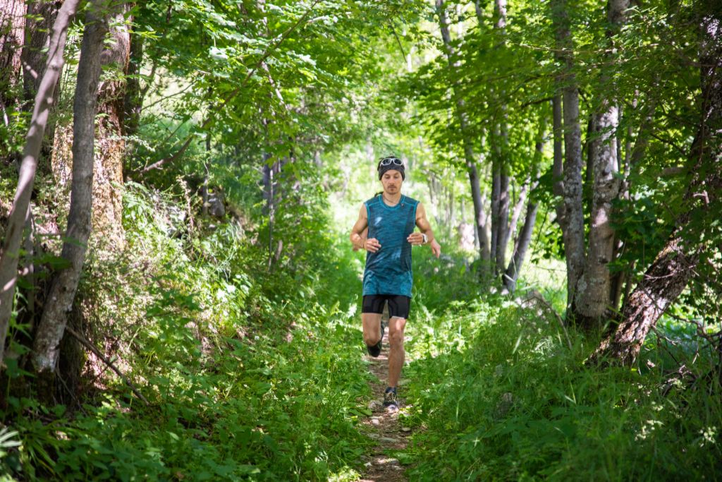
Puy Aillaud (trail route no. 19)
 Easy
Easy Trail
Trail“Emerging onto the plateau of Puy Aillaud amidst the meadows, passing below this tranquil hamlet and then dropping back down along an old track to the charming chapel of Saint-Jean almost makes you forget the great features of the rest of the route.” Marie-Geneviève Nicolas, park ranger at the Parc National des Écrins
Important information
Dans le Parc national des Écrins, les sentiers sont généralement praticables de la mi-juin à fin septembre.
Toutefois, les périodes d'accessibilité des itinéraires et les dates de pose des passerelles varient d’une année à l’autre en fonction de l’enneigement, des dégâts survenus en hiver et des conditions météorologiques. Par ailleurs, l’état des sentiers n’est pas contrôlé quotidiennement et peut évoluer rapidement après un évènement météorologique (orage, crue...). Il est nécessaire de se renseigner auprès des maisons du parc national et des offices de tourisme du territoire avant votre sortie. Pendant la randonnée, en cas de passage dégradé ou dangereux, faites demi-tour et signalez-le.
Description
When you come to the the Vallouise bridge ("Pont de Vallouise"), take the track leading up the left-hand bank of the Gyr leading towards Pelvoux.
- Cross the Gyr over a wide footbridge and after a short distance, on a hairpin in the track, take a path running below a stable and soon after this take the path on the right to Puy Aillaud.
- After the Pas d'Aval, a short narrow stretch through boulders, follow the yellow or white painted posts until you reach the road. Turn left onto the road to pass below the village of Puy Aillaud and the take the track towards the chapel of Saint-Jean.
- Turn left back onto the road for a hundred metres or so, leaving the walking trail that leads away straight ahead.
- After the hairpin, you plunge onto a steep path edged with deciduous trees running straight down the slope. The path runs through a forest of oak and pine trees, and you continue the descent until you reach Vallouise. The descent can be slippery in places.
- Departure : Camping Huttopia, Vallouise
- Arrival : Camping Huttopia, Vallouise
- Towns crossed : Vallouise-Pelvoux
9 points of interest
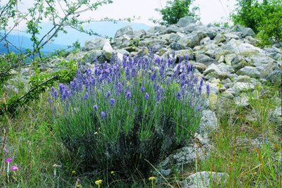
La lavande à feuilles étroites - Jean-Pierre Nicollet - Parc national des Écrins  Flora
FloraThe narrow-leaved lavender
The path crosses some limestone screes. It is a dry environment. The narrow-leaved lavender grows in sunny areas, a reminder that the Pays de Écrins is in the Southern Alps after all! Not to be confused with the lavandin, this plant naturally grows on rocky slopes in the mountains of the Midi.
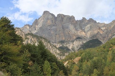
Le massif du Montbrison - Office de tourisme Pays des Écrins  Panorama
The Montbrison massif
The path offers a beautiful overall view of the limestone massif of Montbrison, overlooking the hamlets of Pelvoux with the peaks of the Cime de la Condamine, the Tête des Lauzières, the Pic de Montbrison and the Tête d'Amont.
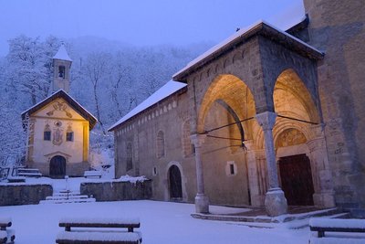
L'église Saint Etienne (à droite) et la chapelle des pénitents (à gauche) - Thierry Maillet - PNE  Architecture
Saint-Étienne de Vallouise Church
Listed and protected as an historic monument since 22 October 1913, the church dedicated to Saint Stephen is one of the most beautiful religious edifices in Hautes-Alpes. It is typical of the Romanesque churches in the Briançon region built in the second half of the 15th century, although its exact construction date is still uncertain.
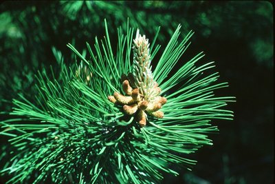
Aiguilles de pin sylvestre - Parc national des Écrins FloraForest of pine and oak
The path now alternates between cleared areas and forested areas. This forest contains Scots pine (recognisable by its orangey coloured trunk, especially at the top), downy oak (its young branches and leaf undersides covered with a fine down), and larch. The Scots pine and downy oak are very drought-tolerant (it is very limey soil here) and can also withstand low temperatures, and they are typical of the montane zone in this part of the Alps.
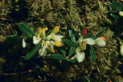
Polygale petit buis - Jean-Pierre Nicollet - Parc national des Écrins FloraThe shrubby milkwort
The shrubby milkwort grows in the undergrowth. This creeping sub-shrub has glossy oval leaves, similar to box leaves. The flowers are white and orangey yellow. Common in the Alps, it grows in open woods and dry forests.
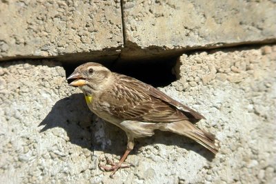
Le moineau soulcie - Damien Combrisson - Parc national des Écrins  Fauna
FaunaThe rock sparrow
A little flock of rock sparrows can often be spotted around Puy Aillaud. This large sparrow earned its French name moineau soulcie, (sourcil meaning eyebrow) because it has a large white eye-stripe. It also has a dark head, a brown back with white stripes, and a white breast and underside striped with light brown. It has a small yellow throat spot, often not visible. It is a year-round resident.
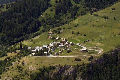
Hameau de Puy Aillaud - Jean-Philippe Telmon - Parc national des Écrins  History
The hamlet of Puy Aillaud
Puy Aillaud is a permanently inhabited hamlet and the highest in Vallouise (1,580 m). This hamlet has preserved some beautiful traditional houses.
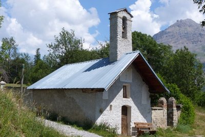
La chapelle Saint-Jean - Office de tourisme Pays des Écrins HistoryThe chapel of Saint-Jean
Surrounded by a cemetery and with a bench installed to the front of its façade, this pretty little seventeenth century chapel has an air of peaceful tranquillity. Maybe to sit and watch the trail runners?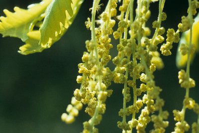
Chêne pubescent - Parc national des Écrins FloraThe downy oak
The route leads down a warm slope, where the downy oak reigns supreme. It is a small oak tree with a twisted growth habit and with marescent leaves, that is to say, they dry out in the autumn but remain on the tree all winter. It is called "downy" because the young branches, buds and sometimes the undersides of its leaves are covered in a fine down. It is a tree that grows happily on the warm dry slopes.
Forecast
Altimetric profile
Recommandations
Before setting off, it is very important to check the opening periods for this route on the website: https://stationdetrail.com/fr/stations/le-pays-des-ecrins/parcours
Share your photographs on social networks with #stationdetrailecrins
Check weather conditions before setting off.
Rescue services contact details: Secours Montagne (Mountain Rescue): +33 (0)4 92 22 22 22 or 112
Show consideration for the work of farmers, livestock keepers and owners
Close all gates behind you
Take your litter home
Do not take shortcuts across pastureland
The trail routes are also suitable for walking
Information desks
Place de l'Eglise, 05340 Vallouise
Vallouise Park house
, 05290 Vallouise
Information, documentation, models, exhibitions, screenings, product sales and works of the Park. Guided tours for school, reservation required. The new Park House opened in Vallouise since June 1, and offers visitors an interactive permanent exhibition inviting to explore the area and its heritage. A temporary exhibition space will allow a renewed offer. Finally, the device is completed by an audiovisual room to organize screenings and conferences Free admission. All animations of the Park are free unless otherwise stated.
Transport
Public transport >> www.pacamobilite.fr
Consider car-sharing >> www.blablacar.fr
For more information, ask at the Tourist Information Office nearest to the trail starting point.
Access and parking
10 km from L'Argentière-La Bessée, take the D994E.
Parking :
More information


Source

Report a problem or an error
If you have found an error on this page or if you have noticed any problems during your hike, please report them to us here: