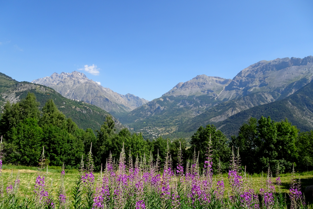
The Puy Saint-Vincent Heritage Path
A perfect combination of discoveries: hamlets, human heritage and an excursion bordering meadows and small woods, enhanced by crossings over little bridges spanning cool refreshing streams!
Description
Waysigning: follow the heritage path signs for Les Prés-Saint Romain (« Sentier du patrimoine – Les Prés – Saint Romain »
A large sign “Sentier du Patrimoine”on the D4 just before you enter Puy Saint-Vincent indicates the start of the path. Head towards the track lower down which runs level below the various hamlets of Puy Saint-Vincent, alternating between meadows and groves of trees.
- At the crossroads with the D4, go through the hamlet of Le Puy, past the communal oven and the church.
- On the D4, take the road running downhill past some wooden guardrails and then continue straight ahead until you come to the Chapelle Saint-Romain.
- At the Chapelle Saint-Romain, turn back on yourself and follow the outward route in reverse. At the “Sentier du Patrimoine” sign you passed at the beginning of the trail, you can continue the itinerary as far as the hamlet of Les Prés by taking the footpath on the left just after you enter Puy Saint-Vincent. Carry on to the large multi-storey car park. Skirt around it by taking the stairs and carry straight on towards Les Prés.
- At the crossroads, fork left and then continue straight ahead until you come to the Chapelle Sainte Marie Madeleine.
- Departure : Just outside Puy Saint-Vincent - Les Alberts
- Arrival : Just outside Puy Saint-Vincent - Les Alberts
- Towns crossed : Puy-Saint-Vincent
8 points of interest
Hameau des Prés - Marie-Geneviève Nicolas - Parc national des Écrins  History
Les Prés, hamlet of Puy-Saint-Vincent
Le Prés is one of the main hamlets of Puy-Saint-Vincent. Like Le Puy and Les Alberts, it stands on a flat plateau which is a glacial escarpment left by the now-retreated Gyronde glacier. Like Prey d'Aval, Prey du Milieu and Prey d'Amant, its name is a reminder that prior to the development of the ski resort, the land here used to be shared by meadows and crops.
La chapelle Sainte Marie Madeleine - Office de tourisme Pays des Écrins  History
The church of Sainte-Marie-Madeleine-des-Prés and its two sun dials
The charming little church of Sainte-Marie-Madeleine-des-Prés, which dates from the sixteenth century, stands in the hamlet of Les Prés. It is surrounded by a wall and a cemetery. On the walls of the church, two sun dials can be seen, both engraved and painted on plaster in 1718. The first is above the door, telling the time in the afternoon, bearing the saying « for a moment of delights, an eternity of torments » which alludes to the life of Saint Mary Magdalene, the well-known sinner who is venerated as a model of penitence. The second, telling the time in the morning, bears the Latin phrase Ars longa, vita brevis which translates as« learning is long, life is short ».
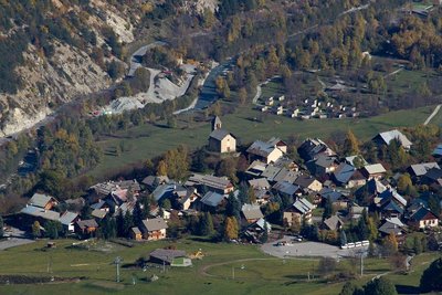
Vue sur Puy Saint Vincent - Christophe Albert - Parc national des Écrins  History
The Sentier du Facteur - the postman's path
In former times, the postman would take this path every day: He would set out from Vallouise, deliver letters in Puy-Saint-Vincent and drop back down to Vallouise, stopping at the hamlets of Parcher on the way. In the winter, when the snow was too deep, the Traversouires (the inhabitants of Puy-Saint-Vincent) donned their snowshoes and wielded their shovels to clear the postman's path down to Vallouise.
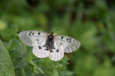
Le semi-apollon - Mireille Coulon - Parc national des Écrins  Fauna
FaunaThe clouded Apollo
This butterfly with hyaline (glass-like) translucent white wings, marked with two black spots, flutters around the clearing or the edges of the forest, where the host plants of its caterpillars grow: the corydalis. Although abundant locally, it is nevertheless a species in sharp decline and is protected.
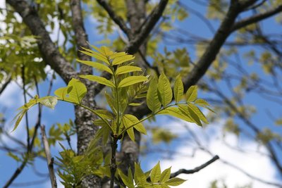
Un frêne élevé - Marie-Geneviève Nicolas - Parc national des Écrins  Flora
FloraThe ash tree
This is one of the most common trees, provided the ground is relatively cool. It is characterised by its pinnate leaves, that is to say, made up of several segments, and in winter is can be recognised by its large black leaf buds. The ash was extremely important in times past: its foliage was used to feed cattle and its hard, flexible wood was used to make a variety of objects such as tool handles.
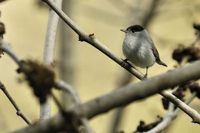
Fauvette à tête noire - Mireille Coulon - Parc national des Écrins  Fauna
FaunaThe Eurasian blackcap
Hidden in the tree foliage, the Eurasian blackcap announces its presence with its loud and piping song. Its head is adorned with a cap which is black in the male and russet in the female. The rest of its plumage is greyish, its underside lighter than its back. It is a migratory bird which travels to the Maghreb to overwinter. However, increasing numbers of birds make only a partial migration, flying to the south of France to spend the winter.
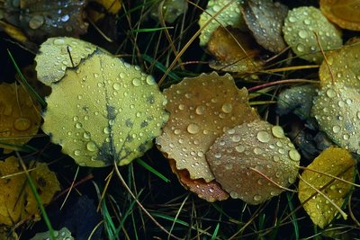
Des feuilles de tremble - Bernard Nicollet - Parc national des Écrins  Flora
FloraThe aspen
A sizeable aspen grows on the roadside, on the edge of a small wood of fellow-aspens. This tree has a smooth, greenish trunk and rounded, crenelated leaves which take on magnificent colours in autumn. The stem, or petiole, of aspen leaves is flat and twisted, so it can be caught by the slightest breeze making the foliage «quake» hence its common name, the quaking aspen. It grows in places where the soil is quite damp.
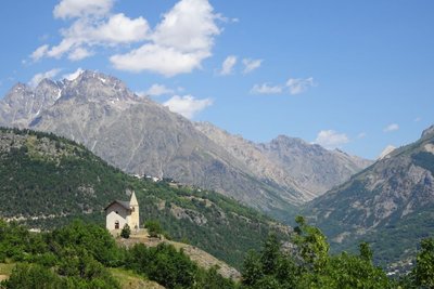
La chapelle Saint-Romain - Office de tourisme Pays des Écrins  History
The chapel of Saint-Romain
Included on the Supplementary Inventory of Historical Monuments in 1931, the chapel of Saint-Romain has been converted into an eco museum. It was the first chapel to be built in Puy-Saint-Vincent and is thought to date from the twelfth century. Up to the mid-fifteenth century, the village bore the name of its patron saint: Puy-Saint-Romain. Then, in honour of the arrival of the Dominican monk Vincent Ferrier, the village took the name Puy-Saint-Vincent. It stands on a rocky promontory outside the village, and offers a panoramic view over the Les Écrins massif and the Gyronde Valley, over Vallouise in particular.
Forecast
Altimetric profile
Recommandations
The itinerary can be followed in either direction.
Information panels explaining the human heritage are provided along the way.
Check weather conditions before setting off.
Rescue services contact details: Secours Montagne (Mountain Rescue): +33 (0)4 92 22 22 22 or 112
Show consideration for the work of farmers, livestock keepers and owners
Close all gates behind you
Take your litter home
Do not take shortcuts across pastureland
Information desks
Les Alberts, 05290 Puy Saint Vincent 1400 m
Vallouise Park house
, 05290 Vallouise
Information, documentation, models, exhibitions, screenings, product sales and works of the Park. Guided tours for school, reservation required. The new Park House opened in Vallouise since June 1, and offers visitors an interactive permanent exhibition inviting to explore the area and its heritage. A temporary exhibition space will allow a renewed offer. Finally, the device is completed by an audiovisual room to organize screenings and conferences Free admission. All animations of the Park are free unless otherwise stated.
Transport
Public transports >> www.pacamobilite.fr
Consider car-sharing >> www.blablacar.fr
For more information, ask at the Tourist Information Office nearest to the trail starting point.
Access and parking
8.5 km from L'Argentière-La Bessée, take the D994E and then the D4.
Parking :
Accessibility
- Accessibility level :
- Beginner
- Emergency number :
- 114
Source

Report a problem or an error
If you have found an error on this page or if you have noticed any problems during your hike, please report them to us here:

