
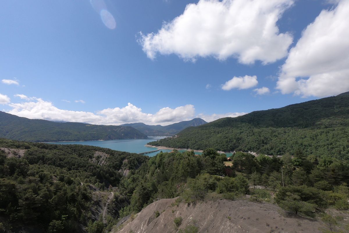
Sentier des Curattes - Les Curattes path
 Easy
EasyFrom the panorama of the Baie St-Michel, this circuit initially leads through a rural landscape. Passing the belvedere of Les Curattes, you continue through forests. From the high lake, numerous wild areas await you before taking you back to the beaches of the Baie St-Michel.
Important information
Dans le Parc national des Écrins, les sentiers sont généralement praticables de la mi-juin à fin septembre.
Toutefois, les périodes d'accessibilité des itinéraires et les dates de pose des passerelles varient d’une année à l’autre en fonction de l’enneigement, des dégâts survenus en hiver et des conditions météorologiques. Par ailleurs, l’état des sentiers n’est pas contrôlé quotidiennement et peut évoluer rapidement après un évènement météorologique (orage, crue...). Il est nécessaire de se renseigner auprès des maisons du parc national et des offices de tourisme du territoire avant votre sortie. Pendant la randonnée, en cas de passage dégradé ou dangereux, faites demi-tour et signalez-le.
Description
From the car park, stay on the road and turn right.
- At «Mas des Bâtardes», take the track on the left towards Les Curattes. Follow the track running along the field edges and the railway line. At the «les Mareisson» crossroads, go straight on towards Les Curattes. Just opposite, take the track on the right leading into the forest.
- When you reach the track in Le Gorny, turn left and carry on past the abandoned farm. At the next intersection, make a 800-metre there-and-back detour to the orientation table. Then return to the intersection and head in the direction of Chanteloube.
- At Chanteloube, take the path on the left towards the Baie St-Michel. Carry on for several kilometres, passing the «le Serre de l'aigle», «les Curattes», «Pra de l'ase», «sous les Curattes» and finally «Rougon». At the first dwellings, take the rightmost path. When you reach the track, turn left and back onto the road. At «La plage des Pommiers» (apple tree beach), head up the road towards La Couche and back to the car park after the memorial.
- Departure : Baie St Michel, Chorges
- Arrival : Baie St Michel, Chorges
- Towns crossed : Chorges
9 points of interest
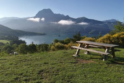
Panorama Baie st Michel - Amélie Vallier  Panorama
Panorama of the Baie Saint-Michel
This area, which has been provided with picnic amenities, offers the most picturesque panorama over the Lac de Serre-Ponçon. In fact, the lake is 2 kilometres wide at this point, and in front of you are the Chapelle Saint Michel and the Pic Morgon, an iconic view of the lake. On your left, to the east, you can see Savines-le-Lac and its bridge. On the right, you can see the secret île de la Tortue.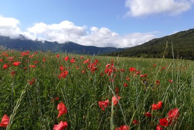
les méssicoles - Amélie Vallier  Flora
FloraMessicole plants
A feature of messicole plants is that they live among crops, even though not sown there deliberately. They are biologically adapted to open areas, and in particular areas that are regularly worked, such as fields. In fact, they use various strategies such as adapting their life cycle and producing large amounts of seeds in order to make up for the disturbance that occurs in their germination area. Many of them are common, such as the poppy, the cornflower and the corn buttercup...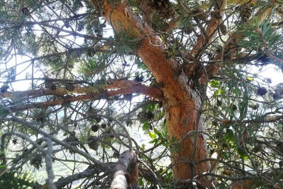
Tronc coloré du Pin sylvestre - Amélie Vallier FloraScots pine
Scots pine is a softwood tree like fir, spruce, larch and juniper. It reaches a height of 30 m (under the best conditions) and is easily recognisable thanks to the orange-red tinge of its branches and the upper part of its trunk. Its short needles are grouped in pairs. Its cones, also known as pine cones, release winged seeds.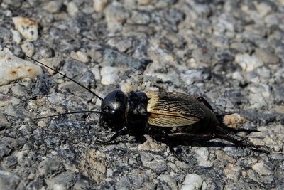
Grillon Champêtre - Mireille Coulon - PNE  Fauna
FaunaThe field cricket
Just 18 to 26 mm long, this little insect has a black head which looks a little like a helmet. The female can be told apart from the male by the presence of a third long appendage at the rear of the body. The cricket’s song is heard from April onwards. The male sings his chirping song from the entrance to his burrow. The fertile females lay their eggs in the ground, which remain there for two weeks before the larvae emerge.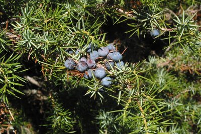
Genévrier commun - Jean-Pierre Nicollet - PNE FloraCommon juniper
This bush is a resinous evergreen conifer. It is characterised by its greenish to blue (glaucous) needles with a white line on their upper side, and fruits resembling blue-black berries. It usually tends to grow in warm environments receiving plenty of sunlight. It grows in grassy or scrub covered areas up to 2,000 metres above sea level.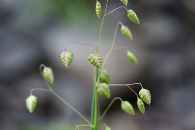
Amourette commune - Bernard Nicollet - PNE FloraQuaking- grass
Quaking-grass or briza media is a plant in the family of upright Poaceae and can reach a height of up to 80 cm. The leaves are 2 to 5 mm wide. The heart-shaped hanging spikelets are coloured purple, changing to yellow as they mature. They tremble in the slightest breeze, hence the name. This very common grass is found in meadows and dry grasslands.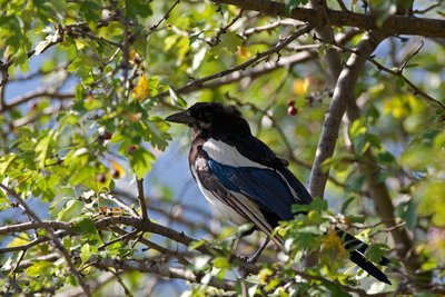
Pie bavarde - Pascal Saulay - PNE FaunaCommon magpie
This bird can be identified by its black and white plumage with blue-green tints on the wings and tail. Its tail is remarkably long. It can be found all year round in varied open environments. Its omnivorous diet consists of invertebrates, seeds and berries, small rodents, eggs and nestlings and even human rubbish. Except during the nesting period when it is solitary, the magpie is gregarious species which gathers into rather raucous groups in the winter.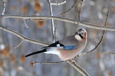
Geai des chênes - Mireille Coulon - PNE FaunaEurasian jay
The Eurasian jay has a colourful plumage. Its black tail and blue wing streak helps to identify this relatively shy bird. It regularly utters raucous caws, but also frequently imitates the calls of several other species. In late winter, jays assemble in groups and sing as a choir, uttering whistles and chirps in a cheerful chatter. They all display their finest feathers and adopt comical attitudes, in preparation for forming into pairs.
Les terres noires ravinées - Amélie Vallier  Geology and geography
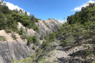
Gullied black earth
Prized by mountain bikers, Terres Noires, or black earth, is formed from rocks which erode easily. The flows caused by precipitations shape and sculpt these friable marls. In the Alpine region, numerous examples can be seen, in particular on slopes, which vary in gradient depending on the area, which increases the speed of the water flow.
Forecast
Altimetric profile
Recommandations
This route leads through areas exposed to the sun: hats and water bottles are recommended.
Remember that you are sharing the path with other users
Information desks

Tourist office Chorges
Grand rue, 05230 Chorges
October to may : Monday to Saturday, 9.00 - 12.30 & 13.30 - 17.00.
April, may, june & september : Monday to Saturday, 9.00 - 12.30 & 14.30 - 18.00
July and August : Monday to Saturday, 9:00 – 12.30 & 14.30 – 19.00 Sunday 9.30 – 12.30
Closed on Thursdays outside French holidays’ periods
Closed on French national holidays, except 14th of July and 15th of August
Transport
Nearest SNCF train station: Chorges
Consider car-sharing:
Public transport: www.pacamobilite.fr
Consider car-sharing: www.blablacar.fr
Access and parking
From Chorges or Embrun along the N94, head to the Baie St-Michel and turn right to reach the memorial.
Parking :
Accessibility
- Emergency number :
- 114
More information

Source

Report a problem or an error
If you have found an error on this page or if you have noticed any problems during your hike, please report them to us here: