

At the gateway to the Ecrins
 Medium
You'll need to be well prepared at the start of the route to tackle the slopes of Puy-St-Eusèbe before arriving at the pretty village of Réallon and its 16th-century church. The ascent comes to an end at the foot of the Ecrins National Park. Quite a reward!
Important information
Dans le Parc national des Écrins, les sentiers sont généralement praticables de la mi-juin à fin septembre.
Toutefois, les périodes d'accessibilité des itinéraires et les dates de pose des passerelles varient d’une année à l’autre en fonction de l’enneigement, des dégâts survenus en hiver et des conditions météorologiques. Par ailleurs, l’état des sentiers n’est pas contrôlé quotidiennement et peut évoluer rapidement après un évènement météorologique (orage, crue...). Il est nécessaire de se renseigner auprès des maisons du parc national et des offices de tourisme du territoire avant votre sortie. Pendant la randonnée, en cas de passage dégradé ou dangereux, faites demi-tour et signalez-le.
Description
- From the Centrale car park, come to a roundabout on the D41 and turn right towards Puy-Saint-Eusèbe (D641). After a 2.5 km climb, take the D741, still heading towards Puy-Saint-Eusèbe, and continue climbing. Cross the hamlet of Les Pins to Le Villard.
- At the primary school, head towards Réallon along the D9. The view is unobstructed and offers a lovely vantage point over the Ecrins massif. The view is becoming increasingly interesting. Orgues (rock pillars), streams and marl follow one another in a wooded environment. Go past Les Méans and, at the next junction, turn right towards Réallon (D41). The landscape will not fail to impress.
- Cross Réallon, observe the remains of an ancient fort and continue through the heart of this valley to reach the hamlet of Les Gourniers, at the gateway to the Ecrins National Park. The road ends here, so you will now have to turn around and go back to the D9/D41 junction.
- Then turn right towards Savines-le-Lac. Pass Les Rousses and, at the next roundabout, follow the D41 towards Savines-le-Lac. Watch your speed on this beautiful descent, while enjoying the views over Serre-Ponçon Lake. Finally reach the valley by the railway line and return to the car park just after the roundabout.
- Departure : Parking de la Centrale, Savines-le-Lac (D41 north of the lake)
- Arrival : Parking de la Centrale, Savines-le-Lac (D41 north of the lake)
- Towns crossed : Savines-le-Lac, Puy-Saint-Eusèbe, and Réallon
Forecast
Altimetric profile
Information desks
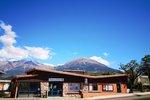
Tourist office Savines-le-Lac
9 Avenue de la Combe d'Or, 05160 Savines-le-Lac
October to march : Monday to Saturday, 9.00 - 12.30 & 13.30 - 17.00.
April, may, june & september : Monday to Saturday, 9.00 - 12.30 & 14.30 - 18.00
July and August : Monday to Saturday, 9.00 - 13.00 & 15.00 - 19.00. Sundays, 10.00 - 13.00 & 15.00 - 18.00
Closed on French national holidays, except 14th of July, and 15th of August
Closed on Thursdays outside French holidays’ periods
Transport
- Zou! Network : Line 69 / Frequency : Every 4 hours
- Zou! network : Line 69 / Frequency : Every 4 hours
Access and parking
Parking :
More information

Source

Report a problem or an error
If you have found an error on this page or if you have noticed any problems during your hike, please report them to us here: