

Loop 48 - The Lookouts of Serre-Ponçon
 Medium
Important information
Dans le Parc national des Écrins, les sentiers sont généralement praticables de la mi-juin à fin septembre.
Toutefois, les périodes d'accessibilité des itinéraires et les dates de pose des passerelles varient d’une année à l’autre en fonction de l’enneigement, des dégâts survenus en hiver et des conditions météorologiques. Par ailleurs, l’état des sentiers n’est pas contrôlé quotidiennement et peut évoluer rapidement après un évènement météorologique (orage, crue...). Il est nécessaire de se renseigner auprès des maisons du parc national et des offices de tourisme du territoire avant votre sortie. Pendant la randonnée, en cas de passage dégradé ou dangereux, faites demi-tour et signalez-le.
Description
- At Chorges station, at the roundabout, head towards the town centre. Pass the Brasserie des Alpes and go straight through the town centre. Before the N94, continue left on the D9 towards Réallon.
- At the farm, turn right towards Les Augiers (GR markings). At the entrance sign to the hamlet, take the track on the left. At the Route des Puy (D109), turn right into the hamlet of L'Eglise. Once there, turn left onto the route de Chabrières. Continue up the main hairpin road. At the viewpoint on the bend, turn right up the Chemin de la Clouisse.
- After the farm (watch out for the Patou), turn right. Stay on the level on the main path around the knoll. At the crossroads of the 4 paths, continue straight up the stony track. Continue straight ahead: cross the D9 road, continue on the route des Gourres. At the hamlet of Pomeyret, continue on the main road with its hairpin bends. At the DFCI track F8, continue straight ahead on the GR.
- Continue on the Joubelle forest road (Track DFCI F1). At the DFCI marker, continue to the right, past the fountain and stay on the main track (DFCI F1 stony path).
- At the DFCI S7 track, go down to the left (GR markings). Go through the hamlet (viewpoint). /!\ Quite a stony descent. After the "Serre du corbeau", continue left on the GR 50, then straight on towards Les Andrieux.
- At the bend, continue on the track to the right. Turn left down the hairpin road. At Les Thomassons, descend the road to the left.
- At the bus stop (mirror), turn left and then immediately right. Continue straight ahead on the small road. Take the downhill option to the left twice. At the roundabouts, take 2 right turns, following the signs for Gap and then the SNCF station to reach the finish line.
- Departure : Chorges
- Arrival : Chorges
- Towns crossed : Chorges and Prunières
1 point of interest

 Fauna
"Piolit-Pic de Chabrières" Natura 2000 site
(Le Piolit 2664m, les aiguilles de Chabrières 2403m)
These grasslands, scree slopes and forests are home to rare and protected species such as the Fox-tail Milkvetch and the Potentilla delphinensis (for plants), the Jersey Tiger, the Rock partridge, the Greater Horseshoe Bat, the White-clawed crayfish, the red frog and the golden eagle (for animals).
Forecast
Altimetric profile
Recommandations
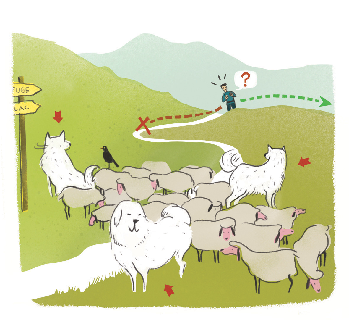 In mountain pastures, protection dogs are there to protect the herds from predators (wolves, etc.).
When I hike I adapt my behavior by going around the herd and pausing for the dog to identify me.
Find out more about the actions to adopt with the article "Protection dogs: a context and actions to adopt".
Tell us about your meeting by answering this survey.
Information desks

Tourist office Chorges
Grand rue, 05230 Chorges
October to may : Monday to Saturday, 9.00 - 12.30 & 13.30 - 17.00.
April, may, june & september : Monday to Saturday, 9.00 - 12.30 & 14.30 - 18.00
July and August : Monday to Saturday, 9:00 – 12.30 & 14.30 – 19.00 Sunday 9.30 – 12.30
Closed on Thursdays outside French holidays’ periods
Closed on French national holidays, except 14th of July and 15th of August
Transport
Bus : Valserres, La Bâtie Neuve, Chorges, Puy Saint Eusèbe, Puy Sanières, Embrun Baratier, Les Orres, Remollon, Theus, Espinasse
Marseille-Briançon : (LER29)
Marseille, Nice : Lignes Express Régionales (LER) +33 (0)809 400 415
Grenoble : Transisère +33 (0)4 26 16 38 38
Gap-Barcelonnette (LER535)
Carpooling area : Rond point des Orres - 05200 Baratier
Plane:
Marseille Provence Airport (188km) - +33 (0)820 811 414
Grenoble Alpes Isère Airport (158km) - +33 (0)4 76 65 48 48
Lyon Saint Exupéry Airport - (203km) +33 (0)826 800 826
Turin Caselle Airport - (178km) + 39 011 567 63 67
Access and parking
Parking :
More information


Source

Report a problem or an error
If you have found an error on this page or if you have noticed any problems during your hike, please report them to us here: