
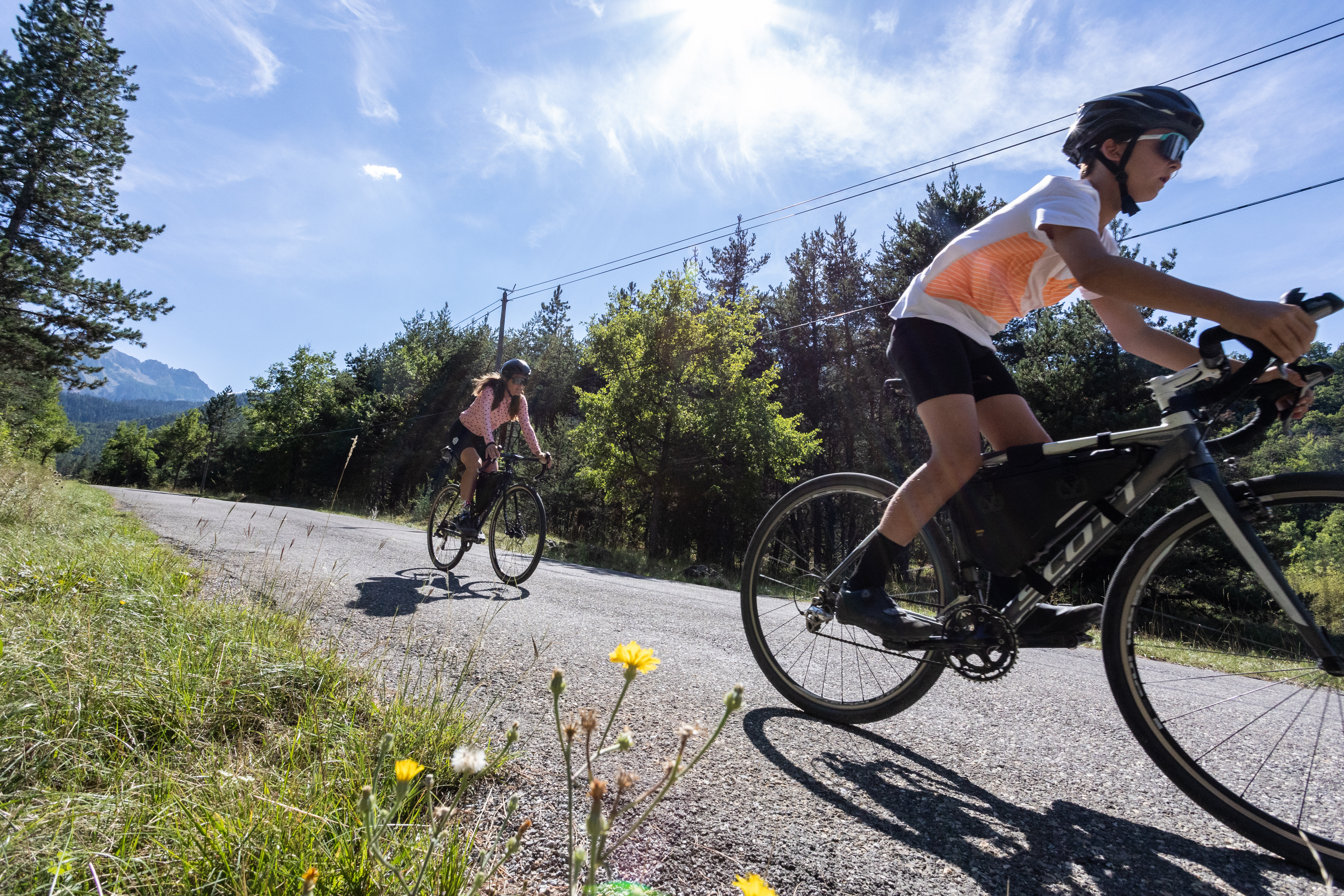
Loop 53 - Les Fontainiers
 Medium
Important information
Dans le Parc national des Écrins, les sentiers sont généralement praticables de la mi-juin à fin septembre.
Toutefois, les périodes d'accessibilité des itinéraires et les dates de pose des passerelles varient d’une année à l’autre en fonction de l’enneigement, des dégâts survenus en hiver et des conditions météorologiques. Par ailleurs, l’état des sentiers n’est pas contrôlé quotidiennement et peut évoluer rapidement après un évènement météorologique (orage, crue...). Il est nécessaire de se renseigner auprès des maisons du parc national et des offices de tourisme du territoire avant votre sortie. Pendant la randonnée, en cas de passage dégradé ou dangereux, faites demi-tour et signalez-le.
Description
- Just after Châteauroux-les-Alpes town hall, turn left up rue sainte-Irénée (D663). At the cemetery, skirt it to the right, past Les Pins camp-site and continue along the main road. Go straight on at Chapelle Saint-Roch. At Les Rozans, climb the steep slope to the right, then take the less steep road to the left.
- At the Gérards intersection, turn right towards Route de la Serbie (DFCI G83).
- Once you reach the hairpin, turn left into the undergrowth to follow the official Tour de Serre-Ponçon Gravel route. Take two left turns down the less steep options. Then turn right at the edge of the wood onto the path on the right, which is carpeted with pine needles. /!\ Several short sections with roots and stones.
- After the houses, continue to the right on the less visible flat track. Above Les Barthelons, descend to the left, then take the first right onto the road. After the hamlet, turn left towards the centre of Embrun.
- At the bend (D465) then at the Caléyère washhouse, ascend the road to the right. Then stay on the main uphill track.
- At the road (marked GR) turn right then left towards Mont Guillaume forest 5km. Then turn right up the track towards the electricity pylon (you can stay on the road for a gentler slope) and turn right again.
- At the Porte de la Forêt car park, take the route forestière des Fontainiers opposite. At the Route forestière du Bosquet, keep right (DFCI track G82).
- Before the steep climb, take the path on the right towards Châteauroux 9 km. /!\ The descent is quite steep. Join the track under the larches and descend to the right. Stay on the main road until you reach the hairpin, then /!\ watch your speed.
- At the hairpin, return to Châteauroux along the same road on the left.
- Departure : Châteauroux les Alpes
- Arrival : Châteauroux les Alpes
- Towns crossed : Châteauroux-les-Alpes and Embrun
1 point of interest

Mélézin - Mireille Coulon - PNE  Flora
The larch
The king of mountain trees in the Southern Alps, the larch is the only conifer to drop its needles in winter. In spring, its cones are a characteristic dark purple. The larch is one of the few European tree species that is imputrescible, that is to say, it does not rot. This is why, despite the fact that it twists as it dries out, it is widely use in frameworks, drinking troughs and other water holding vessels in the mountain villages. Incapable of germinating in its own undergrowth, it needs natural openings such as avalanche corridors for the young shoots to develop. It is found at altitudes in excess of 2,200 metres, adopting dwarf forms in these "combat" zones. The larch tree growing at this point on the trail is several hundred years old.
Forecast
Altimetric profile
Sensitive areas
Short-toed snake eagle
- Impacted practices:
- Aerial,
- Sensitivity periods:
- MarAprMayJunJulAugSep
- Contact:
- Parc National des Écrins
Julien Charron
julien.charron@ecrins-parcnational.fr
Recommandations
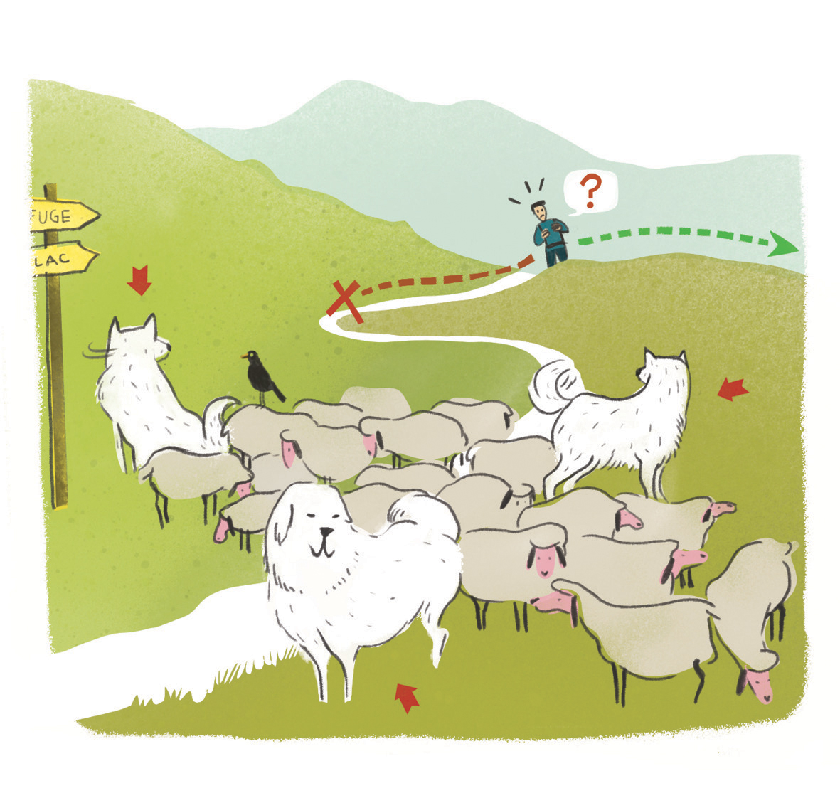 In mountain pastures, protection dogs are there to protect the herds from predators (wolves, etc.).
When I hike I adapt my behavior by going around the herd and pausing for the dog to identify me.
Find out more about the actions to adopt with the article "Protection dogs: a context and actions to adopt".
Tell us about your meeting by answering this survey.
Information desks
Tourist office Embrun
Place Général Dosse - BP 49, 05202 Embrun
October to march : Monday to Saturday, 9.00 - 12.30 & 13.30 - 17.00.
April, may, june & september : Monday to Saturday, 9.00 - 12.30 & 14.30 - 18.00
July and August : Monday to Saturday, 9.00 - 19.00. Sundays, 10.00 - 12.30 & 16.00 - 19.00
On French national holidays (except 14th of July and 15th of August) : 9am to 1pm. Closed on the 1st of January, 1st of May, 25th December and 11th November
Closed on Thursdays outside French holidays’ periods
Transport
Bus : Valserres, La Bâtie Neuve, Chorges, Puy Saint Eusèbe, Puy Sanières, Embrun Baratier, Les Orres, Remollon, Theus, Espinasse
Marseille-Briançon : (LER29)
Marseille, Nice : Lignes Express Régionales (LER) +33 (0)809 400 415
Grenoble : Transisère +33 (0)4 26 16 38 38
Gap-Barcelonnette (LER535)
Carpooling area : Rond point des Orres - 05200 Baratier
Plane:
Marseille Provence Airport (188km) - +33 (0)820 811 414
Grenoble Alpes Isère Airport (158km) - +33 (0)4 76 65 48 48
Lyon Saint Exupéry Airport - (203km) +33 (0)826 800 826
Turin Caselle Airport - (178km) + 39 011 567 63 72
Access and parking
From Marseille, Montpellier A51 to La Saulce, continue towards Tallard (D942) and Briançon (RN 94).
Parking :
More information


Source

Report a problem or an error
If you have found an error on this page or if you have noticed any problems during your hike, please report them to us here: