

Puy Saint Vincent Loop
 Medium
The descent from Puy Saint Vincent resort is beautiful and enjoyable, this loop will give you a good workout without too much difficulty.
Important information
Dans le Parc national des Écrins, les sentiers sont généralement praticables de la mi-juin à fin septembre.
Toutefois, les périodes d'accessibilité des itinéraires et les dates de pose des passerelles varient d’une année à l’autre en fonction de l’enneigement, des dégâts survenus en hiver et des conditions météorologiques. Par ailleurs, l’état des sentiers n’est pas contrôlé quotidiennement et peut évoluer rapidement après un évènement météorologique (orage, crue...). Il est nécessaire de se renseigner auprès des maisons du parc national et des offices de tourisme du territoire avant votre sortie. Pendant la randonnée, en cas de passage dégradé ou dangereux, faites demi-tour et signalez-le.
Description
The starting point is at the Gravière car park, in the centre of Vallouise.
Head down following the Gyronde river, leave the village and continue until the entrance of the village of Les Vigneaux.
- About 300 metres after entering the village, turn right at the bridge, cross the Gyronde and then continue on the right towards Puy Saint Vincent.
After 4km of climbing, you will reach the village of Puy Saint Vincent (1400m), where the road levels out slightly. - Go through the village following the signs for "Station 1600-1800", then after a few kilometres, turn left towards Puy Saint Vincent 1600-1800, just before the exit sign for the village of Puy Saint Vincent.
- Once you reach Station 1600, you can begin the descent, or continue up to Station 1800. The climb steepens slightly.
- Head back down via the same road used on the way up, then at the junction at the exit of Puy Saint Vincent, turn left to descend towards Vallouise.
- You will arrive in the centre of Vallouise, simply turn left to return to the car park.
- Departure : Vallouise
- Arrival : Vallouise
- Towns crossed : Vallouise-Pelvoux, Les Vigneaux, and Puy-Saint-Vincent
Forecast
Altimetric profile
Sensitive areas
Short-toed snake eagle
- Impacted practices:
- Aerial,
- Sensitivity periods:
- MarAprMayJunJulAugSep
- Contact:
- Parc National des Écrins
Julien Charron
julien.charron@ecrins-parcnational.fr
Short-toed snake eagle
- Impacted practices:
- Aerial,
- Sensitivity periods:
- MarAprMayJunJulAugSep
- Contact:
- Parc National des Écrins
Julien Charron
julien.charron@ecrins-parcnational.fr
Recommandations
The route takes place on a road shared with cars, wearing a helmet and gloves is strongly recommended.
Don't forget to bring enough water and food for your ride.
Emergency number: 18
Helmet
Windbreaker
Water
Food
Gloves
Appropriate footwear
Information desks

110 route des Alberts - Station 1400, 05290 Puy Saint Vincent 1400 m
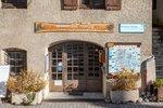
Place de l'Eglise, 05340 Vallouise
Access and parking
From Briançon, take the D4 to Les Vigneaux, then turn right onto the D994E to Vallouise. The car park is in the center of the village, next to the river.
Parking :
Source

Report a problem or an error
If you have found an error on this page or if you have noticed any problems during your hike, please report them to us here: