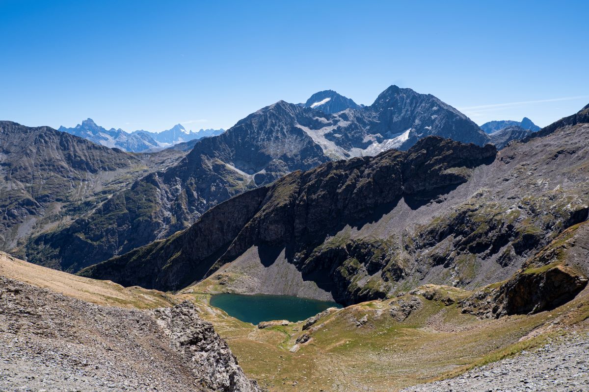
Plan Vianney lake and the Périer gap
This demanding hike that starts on the family (and busy) trail that leads to the Lauvitel lake then leaves the crowd to follow a different footpath that is high and steep overlooking the Lauvitel lake followed by the Plan Vianny lake. It therefore has a wonderful view before getting to the Périer gap.
Description
Cross the Danchère and continue to the crossing near to the Lauvitel stream. Go up the paved road to the left on the right bank of the stream. Cross the Selles stream near to the water catchment and climb up the bends among deciduous trees and spruce. After crossing an unobstructed area, you will come to a flat terrain that leads to the edge of the lake (1530m). To the right cross the large blocks towards the huts. Turn left onto a footpath that climbs on a ledge above the lake. Cross the Héritière stream then further on, the Mas stream and continue the meandering climb on the left bank of the Plan Vianney. Cross it to get to the upper valley. Continue up the valley and cross the first rocky projection by climbing up a small grassy corridor (steep slope) then a second, which is not so steep. Link up to the Plan Vianney lake (2250 m) before taking the footpath on a ledge that starts to the right above the lake. Cross over the rocky ledges until you reach a fork at the foot of the last slope. Go straight ahead and climb a vague, steep corridor (crumbling stones), that leads to the summit. Follow it to the right up to the highest point (2576 m) The return trip is made using the same itinerary in the opposite direction.
- Departure : La Danchère
- Towns crossed : Les Deux Alpes and Le Bourg-d'Oisans
9 points of interest
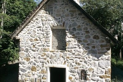
Les décharges de la chapelle de la Danchère - Cyril Coursier - PNE  Architecture
Danchère Chapel
Dedicated to Saint Louis and to Saint Claude, Danchère Chapel displays its agreeable proportions to visitors. The stones forming the arc of a circle above the entrance and the window do not only have aesthetic value. They are rightly called "a relieving structure" because they help to redistribute the weight of the facade on both sides of the openings. In the recess hidden behind wire netting is a ceramic statue of Saint Louis created in the Tarn region.
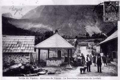
Le hameau de la Danchère - PNE  Architecture
Danchère Hamlet
With its paved lanes, its fountains and its stone wash-house, the Danchère offers an ideal starting point for going to Lauvitel which attracts 30 000 visitors every year. It is one of the numerous hamlets that make up the commune of Vénosc.
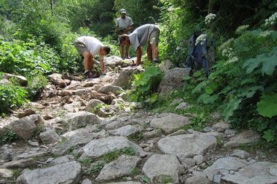
Pavage sur le sentier du Lauvitel - Cyril Coursier - PNE  Know-how
Traditional Paving
The Lauvitel path is often used especially during the summer. To limit the occurrence of erosion linked to the impact of human use but also to water flowing from melting ice or rain water it is covered with traditional paving, maintained thanks to annual restoration.
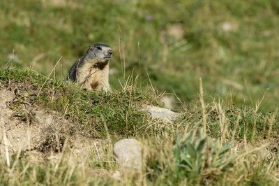
Marmotte sur son terrier - Mireille Coulon - PNE  Fauna
FaunaMarmots
The marmots are some of the permanent inhabitants of the grassland at the alpine level. . The view is very open, the herbaceous food is abundant and the soil sufficiently soft for them to be able to dig their burrows which are necessary for their survival. Although this animal is wild animal, it can become accustomed to the presence of humans and some marmots have started the bad habit of begging for pieces of biscuit from hikers, crisps and apples. Please do not feed them ! These foods, which are unsuitable to their needs, damage their health and survival. Would you think of eating grass in order to survive?
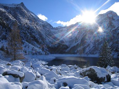
Lac du Lauvitel enneigé - PNE  Lake
LakeLauvitel Lake
Lauvitel Lake is the biggest (around 25-35 ha) and the deepest (40-65 m) in the Ecrins National Park. A rocky landslide around 4000 years ago, added to an existing glacial moraine to form a natural dam capable of retaining such a volume of water. The waters of the lake are cold and well oxygenated. They suit several species of fish including the Arctic Char or the Brown Trout which were introduced for anglers. Today the Lake Lauvitel is the subject of numerous scientific studies: physical parameters, sediment, phyto et zooplankton are collected and analyzed.
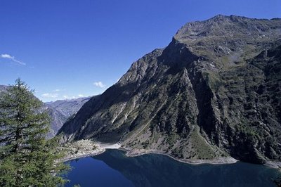
La digue du lac du Lauvitel - Denis Fiat - PNE  Geology and geography
Natural Dam
Around 4000 years ago, a rocky landslide added to an existing glacial moraine to form a natural dam capable of retaining this large volume of water. The seasonal variation of the level of the lake of 20 to 25 m is due to the permeability of the materials making the dam. In fact the lake does not have a spillway and the water infiltrates the boulders of the dam. It offers a beautiful view of the lake which infact inspired the painters at l'Abbé Guétal.
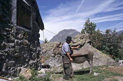
Au châlet de pêche - Denis Fiat - PNE  History
Chalets at altitude
On the Lauvitel dam are ancient prairie chalets as well as chalets that were built between the two World Wars to welcome hunters and anglers. Formally a private property, this valley was rented out to the ‘Bourgeoisie Dauphinoise’ for hunting. Angling, on the other hand, is still practised: it is managed by the Lauvitel Society for private angling. One of the chalets is still used to today to house agents from the Ecrins National Park and scientists from the nature reserve.

 Geology and geography
Vaugnerites
On the footpath leading to the Plan Vianney lake, essentially in the coomb of l'Héritière, outcrops of vaugnerites can be seen. These are dark rocks containing many mica flakes. Chemically similar to lamproite (magmatic rocks with high potassium content), they form enclaves of different sizes from 10 cm to several tens of metres, in the Rochail granite.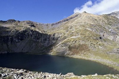
Le lac de Plan Vianney - Denis Fiat - PNE  Lake
LakeLac de plan Vianney
The Plan Vianney lake is home to a good population of brook trout, also known as brook charr or speckled trout. Demanding concerning water quality, this species requires clear, cool well-oxygenated water. Here its reproduction is not through rearing. Fishing is not authorised by decree made the Ecrins National Park's director. Exceptions are made for fishing as part of scientific studies only.
Forecast
Altimetric profile
Sensitive areas
- Impacted practices:
- Aerial, Aquatic, Land, Vertical
- Sensitivity periods:
- JanFebMarAprMayJunJulAugSepOctNovDec
- Contact:
- Parc national des Écrins.
Information desks
Oisans Park house
45 avenue de la République, 38520 Le Bourg d'Oisans
Video presentation of the natural resources of the Oisans mountain and its crafts. Information, documentation about the Park, projections, reading space for children. Accessible to people with reduced mobility. Free admission. All animations of the Park are free unless otherwise stated.
Transport
Access and parking
From Bourg d'Oisans, take the F1091 as far as the hamlet of Le Clapier and take the D520 then the D214c to the right.
Parking :
Source

Report a problem or an error
If you have found an error on this page or if you have noticed any problems during your hike, please report them to us here:


