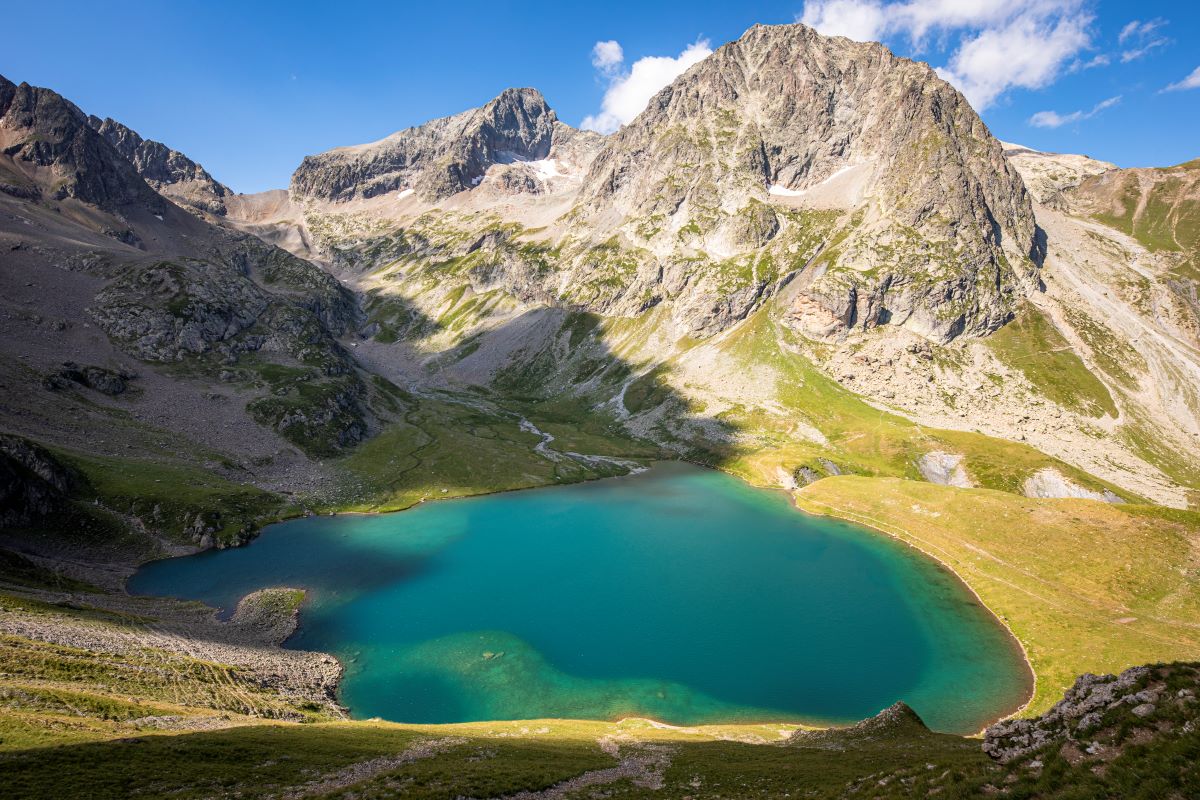
Muzelle Lake
Going up to Muzelle lake is like touching the past. Go up to the waterfalls following the traces of the shepherds... Discover, the ultimate reward, the lake where the imposing suspended glacier is reflected... The comfort of the refuge, pastoral calm, magical moments...
André Brun, retired park ranger in the sector of Muzelle.
Description
From the car park which is next to the left bank of the Vénéon just after the bridge, take the narrow road that leads to the end of Alleau hamlet. Go over the little bridge and take the paved path that goes up steeply into the forest. . After a few bends, a long restful crossing enables you to reach "le Cerisier", a group of houses in ruin. Continue on the path which follows the left bank of the Muzelle torrent, these bends lead to waterfalls which are very welcome in times of great heat. When you arrive at the foot of a big shale slope, the track zig-zags across the torrent and there are many bends to reach a beautiful lawn, then a basin full of bog. Arrive finally at a little hill to see the Muzelle lake and its refuge. Go down on the same path.
- Departure : L'Alleau, Vénosc
- Towns crossed : Les Deux Alpes
6 points of interest
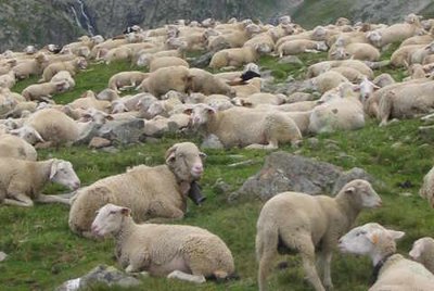
Pastoralisme au lac de la Muzelle - PNE - Brun André  History
A bit of history concerning the valley of Muzelle
At the end of the 19th century the forest was practically nonexistent, it had been reduced in favour of pastoral activity (on the higher planes) and for the culture of cereals, principally barley, above the inhabited areas. Towards 1945, the highest hamlets, like the one at Laffreyte above Bourg-d'Arud, were emptied of their inhabitant. Today the forest has gained ground covering the memory of a few ruins at the bottom of the track... Before the arrival of the motor car and the creation of roads, this itinerary around the lake and the Muzelle mountain pass was often used by the inhabitants of Venosc in order to cross the valley to the neighbouring valley of Valbonnais.
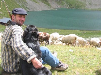
Pastoralisme au lac de la Muzelle - PNE - Brun André  Pastoralism
The pastoral valley
The configuration of the site made it very favourable to pastoralism for several centuries. This area of pastures was rented during the 19th and 20th centuries to seasonal grazers from the South of France. The local flocks from Venosc and particularly the flock from the hamlet of Laffreyte also went there. At that time, the first animals up in the mountain each year were the cows then the sheep. Since the 1980s, a flock of sheep of round 1200 animals from the Hautes-Alpes summer graze from June onwards and spend the summer in this prairie.
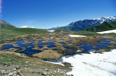
La tourbière de la Muzelle - PNE - Nicollet Jean-Pierre  Flora
FloraMuzelle bog
The humid zone, which you cross just before Muzelle lake, is bursting with astonishing biodiversity. The remains of a big lake created during the retreat of the glacier, this marsh has become filled little by little with plants forming the biggest bog in Vénéon valley. For several generations, the shepherds have used the peat as a fuel. Today it is forbidden to extract it. The place is protected by fences as part of agri-environmental measures.
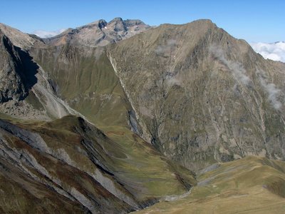
La faille de Ser Barbier - PNE - Albert Christophe  Geology and geography
Ser Barbier Fault
The fault at Ser Barbier brings into contact the crystalline bas (the needle of Venosc) and a marly deposit (Vallon mountain pass). It was formed during the Jurassic period when the Téthys sea opened out, by breaking and crumbling the crystalline massif. The rubbing together of the two parts created a beautiful striated mirror clearly visible due to erosion.
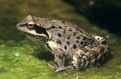
La grenouille rousse - PNE - Coulon Mireille  Flora
FloraFauna and Flora in the Bog
The bog is a very special environment which, by definition produces peat. Its appearance is that of a carpet of spongy sphagnum, plants full of water similar to mosses that accumulate over time. Their scientific study has enabled us to trace the evolution of the climate as well as that of the vegetation. The bogs can be seen at a distance when the Cotton Grass is in flower. Etymologically its name in French describes the 'portelaine' (wool carrier): its fluffy tufts and its cottony appearance make it an easily identifiable plant... You can also see around here and animal that is very active in this area: the common frog. Resistant to the cold, it is a batrachian which is very well adapted to the alpine environment. The yellow abdomen and the large dark mark at the back of the eye incorporating the ear drum are two characteristics observable with this species...
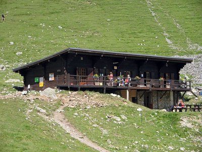
Le refuge de la Muzelle - PNE - Albert Christophe  Hut
HutMuzelle refuge
The bottom of the valley comes up to the rock wall at Muzelle, the pic du Clapier du Peyron and the head of the Muraillette. The modern history of this place is marked by mountaineering. It was on the 2nd July 1875 that Coolidge guided by Almer father and son opened the normal way to Roche de la Muzelle by the East North East face and the North-East ridge.. At this time, even if a pastoral cabin was used by the mountaineers the bivouac was still often used in the Muzelle valley. In 1967, it was in the rocky cirque that the community built the refuge on the shore of Muzelle lake.
Forecast
Altimetric profile
Sensitive areas
Peregrine falcon
- Impacted practices:
- Aerial, Vertical
- Sensitivity periods:
- FebMarAprMayJun
- Contact:
- Parc National des Écrins
Julien Charron
julien.charron@ecrins-parcnational.fr
Short-toed snake eagle
- Impacted practices:
- Aerial,
- Sensitivity periods:
- MarAprMayJunJulAugSep
- Contact:
- Parc National des Écrins
Julien Charron
julien.charron@ecrins-parcnational.fr
Recommandations
 In mountain pastures, protection dogs are there to protect the herds from predators (wolves, etc.).
When I hike I adapt my behavior by going around the herd and pausing for the dog to identify me.
Find out more about the actions to adopt with the article "Protection dogs: a context and actions to adopt".
Tell us about your meeting by answering this survey.
Information desks
Oisans Park house
45 avenue de la République, 38520 Le Bourg d'Oisans
Video presentation of the natural resources of the Oisans mountain and its crafts. Information, documentation about the Park, projections, reading space for children. Accessible to people with reduced mobility. Free admission. All animations of the Park are free unless otherwise stated.
Transport
Coach stop : l'Alleau
Access and parking
From Bourg-d'Oisans follow the D1091, and then take the direction La Bérarde on the D530. At Bourg d'Arud turn right after the bridge over the Vénéon and reach l'Alleau.
Parking :
More information
Source

Report a problem or an error
If you have found an error on this page or if you have noticed any problems during your hike, please report them to us here:


