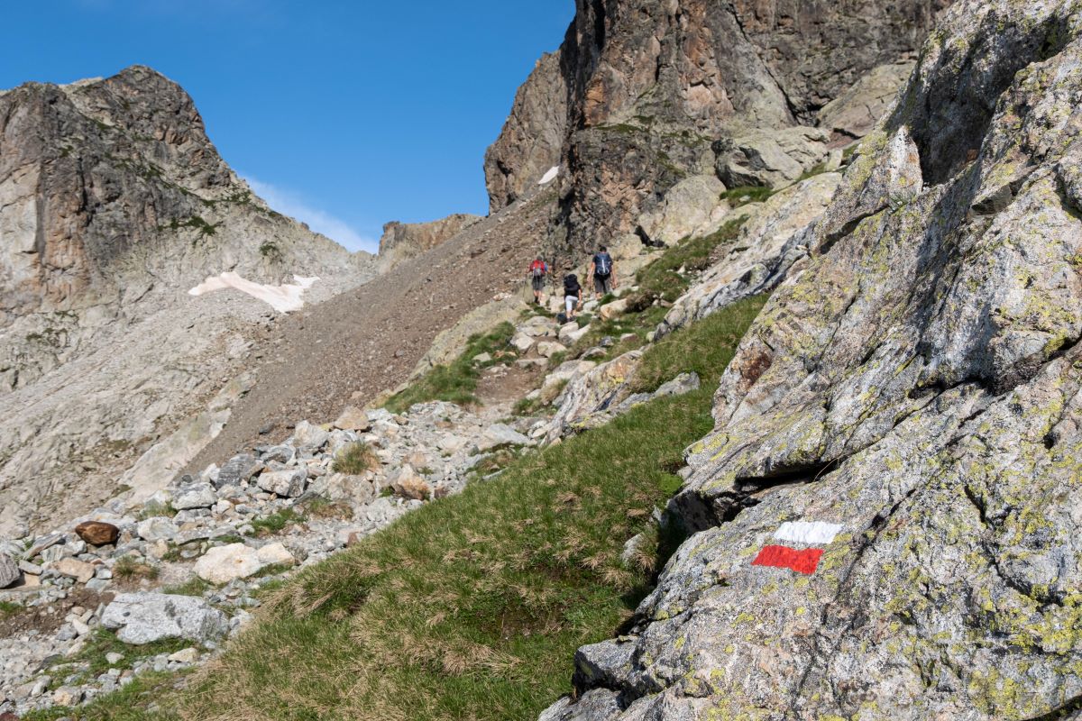
The Pas de l'Olan
A regular and sustained ascent leads hikers in the direction of the sky. The reward is a more and more vast panorama of the Valgaudemar valley and breathtaking views of the South West and South East faces of the Olan (3564 m), with the satellites of the Cime du Vallon (3409 m) and the pic de la Rouye (3085 m).
Description
The path starts with a few bends on the scree and continues by crossing a heathland of heather. The view of the Navette valley and Portes hamlet which faces it comes progressively in to view. Then you arrive at the mountainous level in the middle of alpine grasslands, where there is a view of the village de la Chapelle and the l'Olan refuge. A few steps from there is an old concrete slab which was witness to the passage of an avalanche in the 1950s. A visit to the refuge to meet the guardian and/or to have a small snack is always agreeable. The last part of the ascent can really be admired for its alpine character. The path leads on between old polished glaciers before finishing on the scree just in front of the Pas de l'Olan (2695 m). The field of view extends from the entrance to the valley, the Pic Turbat (3023 m) and in the distance the Dévoluy massif. To begin the descent on the other slope attention is required but there is no technical difficulty. The descent is carried out quite directly on the scree slopes to reach the Clot de Combe-Froide, ancient meadow land. At this point an intersection leads to a crossroads at Bourelle with the original path.
- Departure : La Chapelle-en-Valgaudemar
- Towns crossed : La Chapelle-en-Valgaudemar
10 points of interest
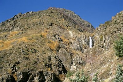
La cascade de Combefroide - Olivier Warluzelle - PNE  Water
WaterCombefroide Waterfall
At the beginning of the path, is a big waterfall that you can approach on a narrow footpath just before climbing the coast. Situated on Combefroide torrent at a rocky escarpment, this waterfall has several projections and presents a total drop of several dozen metres.
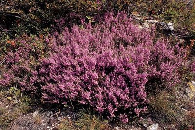
Callune vulgaire - Daniel Roche - PNE  Flora
FloraHeather fields
Over a change in altitude of a hundred metres there is a covering of heather which provides pollen for the bees and purple colour in Autumn, A small persistent shrub with tiny leaves and little pink flowers, it is called Common Heather or False Heather.
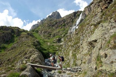
Passerelle franchissant la gorge de la Bourelle - Dominique Vincent - PNE  Geology and geography
Bourelle Gorge
Since the end of the ice age, water has carved the rock and the passage of materials has created a small gorge polishing the base rock (gneiss, micaschists). The National Park has taken on the challenge of building a wooden walkway for walkers to cross this gorge.

 Vernacular heritage
Jas crossing of the Bourelle
Just above the signpost, there are the ruins of a pasture shelter commonly called the, « jas ». Often built using dry stones, this kind of shelter was used to protect the flocks during the summer season.
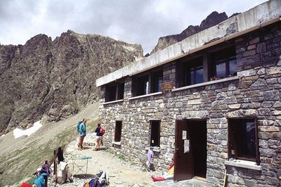
Façade du refuge de l'Olan - Claude Dautrey - PNE  Hut
HutOlan Refuge
Situated at an altitude of 2350 m, this large building constructed in 1957 was carried away by an avalanche two years later. A witness to this is a concrete slab below the refuge. Rebuilt in 1966, it was definitively extended in 1978 with a capacity of 54 places. A stage of the Tour de l'Oisans (GR 54), it welcomes hikers in the summer season and provides a shelter in the winter; it belongs to the Club Alpin Français.
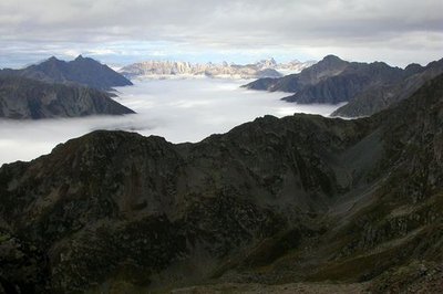
Mer de nuages sur la vallée de La Séveraisse avec au fond l'Obiou au soleil pris du refuge de l'Olan - Jean-Philippe Telmon - PNE  Panorama
View of La Chapelle and the surrounding mountains
The roof of Olan refuge makes a remarkable belvedere over La Chapelle village and the surrounding mountains which are the imposing Olan, the Cime du Vallon and the Rouye. A little higher up, the Pas de l'Olan provides a point of view of the entrance to the Valgaudemar valley and of the other face of the Olan.
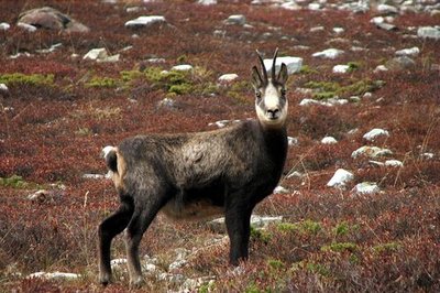
Chamois femelle - Christophe Albert - PNE  Fauna
FaunaChamois, Ibex, ...
All along the path, fauna is present. Watch out for the eagle and the vultures that glide on the ascending winds, as well as the chamois who spy on the world below. A few Ibex can sometimes be observed by mountaineers on the slopes of the Olan, without forgetting the marmot who punctuates the ascent with its strident cry.

 History
Ancient refuge at Pas de l'Olan
When you arrive at Pas de l'Olan, there are a few traces of the first refuge which was under the rocky mountain wall. Looking more like a large log cabin, it was unfortunately squashed by a rock. Due to its remoteness from the valley, the men chose to rebuild it on the current site.
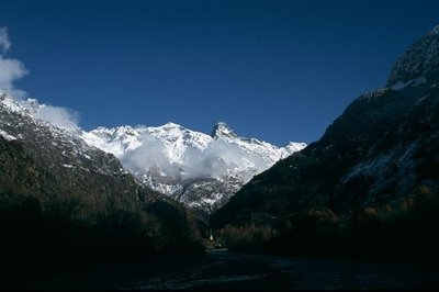
L'Olan et l'entrée de la vallée du Valgaudemar - PNE  Top
TopThe Olan « summits »
L'Olan is a major summit in the Écrins massif. Il culminates at 3564 m and is composed of three summits of which the highest is the Northern summit. The Olan was climbed for the first time right to the central summit on the 8th July 1875, then the Northern summit on the 29th June 1877 by the famous W.B.A Coolidge and his guide Almer. A normal route setting out from the Olan refuge can, with a guide or the right mountaineering knowledge, be the goal of an ascent in the Valgaudemar.
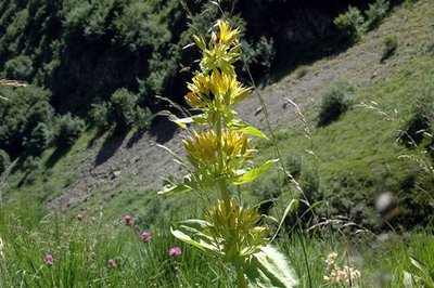
Gentiane jaune - Dominique Vincent - PNE  Flora
FloraFlora at altitude
With a large altitudinal range, the variety of environments and the strong Southern exposure, floral diversity is extremely rich and varied. Most notably you can see the Tiger Lily, which stands out in its environment by the striking originality of its colour and the yellow gentian whose roots are used to make a bitter “eau de vie” with many virtues.
Forecast
Altimetric profile
Recommandations
Leave in the early morning because the hike is exposed to the South and represents a very steep climb. It is possible to break the hike overnight in the refuge. Crossing the Pas de l'Olan is to be avoided when it rains or if there is a risk of storms.
Information desks
Valgaudemar Park house
Ancien Asile Saint-Paul, 05800 La Chapelle-en-Valgaudemar
Information, documentation and a reception area with permanent and temporary exhibitions. La Maison du Parc is labeled "Tourism and Disability". Free admission. All animations of the Park are free unless otherwise stated.
Transport
Possibility of a shuttle (Corps-La Chapelle-Gap). Information at 05voyageurs.com.
Access and parking
On the N85, turn on to the D985 at St-Firmin. Follow on as far as Chapelle-en-Valgaudemar.
Parking :
More information
Source

Report a problem or an error
If you have found an error on this page or if you have noticed any problems during your hike, please report them to us here:


