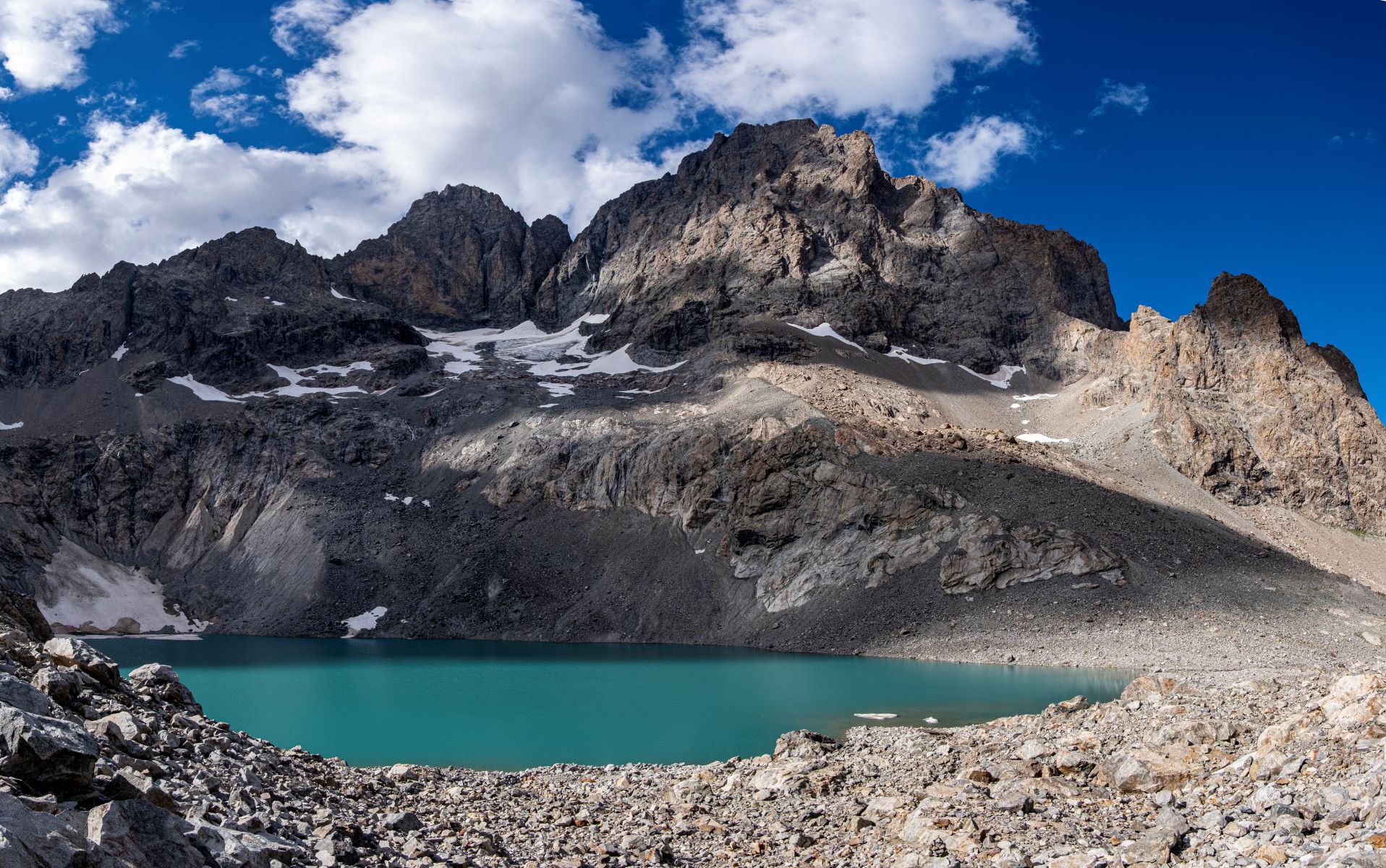
Pavé lake and mountain refuge
"Recent studies indicate that the Pavé lake is the deepest of the massif with a depth of 58 m. The mountain refuge is exceptional by its history. At first, it was a "site hut" during construction of the mountain refuge that was destroyed in an avalanche in its first winter. The sheet metal shelter, untouched, was enlarged and became THE mountain huté.
Eric Vannard, warden Parc national des Ecrins
Description
From the start, at the car park at the bottom of the La Gravière, beyond the Arsine bridge, the footpath to the Pavé mountain refuge first follows the very popular footpath to the Alpe de Villar d'Arène refuge (GR54). It leaves this path at the summit of the glacial cross-cliff that the locals call "Les voûtes". It then goes alongside the Romanche on the right bank for 2 km of the Plan de l'Alpe, which was previously of interest for the construction of a hydroelectric dam. At the Valfourche bridge that marks the entrance to the heart of the Parc National des Ecrins, the route then crosses to the left bank. It leaves the Romanche valley to go up to the Cavales valley, along the edge of the stream of the same name, until it reaches Les Pichettes, where the alpine meadows end. The valley is then purely mineral. The footpath follows the ridge of the remarkable moraine, up to just below the Clot des Cavales pass in order to circumvent a series of rocky ledges and leads to the Pavé lake and refuge.
- Departure : Villar-d'Arêne
- Arrival : Col du Lautaret
- Towns crossed : Villar-d'Arêne
6 points of interest
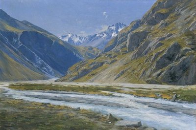
Vallée de la Romanche, Charles Bertier - © Musée de Grenoble  History
Romanche valley, Charles Bertier
The Romanche was a source of inspiration for many mountain artists and it have been painted repeatedly. Charles Bertier (1860-1924) was inspired to paint Vallée de la Romanche au Pied-du-Col and Les Fréaux près de la Grave, two oil paintings that were painted in 1894. The artist from Grenoble learnt to paint landscapes with Jean Achard, and mountains with the abbot Guétal and did not hesitate to set up his easel on the high summits of the Dauphiné Alps. More to the point, his mission was to make his contemporaries 'understand the mountains'!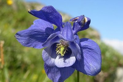
Ancolie des Alpes - Thierry Maillet - PNE  Flora
FloraAlpine Columbines
Hidden at the foot of a rhododendron bush, caught between the scree and the edge of the, is a rare species, it is as bright as it is rare. Do not rub against the Columbine, or it will lose its petals. The leaflets are split with deep incisions, in a double layer to form simple leaves, lifting up young milky buds at the end of the stalk and magnificent widely spread out flowers, azur fragments lost in the vegetation. Columbine flowers are the only ones that possess five spurs, five petals at their extremities in a cornet, protected by five sepals in the form of a lance.
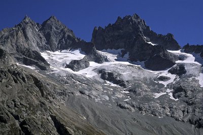
Le glacier de la Grande Ruine et le col de la Casse déserte - PNE - Roche Daniel  History
Alpe Valley
Mountaineers have always particularly liked the Alpe valley. It has long been a place for a base camp, for several big classic climbs in the Massif des Ecrins. It is over the ice cap that the famous roped party Coolidge-Almer succeeded in making the first ascension into the mountain of the Agneaux. Le 17 July 1873 following this they carried out the first crossing of the Casse Déserte mountain pass and the ascent of the Pointe Brevoort at the Grande Ruine.
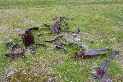
Ancien bocard minier - Cyril Coursier - PNE  History
Exploitation of the mines
The valley has not only been a centre of interest for botanists and mountaineers. It still carries traces today of mining activity. Between 1835 until the beginning of the First World War, thirty to forty people worked in the extraction of minerals, mainly copper, on the slopes of the Chamoissière. A stamp mill enabled minerals to be ground. It remains at the site but is completely broken...
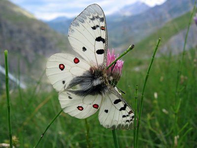
Petit Apollon - PNE - Albert Christophe  Fauna
FaunaSmall Apollo Butterfly
A hardly perceptible rustling in the frozen morning grass betrays the presence of a butterfly disturbed by our steps and unable to use its damp wings... A few delicate jerks and there it is clinging onto some dry grass, then with successive spasms, it opens its pearly wings which are almost translucent in the sunshine, and finally exposes the totality of its anatomy. The Small Apollo, rare and protected – catching or transporting it are forbidden – and there, before our eyes, with its miniscule red ocelluson the edge of each of its upper wings and it’s finely black and white striped antennae.
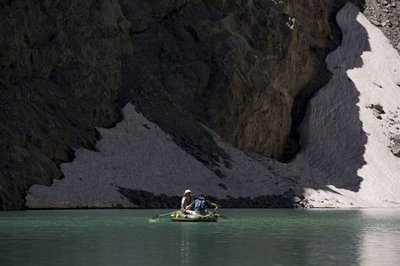
Mission lac sentinelle sur le lac du Pavé - Pascal Saulay - PNE  Lake
LakePavé Lake
In the current context of global warming, the retreat of the highest glacier of Les Cavales a few decades ago, made way for a lake at an altitude of 2820 m. The water in the recently formed lake is very cold: 4°C on the surface. Despite this, measures taken in 2010 as part of the monitoring of high altitude lakes surprised everyone by revealing the presence of plankton.
Forecast
Altimetric profile
Sensitive areas
Golden eagle
- Impacted practices:
- Aerial, , Vertical
- Sensitivity periods:
- JanFebMarAprMayJunJulAug
- Contact:
- Parc National des Écrins
Julien Charron
julien.charron@ecrins-parcnational.fr
Golden eagle
- Impacted practices:
- Aerial, , Vertical
- Sensitivity periods:
- JanFebMarAprMayJunJulAug
- Contact:
- Parc National des Écrins
Julien Charron
julien.charron@ecrins-parcnational.fr
Recommandations
Make sure you have everything in your bag for this hike, as weather conditions can change quickly at this altitude.
 In mountain pastures, protection dogs are there to protect the herds from predators (wolves, etc.).
When I hike I adapt my behavior by going around the herd and pausing for the dog to identify me.
Find out more about the actions to adopt with the article "Protection dogs: a context and actions to adopt".
Tell us about your meeting by answering this survey.
Information desks
Maison du Parc du Briançonnais
Place Médecin-Général Blanchard, 05100 Briançon
Located at the foot of the medieval town fortified by Vauban, declared World Heritage by UNESCO in 2008, the Maison du Parc Briançon is a welcoming place of information exchange. Three floors of exhibition to discover : the natural and cultural heritage, the museum of the history of skiing in Briançon. Documentation, maps, guidebooks, books and products of the Park. Guided tours for groups by reservation. Free admission.
Transport
Bus route Grenoble - Briançon, via le col du Lautaret (ligne express régionale : LER 35).
Access and parking
From La Grave, take the D1091 towards Villar d'Arène. Turn right onto the D207. At the crossing, turn right towards the Alpe mountain refuge. Cross the bridge and take the track to the right that leads to the car park 1 km away.
Parking :
More information
Source

Report a problem or an error
If you have found an error on this page or if you have noticed any problems during your hike, please report them to us here:


