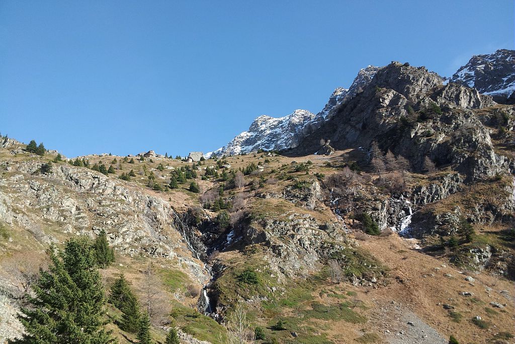
La Chalp valley
A steep climb that gives off Mediterranean scents.
The first climb is across a warm, dry hillside, amidst heather moors and orchid-filled lawns, and opens up progressively into a panoramic view of the Vercor foothills.
The footpath then leads into a cooler high mountain setting.
At the end of the valley, it is not rare to see a few calm chamois grazing on the fine grass amongst the scree.
Marion Digier, Heritage technician in the Valbonnais area.
Description
Start from either the car park at the exit of La Chalp or next to the fountain. Initially, follow directions for "Cascades des Roberts" via Rue du Barquier that lead straight to the top of the hamlet. On the right, at Cotes Vincent, take the Soreïou road that climbs straight up to the last houses of the hamlet. Leaving these hoses on the right, follow the footpath (yellow signs to the entrance of the Park). At the first crossroads, you can take a detour to the Roberts waterfall before coming back to the main route. The footpath that climbs up through the dry heaths of the south facing slopes offers regular viewpoints of the valley. It then goes through a pine forest before shifting to the other slope and into a spruce forest. At the end of the forest, the footpath continues under a rocky ledge that blocks the entry to the valley and bypasses it to the left. After the ledge, the footpath ends at the bottom of the valley.
The return trip will be by the same path.
- Departure : La Chalp hamlet, Valjouffrey
- Towns crossed : Valjouffrey
12 points of interest
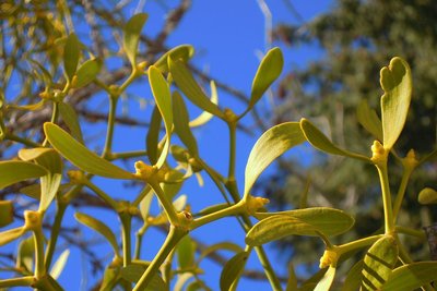
Gui dans un ancien verger sur le sentier - Marion Digier - PNE  Flora
FloraMistletoe
Along the footpath after the crossing towards the waterfall, the old fruit trees are covered in mistletoe. Mistletoe is a surprising plant species in many ways. It is "hemiparasitic", which means it partly parasites its host (in this case fruit trees). These plants absorb water and nutrients from the host plant that it turns into sugars and protein through photosynthesis. However, there is still a lot to learn about the plant that is probably more "parasiting" than we think. Its latin name Viscum album means "glue" because of the stickiness of its berries.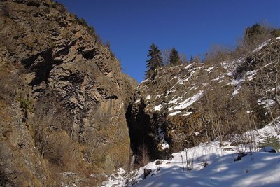
Cascade des Roberts à la Chalp en Valjouffrey - Marion Digier - PNE  Vernacular heritage
The Roberts waterfall and dike
For those who are interested in local heritage, you can make a detour via the Roberts waterfall (10 mins there and back). Downstream, there is an imposing dry stone dike built to protect the hamlet from the stream flooding. Its origin is unknown. Made of huge blocks of granite, it was restored by the voluntary association "Mémoire battante" in 2011 with help from craftspeople belonging to "Pierres sèches, savoir-faire et patrimoine" (Dry stones, know-how and heritage) A canal (béal) bordered with flagstones starts at the foot of the waterfall and ends at the dike.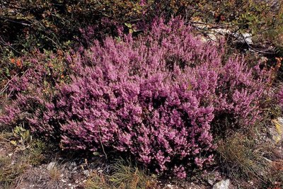
Callune vulgaire à l'automne - Daniel Roche - PNE  Flora
FloraCommon heather
Common heather grows on acidic ground, which has sunlight and is well-drained. Here it can be found in the sunny dry heaths of the south facing slope of La Chalp. “La callune” in French gets its name from the Greek kallynein, which means "sweep" In the past its stems were used to make brooms. Heather has fungus at its roots (they are mycorrhized) to help absorb mineral elements from the soil. This combination is particularly useful in such a poor, acidic terrain.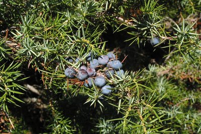
Fruit du genévrier commun - Nicolet Jean Pierre - PNE  Flora
FloraCommon juniper
This bush also likes the dry sunny slopes. It can be distinguished from other junipers by its single white line on the upper side of its thorns. Its berries are well known as seasoning in sauerkraut and they have digestive qualities in pâtés. Previously these berries were crunched on during cold spells. Mistle thrushes that thrive in the Autumn on this slope, also apppreciate them.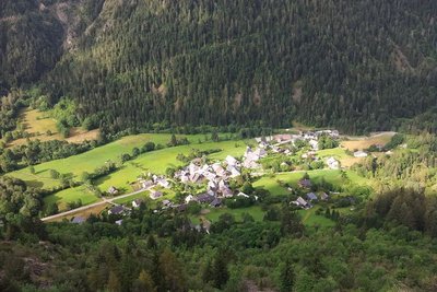
Vu plongeante sur le hameau de la Chalp - Nicolet Bernard - PNE  Panorama
The viewpoint over La Chalp hamlet and the valley.
At 1260 m in altitude, a viewpoint overlooks the valley, the hamlet of La Chalp and its hedged surroundings. In the plain, a network of hedges still border the tracks and delimit agricultural plots. Meadows are generally mowed and are of great floristic diversity. The Tralivernets reed bed, which is also visible from this viewpoint, is home to the marsh warbler: a bird that likes the tall vegetation that grows along the wetlands and streams.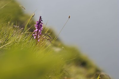
Orchis mâle - Mireille Coulon - PNE  Flora
FloraOrchids
The dry grassland on these southern slopes are home to a few orchids including the early-purple orchid and the burnt orchid. Orchids are a complex family whose species often change name and classification, as was recently the case with the burnt orchid that has joined the Neotinea group. It is called 'burnt' due to the dark crimson colour at the top of the flower. Further away in the forest on the northern side, forest species such as broad-leaved helleborine and creeping lady's tresses are to be found.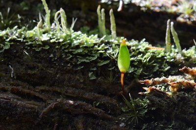
Buxbaumie verte - Nicolet Bernard - PNE  Flora
FloraGreen shield moss
You will need to put your nose close to the ground on old tree stumps, or where there are rotting branches in order to see this minute moss. It is considered as rare and as part of natural heritage. Prospection by the Ecrins National Park wardens is therefore under way. A protocol to determine the threshold for detection of the species has been put in place by statisticians. From April on, it is possible to detect it due to its “sporophytes”, small shiny green capsules that enclose the spores. In the Valbonnais sector, shield moss is very much present in the forests of north facing slopes.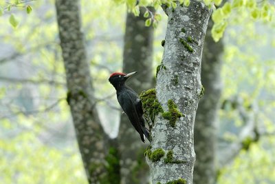
Pic noir - Mireille Coulon - PNE  Fauna
FaunaBlack woodpecker holes
In the spruce forest, the black woodpecker has paid a visit to old rotting tree trunks. It has drilled holes, in search of bark beetles or carpenter ants that it feeds on. This odd black bird with a red crown is the biggest woodpecker in the Alps. It likes forests with large trees that are spaced out and carves out its dwelling high in the trunks. It incessantly hammers away at tree trunks to seduce a female, defend its territory or even search for food. Once they are abandoned, these dwelling become home to other lodgers such as boreal owls, bees, martens…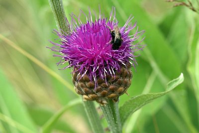
Rhapontique scarieux - Cédric Dentant - PNE  Flora
FloraGiant scabiosa
This giant thistle catches the walker’s eye as it can grow up to a metre high. It does not prick and its large deep pink flowers have pearly borders. This is a nationally protected plant and only subsists in the Alpine arc. It is adapted to siliceous grounds. It can be seen here at the beginning of the summer along the footpath at the edge of the spruce forest.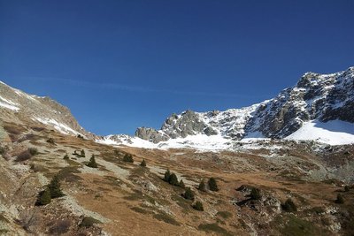
Arrivée dans le vallon de la chalp - Marion Digier - PNE  Panorama
The viewpoint of the valley
At 2020 m in altitude, the Petit and Grand Chapelet ridges spread to the East up to the Devil's ridges and to the West they reach the summits of Gargas, Chamoux and Colombier. Behind this line of summits, the Obiou emerges descreetly. Further west we can imagine Mount Aiguille and the Grand Veymont. The footpath ends here but the valley opens up overlooked by the Valsenestre Peak and the tip of La Chalp.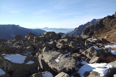
Eboulis granitiques du vallon de la Chalp et vue sur le Vercors - Marion Digier - PNE  Geology and geography
The Valsenestre Peak and it granite massif and scree
Underfoot rocks that are over 200 to 300 million years old, tell the ancient geological history of the Alps! In the Chalp valley, two types of rock meet - granite and amphibolite. These rocks were formed during the hercynian period, long before the the uplift of the Alps. At the foot of the ledges that surround the valley, there is a geological fault called "Aspres-les-Corps fault". It is part of an alignment of faults that spreadfrom the Dévoluy area to the Beaufortain area.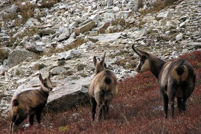
Chamois en groupe - Christophe Albert - PNE  Fauna
FaunaChamois
This high, perched valley is ideal for the peace and quiet that chamois need. Groups of females with their kids, known as “chevrées” often visit the area. The Ecrins National Park is monitoring populations of chamois. Three times as year, with the aid of a telescope, the Park wardens watch over roughly a hundred animals to keep a check on their health. At the same time, in collaboration with the Hautes Alpes Hunting Federation, blood samples are taken from chamois in the selected area to check for possible illness.
Forecast
Altimetric profile
Recommandations
The final section of this footpath is not advised at the beginning of autumn or the end of spring. The crossing at the end of the forest can be icy or snowy due to its north-facing exposition.
Reminder: No campfires or dogs in the heart of the Park.
Public transport: check carefully, buses do not run every day.
Information desks
Maison du Parc du Valbonnais
Place du Docteur Eyraud, 38740 Entraigues
Reception, information, temporary exhibition room, reading room and video-projection on demand. Shop: products and works of the Park. Free admission. All animations of the Park are free unless otherwise stated.
Transport
Bus from La Mure to Entraigues - Route 4120 Isere Conseil Général. Connection at « Entraigues Place » with the local Valjouffrey service (8 seater community bus) to Désert-en-Valjouffrey
Bus times Monday: 12.45, Wednesday 12.45 (all year) and 7pm (except during school holidays) and return: Monday 6.30 am, 3.30 pm and Wednesday 6.30 am (all year).
Access and parking
From Entraigues, take the D117 road towards Valjouffrey.
La Chalp-en-Vajouffrey is the 3rd hamlet after Entraigues.
Parking :
More information
Source

Report a problem or an error
If you have found an error on this page or if you have noticed any problems during your hike, please report them to us here:


