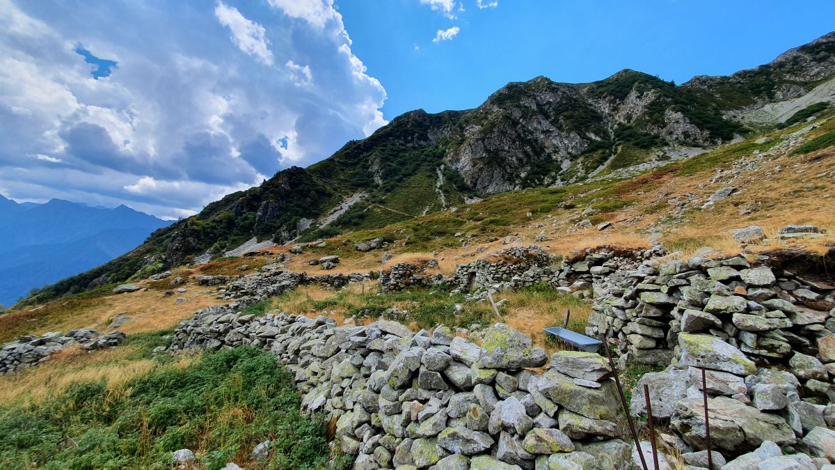
The 6 mountain huts
The smells, colours and atmosphere change constantly during the change in altitude.
You will be taken back in time and your imagination will roam thinking of the traces left by ancestors of the area, their history and their way of life. You will be overcome by a sense of respect for these mountain artisans.
Description
From the car park in Saint Maurice en Valgaudemar, return to the surfaced road towards the church and take the road to the right until you reach the sign indicating the way to 6 Mountain Huts. From here, follow the path marked with a red dot towards the Salette mountain hut. Cross the bridge over the Saint-Maurice stream and follow the path. At the next junction, follow the footpath that goes up to the right (do not take the path to the left that leads to the Rochimont mountain hut).
Further on, the trail comes close to the stone ruins of a small mountain pasture hamlet and soon after leads to the Salette pastoral hut, which is situated at an altitude of 1650 m. After walking for 2 hours, the small fountain will be more than welcome.
To reach the "6 mountain huts", continue the climb for about an hour on an open but rocky and narrow pathway with many bends, until you get to the surprising yet incredible hamlet that is situated at an altitude of 1980 m.
After a welcome break in the superb cirque at the foot of the Grun de Saint-Maurice, which is filled with the history of the place, you can return by the same route.
- Departure : Saint-Maurice en Valgaudemar
- Towns crossed : Saint-Maurice-en-Valgodemard
10 points of interest
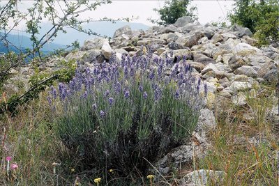
Lavande à feuilles étroites - Bernard Nicolet - PNE  Flora
FloraWhat are you, lavender?
Fine, or Alpine lavender (Lavandula angustifolia) grows exclusively in the mountains, only at an altitude above 500 m. Its essential oil is exceptional and the greatest perfumers use it despite its low yield (130 kilos are necessary to produce 1 litre of essential oil). Etymologically, the word lavender comes from the Latin verb laver, meaning to wash. This origin leads us to think that very early on, lavender was used to perfume freshly washed laundry.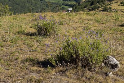
Pieds de lavandin - Pascal Saulay - PNE  Flora
FloraLavandin
In the 1930s, lavandin (Lavandula x intermedia) saw the day. It is a hybrid and therefore sterile, but it is easy to produce and is the most grown species nowadays as its yield is three times that of fine lavender. Its oil is used in industrially produced perfumes. Unlike fine lavender, this variety does not thrive at high altitude.
 Flora
FloraFlora
You will be witness to a surprising change in plant life between 1000 m and 2000 m in altitude. Indeed, your first steps will take you through an almost Mediterranean vegetation with juniper and lavender...What lovely fragrances! All that is missing is the sea.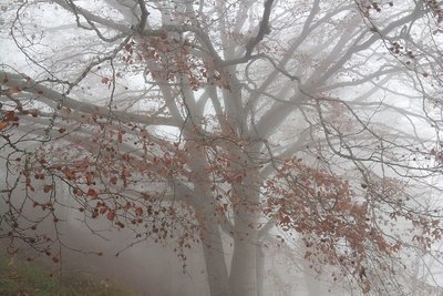
Vieux hêtre dans la brume - Bernard Nicolet - PNE  Fauna
FaunaThe beech forest
Rapidly you will enter a superb beech forest whose tormented trees will offer gentle shade. Beech is particularly well adapted to the level of the mountains where it finds the humid atmosphere necessary for its growth.
Its fruit, beechnuts, are edible like chestnuts. They are more difficult to shell, and were used as food for pigs for some length of time.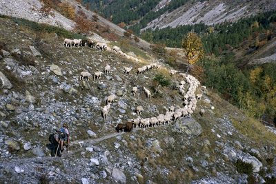
Descente des brebis de l'Aup - Dominique Vincent - PNE  Pastoralism
Transhumance
The steep slopes of the Valgaudemar area, where cows are not at ease, means cattle breeding is not possible. Sheep however, are quite at home.
As grass is rare at high altitude, transhumance is necessary. The idea is to follow the growth of grass, which is staggered according to altitude. The flock is therefore taken to the top, then makes its way down progressively.
Nowadays keeping methods have changed. Breeders, who often have more than one activity, make regular trips to check on the health of the flock in particular. The sheep are otherwise free to roam as the Grun cirque rockfaces act as a natural barrier. This type of keeping is known as "garde à l'arrage".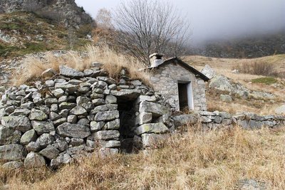
Cabane de la salette - Dominique Vincent - PNE  Vernacular heritage
Pasture hamlets
For the sake of comfort, breeders and shepherds established pastoral hamlets where they lived for several weeks. A ruined hamlet at an altitude of 1350 m, La Salette at about 1650 m and the highest mountain pasture, 6 Mountain Huts at 2000 m are all reminders of the past.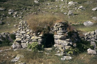
Les six cabanes - Marie-Paule Hachon - PNE  History
6 Mountain Huts hamlet
There were originally 10 mountain huts built on the high plateau. Today only 6 are still visible. Some are buried, whereas others have corbelled arches covered by tussocks of grass. This technique was also used in the Pyrenees (Les Orrys) and Corsica. Although it looks Neolithic, the site of 6 Mountain Huts was recently dated to the 17th century. It reminds us of how difficult living conditions must have been.
The remnants of these pastoral dwellings could no doubt tell the story of their forgotten lodgers.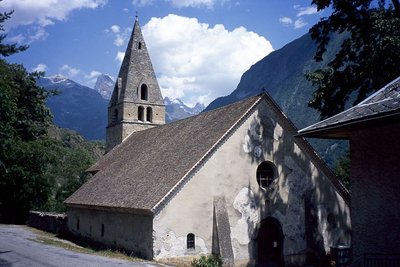
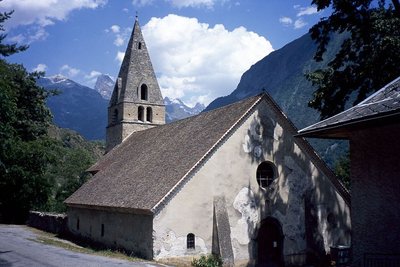
Eglise de Saint-Maurice en Valgaudemar - Dominique Vincent - PNE  Architecture
Saint Maurice parish churc
This church that was built by Cluniac monks, is the oldest in the Champsaur and Valgaudemar valleys. There is proof of its existence at the end of the 11th century. Its square bell tower is of typical Lombard tradition. The simple interior is composed of three naves with ridged vaults and a flat apse. Spared by the religious wars of the 16th century, its first restoration dates back to 1668.
Eglise de Saint-Maurice en Valgaudemar - Dominique Vincent - PNE  Architecture
Saint Maurice en Valgodémard church
As you cross the main town, which is the start of the walk, you will no doubt have noticed to the right, the church protected by an impressive lime tree. Saint Maurice’s church was built in the 11th century by Cluny monks that were the largest monastic order in the Middle Ages, and spread throughout Europe. It was possible to date it using painted walls that were discovered beneath paintings that were more recent.
It is the oldest church in the Valgaudemar area.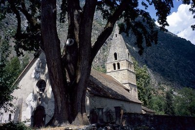
Tilleul de Sully - Dominique Vincent - PNE  Flora
Flora"Sully" the lime tree
"Sully" is the 300-year old lime tree that takes centre stage and generously offers shade. It is said that this tree was planted during the reign of Henry IV by decision of the Duke of Sully who was his minister of finances, economy and agriculture. He had lime trees planted in every district in France. The Duke of Sully is also the author of this famous quote: "Ploughing and grazing are the two breasts by which France is fed..." Its circumference is estimated to be 7.40 m.
Forecast
Altimetric profile
Sensitive areas
Short-toed snake eagle
- Impacted practices:
- Aerial,
- Sensitivity periods:
- MarAprMayJunJulAugSep
- Contact:
- Parc National des Écrins
Julien Charron
julien.charron@ecrins-parcnational.fr
Information desks
Valgaudemar Park house
Ancien Asile Saint-Paul, 05800 La Chapelle-en-Valgaudemar
Information, documentation and a reception area with permanent and temporary exhibitions. La Maison du Parc is labeled "Tourism and Disability". Free admission. All animations of the Park are free unless otherwise stated.
Transport
Navetta del conseil général (Voyageurs 05) da Saint-Firmin. Collegamento con i bus provenienti da Gap e da Grenoble.
Informazioni al 0033(0)4 92 502 505
Access and parking
7 km from Saint-Firmin, take the D985a until you reach the Saint-Maurice en Valgaudemar car park.
Parking :
Source

Report a problem or an error
If you have found an error on this page or if you have noticed any problems during your hike, please report them to us here:

