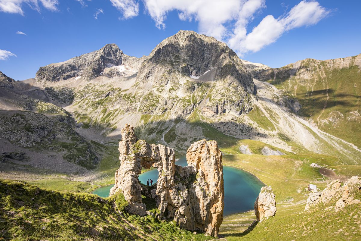
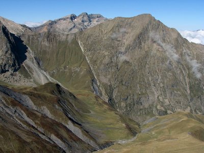
Tour de l'Aiguille de Vénosc
A subtle blend, with bucolic views succeeded by an Alpine refuge on the lakeside, with a glacier looking down, and then the austere panorama of rock and ice of the valley col. Not to mention the pride of completing parts of the famous GR®54 and the privilege of seeing the total reserve of Lauvitel and its impressive mountain lake from above.
2 steps
Description
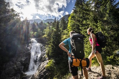
After walking up the little narrow street towards the upper part of the village of Alleau, the climb begins on a fine forest path that then passes above the left bank of the Pisse torrent. The ascent is continuous, but the slope finally flattens out and you arrive at the magnificent corrie of Lake Muzelle with its refuge elegantly placed just above the lake. Both are watched over from above by the Muzelle glacier. After a restful night at the refuge, you start up a fairly steep path that zigzags its way just under the valley pass. Here, take your time to admire the Barre des Ecrins from an uncommon angle. Soon afterwards, the descent looks down almost continually on Lake Lauvitel, with sections that are sometimes fitted with handrails. After Lauvitel “beach” and its pile of stone blocks, the descent towards La Danchère passes along a path that is almost entirely paved and that can get quite crowded. You then return to the village of L’Alleau partly alongside the powerful River Vénéon, in peace and quiet, through the forest.
- Departure : Le Bourg d'Arud
- Arrival : Le Bourg d'Arud
- Towns crossed : Les Deux Alpes and Le Bourg-d'Oisans
14 points of interest
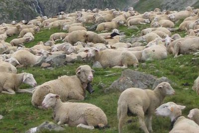
Pastoralisme au lac de la Muzelle - PNE - Brun André  History
A bit of history concerning the valley of Muzelle
At the end of the 19th century the forest was practically nonexistent, it had been reduced in favour of pastoral activity (on the higher planes) and for the culture of cereals, principally barley, above the inhabited areas. Towards 1945, the highest hamlets, like the one at Laffreyte above Bourg-d'Arud, were emptied of their inhabitant. Today the forest has gained ground covering the memory of a few ruins at the bottom of the track... Before the arrival of the motor car and the creation of roads, this itinerary around the lake and the Muzelle mountain pass was often used by the inhabitants of Venosc in order to cross the valley to the neighbouring valley of Valbonnais.
Pastoralisme au lac de la Muzelle - PNE - Brun André  Pastoralism
The pastoral valley
The configuration of the site made it very favourable to pastoralism for several centuries. This area of pastures was rented during the 19th and 20th centuries to seasonal grazers from the South of France. The local flocks from Venosc and particularly the flock from the hamlet of Laffreyte also went there. At that time, the first animals up in the mountain each year were the cows then the sheep. Since the 1980s, a flock of sheep of round 1200 animals from the Hautes-Alpes summer graze from June onwards and spend the summer in this prairie.
La tourbière de la Muzelle - PNE - Nicollet Jean-Pierre  Flora
FloraMuzelle bog
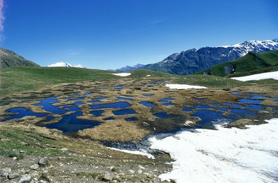
The humid zone, which you cross just before Muzelle lake, is bursting with astonishing biodiversity. The remains of a big lake created during the retreat of the glacier, this marsh has become filled little by little with plants forming the biggest bog in Vénéon valley. For several generations, the shepherds have used the peat as a fuel. Today it is forbidden to extract it. The place is protected by fences as part of agri-environmental measures.
La faille de Ser Barbier - PNE - Albert Christophe  Geology and geography
Ser Barbier Fault
The fault at Ser Barbier brings into contact the crystalline bas (the needle of Venosc) and a marly deposit (Vallon mountain pass). It was formed during the Jurassic period when the Téthys sea opened out, by breaking and crumbling the crystalline massif. The rubbing together of the two parts created a beautiful striated mirror clearly visible due to erosion.
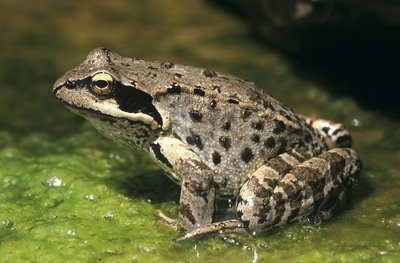
La grenouille rousse - PNE - Coulon Mireille FloraFauna and Flora in the Bog
The bog is a very special environment which, by definition produces peat. Its appearance is that of a carpet of spongy sphagnum, plants full of water similar to mosses that accumulate over time. Their scientific study has enabled us to trace the evolution of the climate as well as that of the vegetation. The bogs can be seen at a distance when the Cotton Grass is in flower. Etymologically its name in French describes the 'portelaine' (wool carrier): its fluffy tufts and its cottony appearance make it an easily identifiable plant... You can also see around here and animal that is very active in this area: the common frog. Resistant to the cold, it is a batrachian which is very well adapted to the alpine environment. The yellow abdomen and the large dark mark at the back of the eye incorporating the ear drum are two characteristics observable with this species...
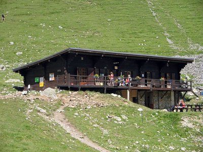
Le refuge de la Muzelle - PNE - Albert Christophe  Hut
HutMuzelle refuge
The bottom of the valley comes up to the rock wall at Muzelle, the pic du Clapier du Peyron and the head of the Muraillette. The modern history of this place is marked by mountaineering. It was on the 2nd July 1875 that Coolidge guided by Almer father and son opened the normal way to Roche de la Muzelle by the East North East face and the North-East ridge.. At this time, even if a pastoral cabin was used by the mountaineers the bivouac was still often used in the Muzelle valley. In 1967, it was in the rocky cirque that the community built the refuge on the shore of Muzelle lake.
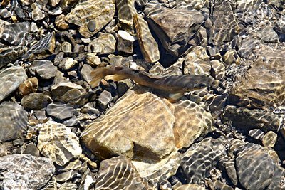
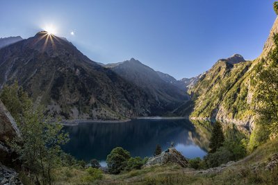
La truite fario - PNE - Telmon Jean-Philippe  Lake
LakeLac de la Muzelle
The Lac de la Muzelle is a glacier lake with cold waters, poor in life. The fish population is limited to salmonids (Arctic char, brook trout, etc.). Their active period is limited to summer. Since their food sources are low, they suffer from dwarfism. Each year, scientific monitoring is carried out by various universities and the National Park: samples of fish, phytoplankton, zooplankton and physical measurements.
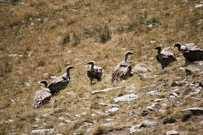
Vautours fauves - Marion Molina  Fauna
FaunaGriffon vultures
From the Col du Vallon, you can sometimes see griffon vultures. The bird returned to the mountains a few years ago. Bigger than an eagle, with beige and brown plumage, it generally glides in flight, and its movements are broad and slow. But what characterises the species above all is its gregariousness: griffon vultures like to be together, whether on the ground or in the air. This behavioural adaptation makes it easier for them to find the animal carcasses they feed on.
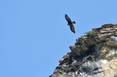
Aigle royal en vol - Mireille Coulon - PNE FaunaGolden eagles
Several birds of prey cross the skies above L’Oisans. Among them are two couples of golden eagles that share the Muzelle and Lauvitel valleys. They have an impressive wingspan (2.30 m on average), are mostly brown colour, and often hunt marmots at low altitude.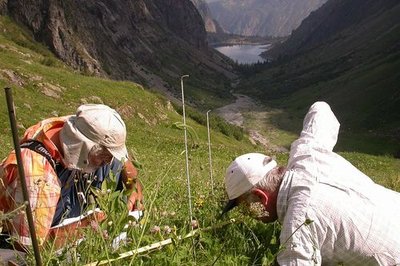
Réserve intégrale du Lauvitel, relevé des lignes de lecture de la végétation - Denis Fiat - PNE FloraRéserve intégrale du Lauvitel
The Lauvitel full reserve area was created on 9 May 1995, and is a first in France in a National Park. It lies at the end of the valley and has been owned by the state since 1980. This area, where all human activity is forbidden, is a site for scientific observation of an environment over the long term. Vegetation, animals, water and climate are studied and compared with the data from other sites. Access to the reserve is strictly forbidden except for scientific purposes.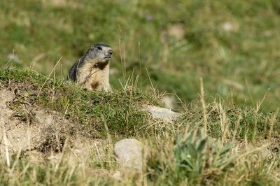
Marmotte sur son terrier - Mireille Coulon - PNE FaunaMarmots
The marmots are some of the permanent inhabitants of the grassland at the alpine level. . The view is very open, the herbaceous food is abundant and the soil sufficiently soft for them to be able to dig their burrows which are necessary for their survival. Although this animal is wild animal, it can become accustomed to the presence of humans and some marmots have started the bad habit of begging for pieces of biscuit from hikers, crisps and apples. Please do not feed them ! These foods, which are unsuitable to their needs, damage their health and survival. Would you think of eating grass in order to survive?
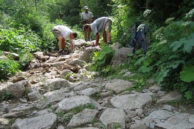
Pavage sur le sentier du Lauvitel - Cyril Coursier - PNE  Know-how
Traditional Paving
The Lauvitel path is often used especially during the summer. To limit the occurrence of erosion linked to the impact of human use but also to water flowing from melting ice or rain water it is covered with traditional paving, maintained thanks to annual restoration.
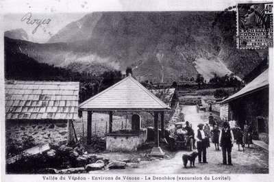
Le hameau de la Danchère - PNE  Architecture
Danchère Hamlet
With its paved lanes, its fountains and its stone wash-house, the Danchère offers an ideal starting point for going to Lauvitel which attracts 30 000 visitors every year. It is one of the numerous hamlets that make up the commune of Vénosc.
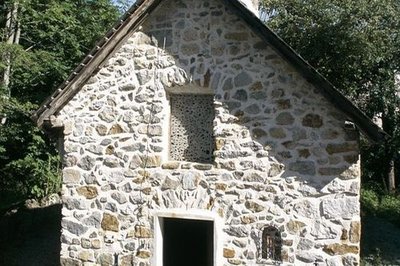
Les décharges de la chapelle de la Danchère - Cyril Coursier - PNE ArchitectureDanchère Chapel
Dedicated to Saint Louis and to Saint Claude, Danchère Chapel displays its agreeable proportions to visitors. The stones forming the arc of a circle above the entrance and the window do not only have aesthetic value. They are rightly called "a relieving structure" because they help to redistribute the weight of the facade on both sides of the openings. In the recess hidden behind wire netting is a ceramic statue of Saint Louis created in the Tarn region.
Forecast
Altimetric profile
Sensitive areas
- Impacted practices:
- Aerial, Aquatic, Land, Vertical
- Sensitivity periods:
- JanFebMarAprMayJunJulAugSepOctNovDec
- Contact:
- Parc national des Écrins.
Golden eagle
- Impacted practices:
- Aerial, , Vertical
- Sensitivity periods:
- JanFebMarAprMayJunJulAug
- Contact:
- Parc National des Écrins
Julien Charron
julien.charron@ecrins-parcnational.fr
Peregrine falcon
- Impacted practices:
- Aerial, Vertical
- Sensitivity periods:
- FebMarAprMayJun
- Contact:
- Parc National des Écrins
Julien Charron
julien.charron@ecrins-parcnational.fr
Short-toed snake eagle
- Impacted practices:
- Aerial,
- Sensitivity periods:
- MarAprMayJunJulAugSep
- Contact:
- Parc National des Écrins
Julien Charron
julien.charron@ecrins-parcnational.fr
Recommandations
The best period for this tour is from mid-June to the end of September, when the Muzelle refuge is open.
Ask about weather and snow levels in the col valley in early summer.
Some sections in the descent towards Lauvitel have handrails and can be tricky in wet weather. The same goes for the paved paths in the descent after Lake Lauvitel, which can sometimes be slippery.

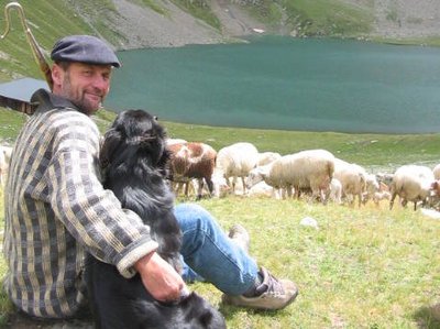
 In mountain pastures, protection dogs are there to protect the herds from predators (wolves, etc.).
When I hike I adapt my behavior by going around the herd and pausing for the dog to identify me.
Find out more about the actions to adopt with the article "Protection dogs: a context and actions to adopt".
Tell us about your meeting by answering this survey.
Information desks

Oisans Park house
45 avenue de la République, 38520 Le Bourg d'Oisans
Video presentation of the natural resources of the Oisans mountain and its crafts. Information, documentation about the Park, projections, reading space for children. Accessible to people with reduced mobility. Free admission. All animations of the Park are free unless otherwise stated.
Access and parking
Access to Bourg d'Arud from Bourg d'Oisans 13 km away along the D 1091 (towards Briançon), then D530 (towards Venosc, then Le Bourg d'Arud and St Christophe en Oisans).
Parking :
More information
Source

Report a problem or an error
If you have found an error on this page or if you have noticed any problems during your hike, please report them to us here: