The L’Argentière-la-Bessée green route ("Voie Verte")
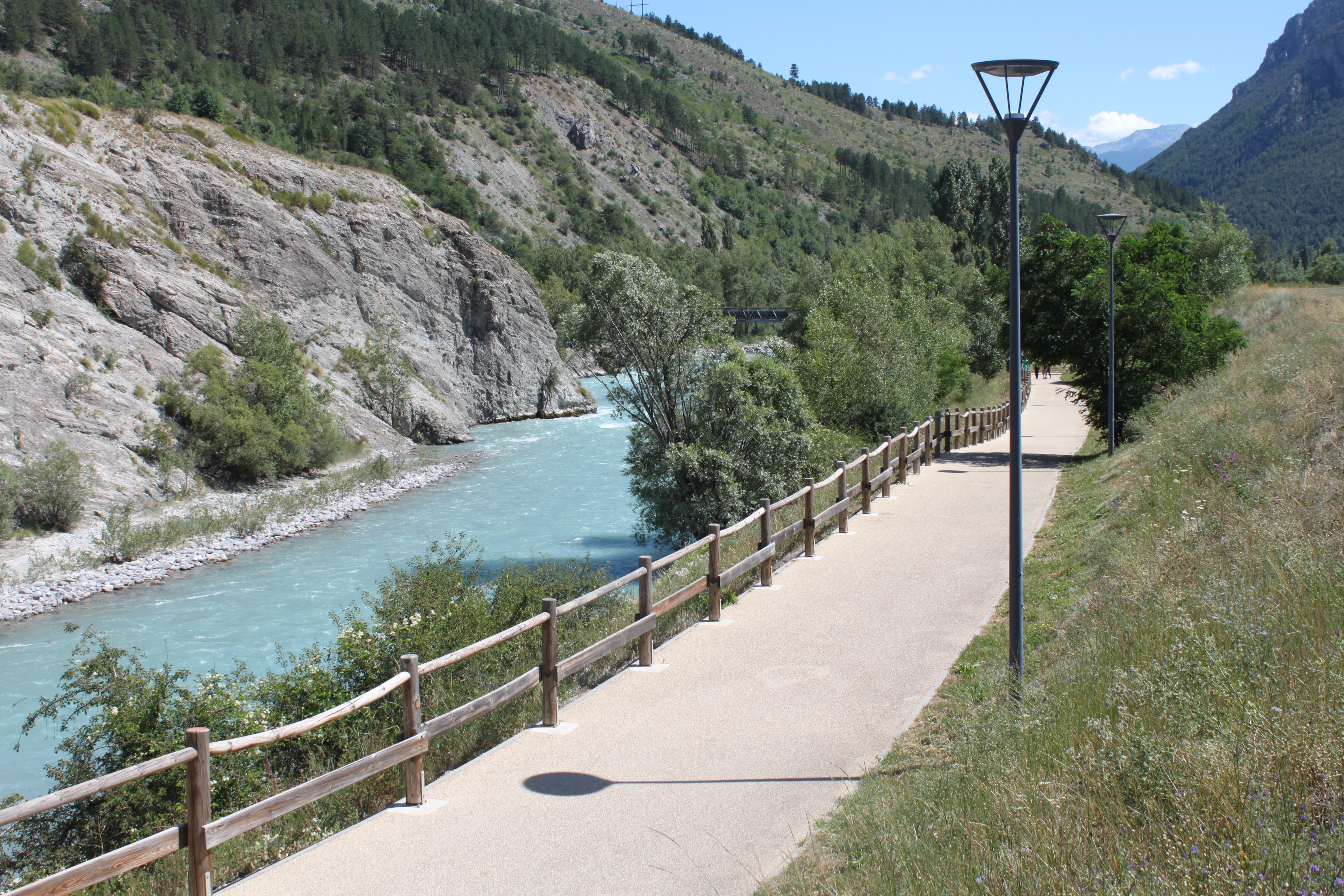
Ideal for the whole family, this very easy route takes you into the two worlds built in the past by L'Argentière-la-Bessée, and which continue to shape its history today. First, on the first part of the route you will discover the industrial history of L'Argentière-la-Bessée with its many now-historical sites as well as buildings still in use today. Then, along the second part of the route, the municipality's sports multiplex with its white water stadium which attracts crowds of people in the summer and stages annual competitions.
Description
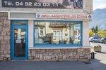
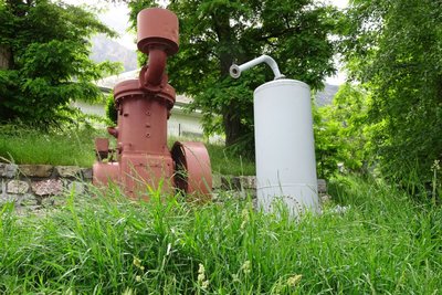
The green route starts near the L'Argentière-la-Bessée information office ("Bureau d'Informations") and the public finance office, on the left-hand bank of the Durance, along a track laid out for pedestrians and mountain bikers. At the beginning of the trail, you can admire a nineteenth century vertical compressor, a historical tool of industry that is an immediate introduction to one of the themes you will encounter on the route.
- Turn right and cross the pedestrian footbridge taking you to the right-hand bank of the Durance and the developed part of the town
- Take the first left after the footbridge and continue straight ahead along a shared track. On your left, you can admire the municipal electricity system and, a few metres further on, the children's play area
- At the end of the pedestrian track, continue straight ahead between two of the municipality's iconic historical industries. On their walls, you will also see information panels telling something of the industrial past of L'Argentière-La Bessée
- After passing these historical buildings, head left and then right to join another pedestrian track following the right-hand bank of the Durance
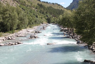
- Cross the pedestrian footbridge spanning the Fournel. You then leave the world of industry behind as you enter a world of sport with the presence of numerous sporting amenities, including the well-known white water stadium.
- Go along the edge of the campsite on the banks of the Durance, until you come to the local road and a bridge, the Pont de Chancel
- Turn back on yourself and follow the same route back to your starting point
- Departure : Tourist information office ("Bureau d’Information Touristique") in L’Argentière-la-Bessée
- Arrival : Tourist information office ("Bureau d’Information Touristique") in L’Argentière-la-Bessée
- Towns crossed : L'Argentière-la-Bessée
7 points of interest
Le compresseur vertical - Office de tourisme Pays des Écrins  History
The vertical compressor
In 1910, a 22-year-old engineer, Gilbert Planche arrived in L'Argentière-La Bessée to take advantage of the water here and open a large aluminium factory.
The vertical compressor is the forerunner of the pneumatic drill. The mine operators needed a large quantity of coal and compressed air helped to accelerate coal output. In 1852, Swiss physicist Jean-Daniel Colladon invented the pneumatic drill. The vertical compressor enabled the production of compressed air which powered a drill and simplified coal excavation. The compressor is placed vertically on its support, hence its name.
Louis Leprince-Ringuet et L'Argentière - Office de tourisme du Pays des Écrins  History
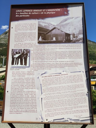
Louis Leprince-Ringuet and L'Argentière
Louis Leprince-Ringuet was the director of the Physics Laboratory of X ("X" being a polytechnic school in Villeurbanne) established in L'Argentière. During the summer of 1942, he took in several Jewish students, thus saving them from the Nazis and deportation to Auschwitz. A panel presents the discoveries made by Louis Leprince-Ringuet in this laboratory. A text by Bernard Lévi is also displayed. As a young Jewish student, he took part in research at the laboratory during the summer of 1942. In it he thanks the scientific team for helping him to escape the anti-Semitic barbarism.
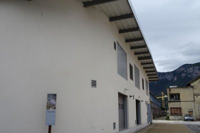
Anciennement l'usine Péchiney - Office de tourisme Pays des Écrins  History
The Péchiney factory
This French electro metal company established itself in L'Argentière in 1907. The construction of the aluminium factory started in 1909 and it opened its doors in 1910, powered by the electricity plant built by Gilbert Planche. With it, L'Argentière became an industrial town. The economic crisis of the 1970s and the rise of foreign sources of supply led to the factory's closure in 1985. It was partially demolished in 1988. The workers left the town and in order to prevent the abandonment of L'Argentière, a restructuring project was launched.
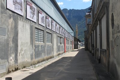
Anciennes industries de L'Argentière-la-Bessée - Office de tourisme du Pays des Écrins  History
Former industrial area of L’Argentière-la-Bessée
On the two walls of these now-disused industrial structures, you can read the history of L’Argentière-la-Bessée. The town is marked by its industrial past, in particular by the presence of a hydroelectric power station built between 1907 and 1909 to harness the power of the mountain waterfalls. At the time, it was the most powerful power station in Europe. Other industries were also established here, like the Société du Quartz Fondu fused quartz works and the aluminium factory which provided livelihoods for a large number of workers.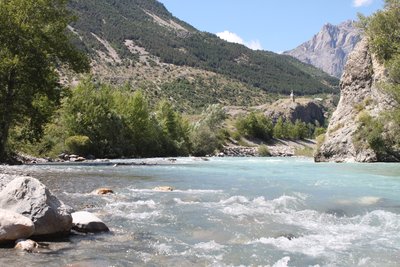
La Durance - Office de tourisme du Pays des Écrins  Water
WaterThe Durance
The Durance is the biggest river in Provence. Its source rises in the municipality of Montgenèvre at an altitude of 2,390 metres, and it flows down to meet the Rhône to the south of Avignon. This is a "pluvio-nival" river, that is to say, its flow depends on the natural addition of water due to snowmelt and rainfall. It thus constitutes a real playground for kayakers from across Europe.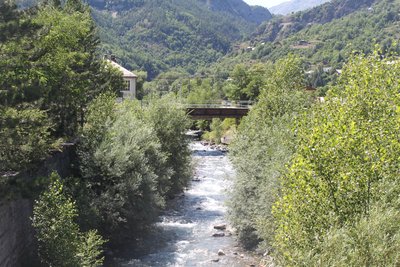
Le Fournel - Office de tourisme du Pays des Écrins  Water
WaterThe Fournel
The source of the Fournel rises in the Fournel valley, in the heart of the Parc National des Écrins, and flows into the Durance near the white water stadium. It is known as a high alpine canyon offering lots of sport and leisure possibilities, and is the most popular in the Haut Val Durance. It is ideal for an introduction to vertical activities, in particular thanks to the presence of several jumps, toboggan runs and rappel sites. Access is authorised from April to October and is regulated because it is located upstream from an EDF water intake, which presents a real hazard.
Stade d'eau vive - Office de tourisme du Pays des Écrins  Water
WaterThe white water stadium
As part of its restructuring after the closure of the industrial site, the town of L'Argentière-la-Bessée opted for sports tourism, exploiting the natural elements present on the site, that is to say, water. Standing at the beginning of the longest navigable section of the Durance river, in 1993 the municipality decided to establish itself as a major white water centre by creating this stadium which covers a 400-metre stretch. So thanks to its reputation and its ideal situation, every year this stadium hosts several elite competitions at national and international level.
Forecast
Altimetric profile
Sensitive areas
Short-toed snake eagle
- Impacted practices:
- Aerial,
- Sensitivity periods:
- MarAprMayJunJulAugSep
- Contact:
- Parc National des Écrins
Julien Charron
julien.charron@ecrins-parcnational.fr
Recommandations
Rescue services contact details: Secours Montagne (Mountain Rescue): +33 (0)4 92 22 22 22 or 112
Take your litter homeInformation desks
23 Avenue de la République, 05120 L'Argentière-La Bessée
Vallouise Park house
, 05290 Vallouise
Information, documentation, models, exhibitions, screenings, product sales and works of the Park. Guided tours for school, reservation required. The new Park House opened in Vallouise since June 1, and offers visitors an interactive permanent exhibition inviting to explore the area and its heritage. A temporary exhibition space will allow a renewed offer. Finally, the device is completed by an audiovisual room to organize screenings and conferences Free admission. All animations of the Park are free unless otherwise stated.
Transport
Public transport >> www.pacamobilite.fr
Consider car-sharing >> www.blablacar.fr
For more information, ask at the Tourist Information Office nearest to the trail starting point.
Access and parking
Parking :
Accessibility
- Accessibility level :
- Beginner
- Emergency number :
- 114
Source

Report a problem or an error
If you have found an error on this page or if you have noticed any problems during your hike, please report them to us here:

