
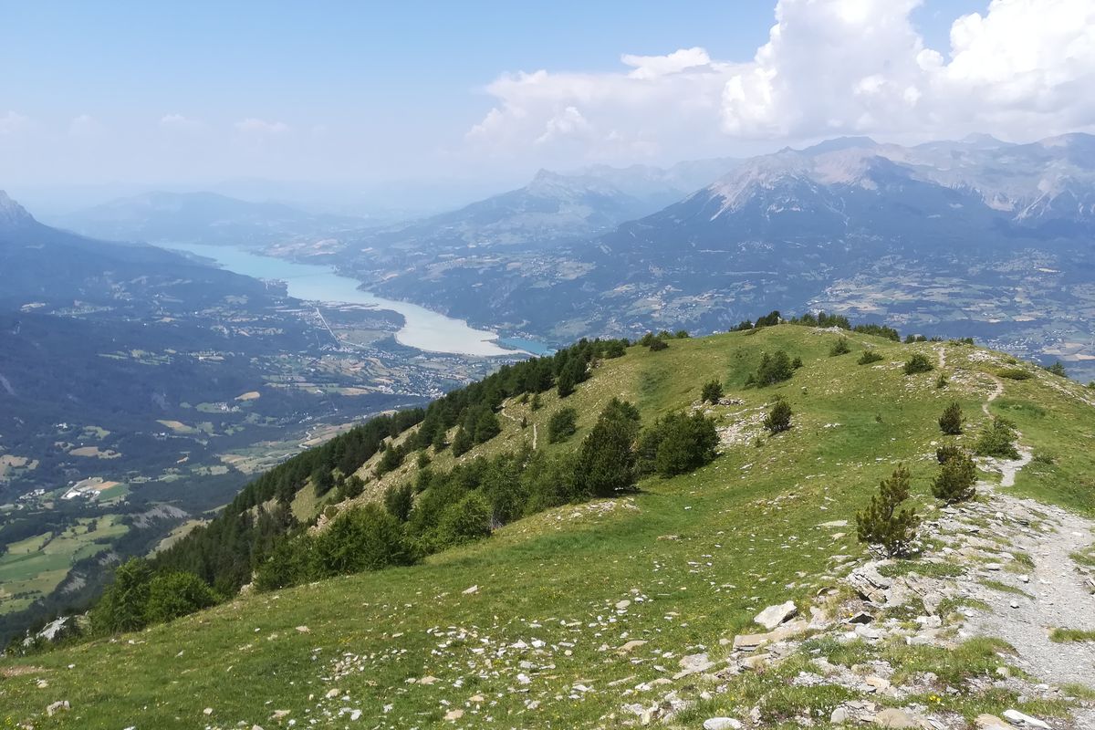
Le Méale
 Medium
Climb up to the peak of St-Sauveur, called Le Méale. At 2,426 metres above sea level, the 360° view will leave you speechless! To get there, you start out gently through the forest of Le Méale and pass through the state-owned forest of Pouzenc. From here, you have a beautiful climb ahead of you, through flower-filled areas. You cannot fail to be moved by this adventure, with unique vantage points over the valleys of Crévoux, Les Orres and the Durance.
Important information
Dans le Parc national des Écrins, les sentiers sont généralement praticables de la mi-juin à fin septembre.
Toutefois, les périodes d'accessibilité des itinéraires et les dates de pose des passerelles varient d’une année à l’autre en fonction de l’enneigement, des dégâts survenus en hiver et des conditions météorologiques. Par ailleurs, l’état des sentiers n’est pas contrôlé quotidiennement et peut évoluer rapidement après un évènement météorologique (orage, crue...). Il est nécessaire de se renseigner auprès des maisons du parc national et des offices de tourisme du territoire avant votre sortie. Pendant la randonnée, en cas de passage dégradé ou dangereux, faites demi-tour et signalez-le.
Description
From the car park, turn left onto the road. At the bend, take the track on the left towards the path to Le Méale ("Sentier du Méale"). At the next intersection, stay on the uphill track. Go past the three channelled springs and head towards Les Orres. Enter the state-owned forest of Pouzenc.
- After a few hundred metres, when you come to some stones and a gate, take the path on the left (sign with a white arrow). At the crossroads, follow signs for Crévoux. When you come to the track, go right towards Le Méale and follow the track running uphill. At the hamlet of Le Serre, turn left.
- Finally, at the place called « Croix-Pierre », turn left. Follow the path right and this brings you to the top of Le Méale. From here, loop around to the crossroads at the place called « Croix de Serre ». Join the path on the right which brings you back to « Crête du Méale ». At the sign, turn left. At the « Piste de la Plâtrière », head towards the forest car park. On the way, turn right. In Les Clotasses, take the path on the left leading to the car park.
- When you come to the picnic tables, take the path on the left. At « La combe Noire » ,head to Les Gaillards following the GRP (regional long-distance trail) route.
- Departure : Hamlet of Les Gaillards, St Sauveur
- Arrival : Hamlet of Les Gaillards, St Sauveur
- Towns crossed : Saint-Sauveur, Les Orres, and Crévoux
Forecast
Altimetric profile
Recommandations
This route leads through areas exposed to the sun: hats and water bottles are recommended.
Information desks
Tourist office Embrun
Place Général Dosse - BP 49, 05202 Embrun
October to march : Monday to Saturday, 9.00 - 12.30 & 13.30 - 17.00.
April, may, june & september : Monday to Saturday, 9.00 - 12.30 & 14.30 - 18.00
July and August : Monday to Saturday, 9.00 - 19.00. Sundays, 10.00 - 12.30 & 16.00 - 19.00
On French national holidays (except 14th of July and 15th of August) : 9am to 1pm. Closed on the 1st of January, 1st of May, 25th December and 11th November
Closed on Thursdays outside French holidays’ periods
Transport
Public transport: www.pacamobilite.fr
Consider car-sharing: www.blablacar.fr
Access and parking
From the roundabout in the Baratier retail centre, head towards Baratier and follow signs for Crévoux. Carry on until you come to the hamlet of Les Gaillards.
Parking :
More information

Source

Report a problem or an error
If you have found an error on this page or if you have noticed any problems during your hike, please report them to us here: