
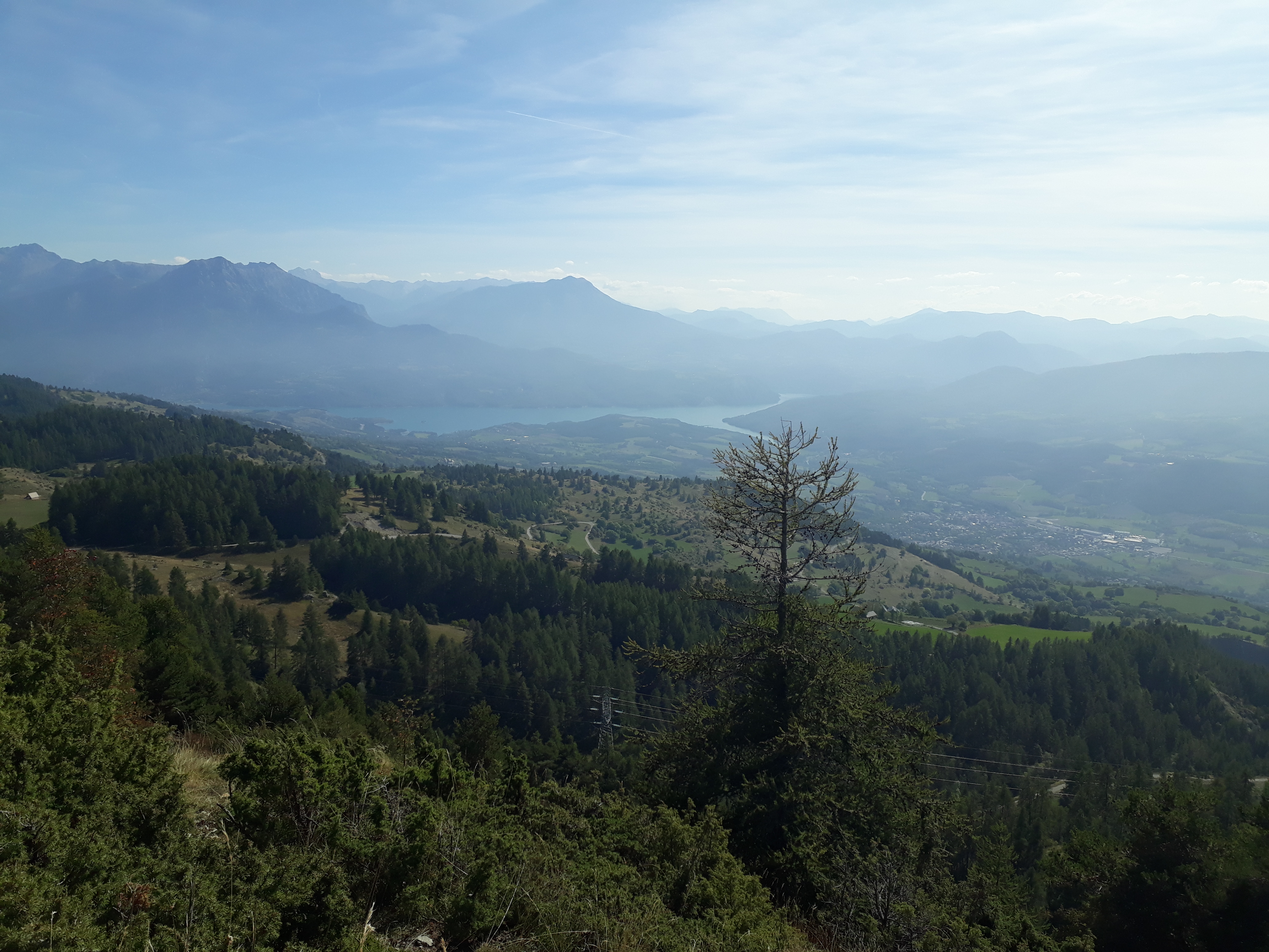
The slopes of Chorges
 Medium
Important information
Dans le Parc national des Écrins, les sentiers sont généralement praticables de la mi-juin à fin septembre.
Toutefois, les périodes d'accessibilité des itinéraires et les dates de pose des passerelles varient d’une année à l’autre en fonction de l’enneigement, des dégâts survenus en hiver et des conditions météorologiques. Par ailleurs, l’état des sentiers n’est pas contrôlé quotidiennement et peut évoluer rapidement après un évènement météorologique (orage, crue...). Il est nécessaire de se renseigner auprès des maisons du parc national et des offices de tourisme du territoire avant votre sortie. Pendant la randonnée, en cas de passage dégradé ou dangereux, faites demi-tour et signalez-le.
Description
- Follow the La Montagne shepherd’s road for 200 m.
- Turn right onto a path that cuts two hairpins in the road.
- Head uphill towards the Gontards sheepfold. Turn right, cross a pass and descend into a cultivated area. Climb the track on the left, turn right, pass the serre du Corbeau, descend to the Forest des Berthiers and continue on the uphill track to the forest road.
- Ascend to the crossroads with the Route de la Montagne at the place known as "Jardin des Gardes". Shorter option (2 hrs): descend to the left, take a left fork and head for Les Gontards.
- Pass to the right of the metal gate. Leave the Col de la Gardette path and follow the track to a stone hut on the left in a paddock. Turn left into the paddock and walk down the path that runs alongside the road. At the bottom, cross a cattle assembly yard, cross the stream and then a torrent and climb a stony path. After a balcony walk (the panorama extends as far as Mont Ventoux), at the end of the path, descend to the left into the undergrowth, turn left then right to find a path that leads to a footpath.
- Go down it on the left to a path. Head left towards the hut, cross the Réallons stream and climb up to the shepherd’s road. Descend to the Gontards crossroads. Turn right at two bends in the road to reach the car park.
- Departure : To the right, at the end of the tarmac road (7 km from Chorges)
- Arrival : To the right, at the end of the tarmac road (7 km from Chorges)
- Towns crossed : Chorges
1 point of interest

 Fauna
Fauna"Piolit-Pic de Chabrières" Natura 2000 site
(Le Piolit 2664m, les aiguilles de Chabrières 2403m)
These grasslands, scree slopes and forests are home to rare and protected species such as the Fox-tail Milkvetch and the Potentilla delphinensis (for plants), the Jersey Tiger, the Rock partridge, the Greater Horseshoe Bat, the White-clawed crayfish, the red frog and the golden eagle (for animals).
Forecast
Altimetric profile
Recommandations
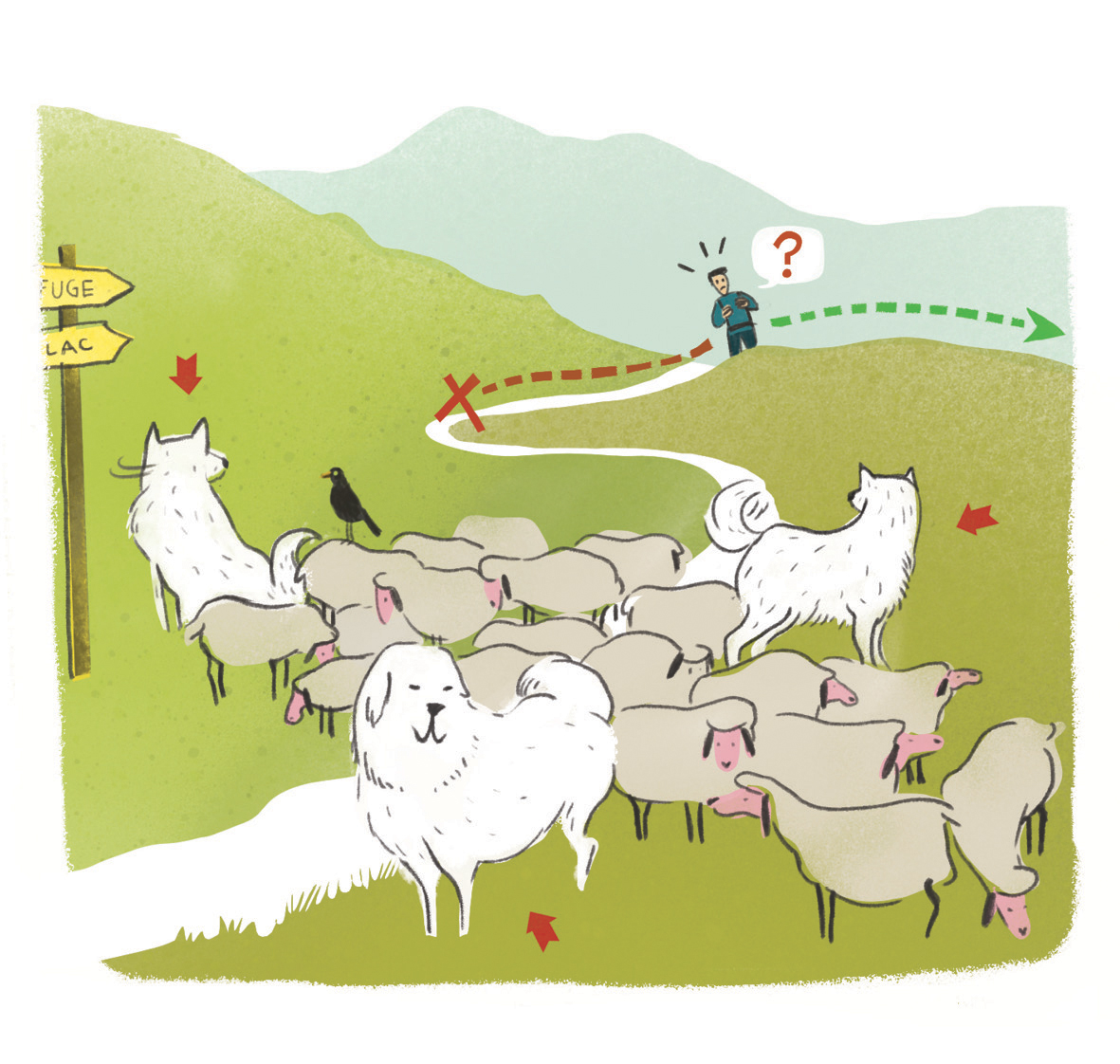 In mountain pastures, protection dogs are there to protect the herds from predators (wolves, etc.).
When I hike I adapt my behavior by going around the herd and pausing for the dog to identify me.
Find out more about the actions to adopt with the article "Protection dogs: a context and actions to adopt".
Tell us about your meeting by answering this survey.
Information desks

Tourist office Chorges
Grand rue, 05230 Chorges
October to may : Monday to Saturday, 9.00 - 12.30 & 13.30 - 17.00.
April, may, june & september : Monday to Saturday, 9.00 - 12.30 & 14.30 - 18.00
July and August : Monday to Saturday, 9:00 – 12.30 & 14.30 – 19.00 Sunday 9.30 – 12.30
Closed on Thursdays outside French holidays’ periods
Closed on French national holidays, except 14th of July and 15th of August
Access and parking
Parking :
More information

Source

Report a problem or an error
If you have found an error on this page or if you have noticed any problems during your hike, please report them to us here: