
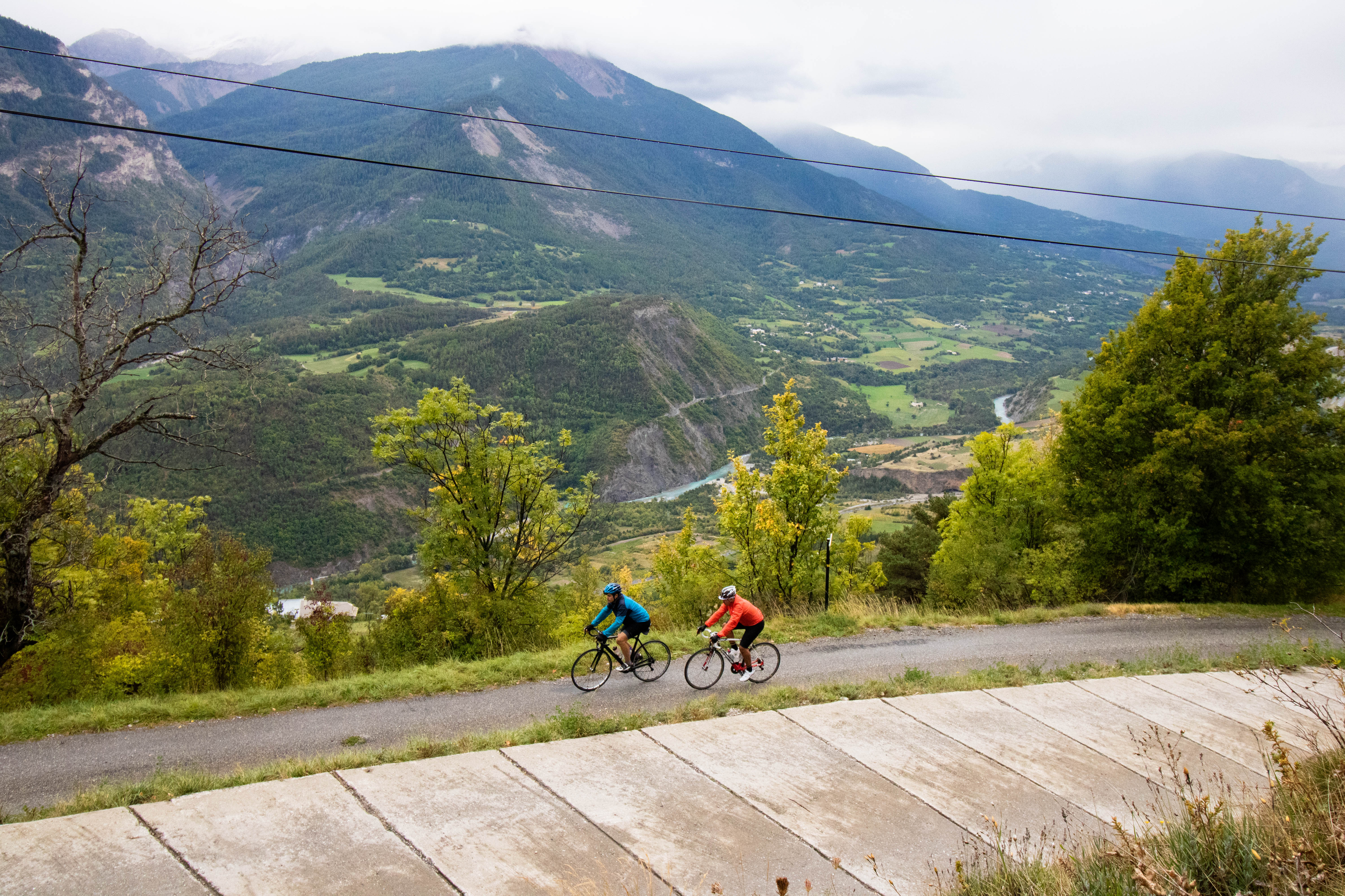
The balconies of Saint-Marcellin
 Easy
This route requires a little physical effort on the first ascent. But the reward will be great, with a panoramic view of the Embrunais mountains and the foothills of the Ecrins massif. The route takes you along narrow roads overlooking the Durance valley. Your camera will be busy!
For your information: after Serre Buzard, there is an 800 m descent on a stony track. Stay focused or tackle this section on foot.
Important information
Dans le Parc national des Écrins, les sentiers sont généralement praticables de la mi-juin à fin septembre.
Toutefois, les périodes d'accessibilité des itinéraires et les dates de pose des passerelles varient d’une année à l’autre en fonction de l’enneigement, des dégâts survenus en hiver et des conditions météorologiques. Par ailleurs, l’état des sentiers n’est pas contrôlé quotidiennement et peut évoluer rapidement après un évènement météorologique (orage, crue...). Il est nécessaire de se renseigner auprès des maisons du parc national et des offices de tourisme du territoire avant votre sortie. Pendant la randonnée, en cas de passage dégradé ou dangereux, faites demi-tour et signalez-le.
Description
- From the centre of the village, head north and pass over a stream. Continue on the D994h (Route d'Italie) then climb left towards Saint-Marcellin. Follow the "Coins du Monde" sign through the village.
- The ascent is gradual and becomes gentler as you approach the hamlet of Serre Buzard. Stay on the main road, which narrows as it runs alongside the houses and reaches a cross at a fork in the road.
- Now take a small track that descends to the right. The surface is not always smooth, so walk carefully down this section. Reach the Béguê fairly quickly, where the tarmac is more pleasant to ride on.
- Cross the hamlet of La Touisse and glide down to Fontfourane.
- Continue to Route d'Italie then return to Châteauroux-les-Alpes.
- Departure : Town centre car park, Châteauroux-les-Alpes
- Arrival : Town centre car park, Châteauroux-les-Alpes
- Towns crossed : Châteauroux-les-Alpes
Forecast
Altimetric profile
Information desks
Tourist office Embrun
Place Général Dosse - BP 49, 05202 Embrun
October to march : Monday to Saturday, 9.00 - 12.30 & 13.30 - 17.00.
April, may, june & september : Monday to Saturday, 9.00 - 12.30 & 14.30 - 18.00
July and August : Monday to Saturday, 9.00 - 19.00. Sundays, 10.00 - 12.30 & 16.00 - 19.00
On French national holidays (except 14th of July and 15th of August) : 9am to 1pm. Closed on the 1st of January, 1st of May, 25th December and 11th November
Closed on Thursdays outside French holidays’ periods
Transport
From Gap or Embrun:
- Zou! network : Line 69 / Frequency : 5 times a day
More information: https://zou.maregionsud.fr
Access and parking
Follow the N94 from Gap or Embrun towards Briançon then Châteauroux-les-Alpes.
Parking :
More information

Source

Report a problem or an error
If you have found an error on this page or if you have noticed any problems during your hike, please report them to us here: