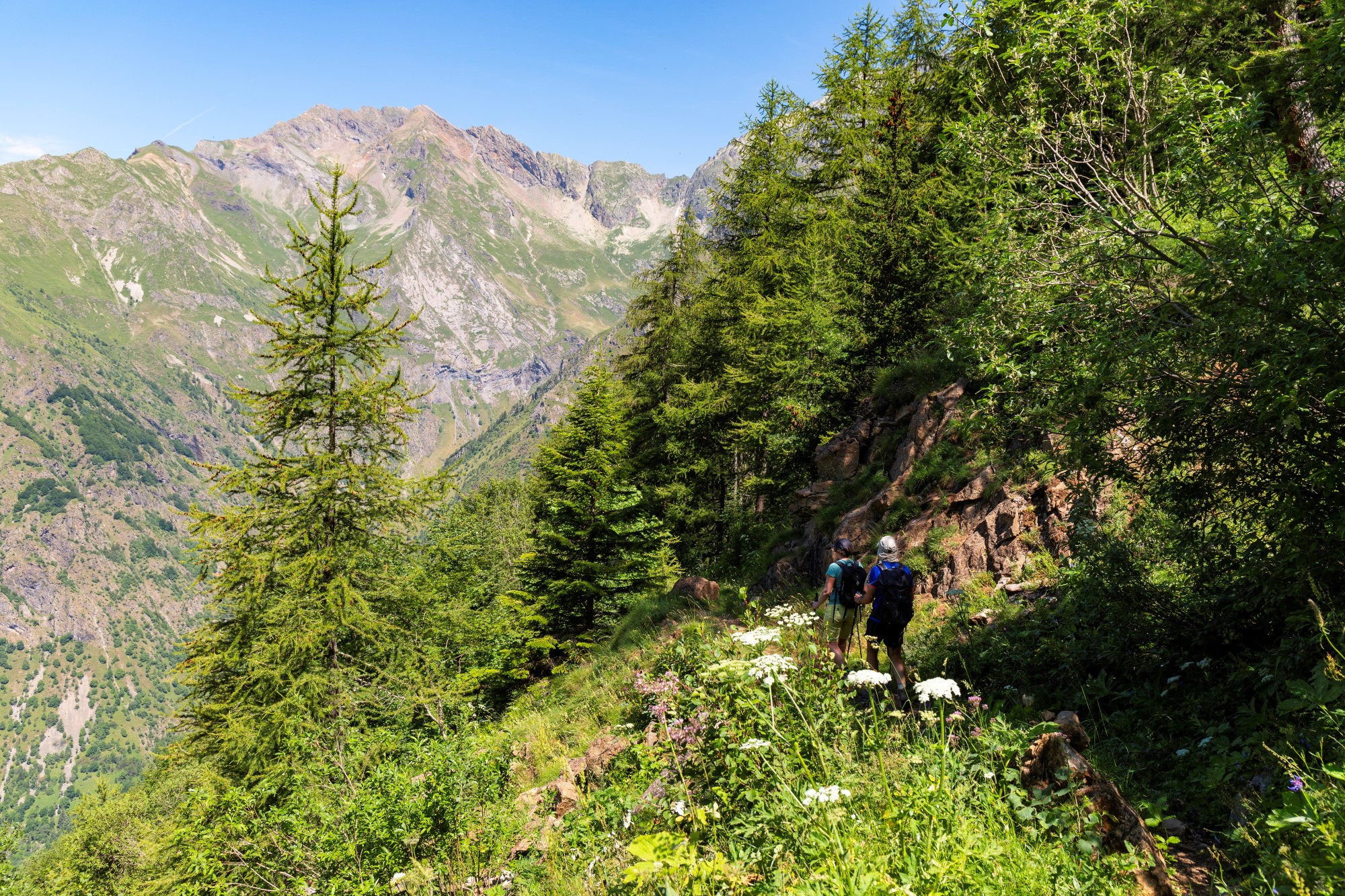
Combe Oursière
”Early in the morning, everything is quiet in the Combe Oursière valley. After making our way through a larch forest with its shimmering colours, and then crossing calluna heaths that turn red in autumn, we arrive in a stonier world. At the bottom of the corrie, chamois graze peacefully on the scree herbs."
Marion Digier, regional park keeper in Valbonnais
Important information
Dans le Parc national des Écrins, les sentiers sont généralement praticables de la mi-juin à fin septembre.
Toutefois, les périodes d'accessibilité des itinéraires et les dates de pose des passerelles varient d’une année à l’autre en fonction de l’enneigement, des dégâts survenus en hiver et des conditions météorologiques. Par ailleurs, l’état des sentiers n’est pas contrôlé quotidiennement et peut évoluer rapidement après un évènement météorologique (orage, crue...). Il est nécessaire de se renseigner auprès des maisons du parc national et des offices de tourisme du territoire avant votre sortie. Pendant la randonnée, en cas de passage dégradé ou dangereux, faites demi-tour et signalez-le.
Description
From the car park, take the track up to the Béranger valley as far as the edge of the Ecrins Park. At the National Park entrance panel is a place where tree trunks are kept, which is the starting point for a path running parallel with the track. Follow the path for about a hundred metres, then take the right-hand fork to cross Bot wood. The path runs under a rocky bar and twists and turns its way up to the Draire river gorge. The landscape then opens up, the forest giving way little by little to more isolated trees and lower-lying vegetation. At the crossroads with the Echarennes valley, turn right onto the path taking you up to the top of the Combe Oursière valley. After the half-barrel cabin, you can continue on across the valley along a small path that keeps to the same level. The path leads to the panorama over Pré Chrétien. You follow the same route on the way back.
- Departure : Village of Valsenestre, Valjouffrey
- Towns crossed : Valjouffrey
12 points of interest
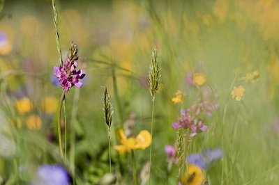
Prairie de fauche - Marc Corail - PNE  Flora
FloraNatural Hayfields
Agricultural specialists consider a meadow as natural if it has not been ploughed or fertilised over the last ten years. This is the case for those that you will see, surrounded by hedges, at the start of the hike. The meadows have an important variety of plant life and consequently attract multitudes of pollinating insects, including domesticated bees of course.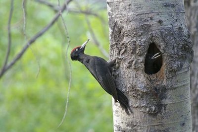
Pic noir et ses petits au nid - Jean-Philippe Telmon - PNE  Fauna
FaunaBlack woodpecker
As you make your way through forest of Le Bot and on to the Cabane de Combe Oursière, you may well hear the alarm call of the black woodpecker, and the « kru kru kru kru» sound it makes when it flight. This strange black bird with a red crown is the biggest woodpecker in the Alps. It prefers forests with large, widely spaced trees, carving out its nest in the trunk. There are a number of reasons for his incessant hammering on the trunk: to attract a female, to defend his territory and also to dislodge bark beetles or carpenter ants.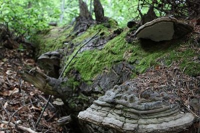
Arbre mort - PNE FloraAllowing trees to grow old
As part of the Natural 2000 network, the municipality of Valjouffrey is committed to preserving its old trees, to help maintain biodiversity in the forest. In fact, in order for a forest to be rich and diversified, it is very important that it retains its old trees and the dead wood lying on the ground. The rangers of the Parc National Des Écrins and officials of the French national forestry agency have marked more than 500 trees in the municipality for this purpose. As you pass through the Forêt du Bot, you might come across trees marked with a little plaque reading « arbre conservé pour la biodiversité » (tree preserved for biodiversity).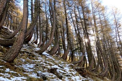
Mélèzes "en crosse" - Bernard Nicollet - PNE Flora"Crosier" shaped larch trees
Some beautiful crosier-shaped larch trees can be seen from the path. In winter, in steeply sloping areas, the blanket of snow exerts pressure on the base of the tree trunks. The curved shape of the larch is due to its adaptation to the pressure exerted by the snow. On very steep slopes, this morphological adaptation can make it fragile however. Larches are the "pioneer" trees of the mountains. They are capable of colonising hostile environments such as screes and debris cones. They are laying the groundwork for the future forest.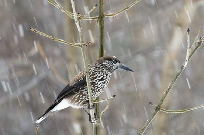
Casse-noix moucheté sous la neige - Mireille Coulon - PNE FaunaSpotted nutcracker
“Kre kre kre”… From the top of a larch tree, a chocolate brown bird spotted with white takes flight, loudly protesting with a harsh, raucous caw. With its powerful beak, the nutcracker shells hazelnuts and removes the seeds from pine cones (Swiss pine and mountain pine). Starting in early summer, he busies himself preparing provisions for the winter and following spring... The bird has a good memory because he finds almost all of his caches even though they are very carefully hidden.
 History
The “Combe of the Bears”
The name « Combe Oursière » is thought to refer to the presence of bears in the small valley. In 1800, there were 26 to 30 bears still living in L'Oisans and its region. The last known bears around Valsenestre were thought to have retreated in the last century towards La Morte and Lavaldens, and the last of them is thought to have been killed above Livet. The last reliable sighting of a bear in the Alps is thought to have been in 1937, in Le Vercors. Geology and geography
Ripple marks
At first sight rather boring, this term describes pretty designs left behind by the waves or current on the sea bed. They are elongated, parallel and evenly spaced ripples, seen in sandy sediments and caused by water. The ripple marks of Combe Oursière are not easy to see because they are hidden by vegetation, but they offer us a glimpse of a distant past when this area was under water.- History
Reforestation of mountain land
On day in 1843, at four o'clock in the morning, an avalanche thundered down the Combe Oursière and engulfed the village. Only five houses were spared. As in many other valleys, the lack of trees had allowed the snow to start slipping. In 1895, the government purchased municipal land with the aim of reforesting it, thereby protecting the hamlet of Valsenestre The mounds visible at the top of the valley are signs of this work which involved reforestation and the maintenance of tree plantations. This continues to this day, under the auspices of the Mountain Land Rehabilitation agency. 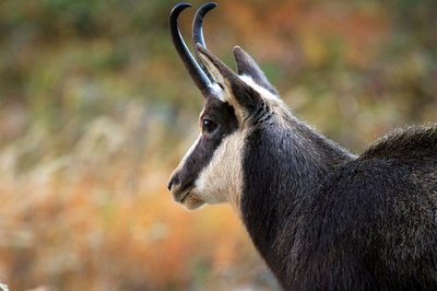
Chamois mâle - Christophe Albert - PNE FaunaChamois
From dawn, chamois can commonly be observed in this valley. A scientific monitoring operation called « IPS » (walking population count index) is carried out in this area by Park rangers. Some twenty or so circuits are walked every year across the park and the results are used to calculate this index. It is based on the average number of animals observed on a given route, which is walked several times. The aim of this protocol is to assess changes in the chamois populations.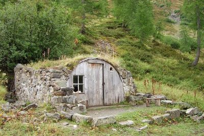
Cabane de Combe Oursière - Marion Digier - PNE HistoryHalf-barrel cabin of Combe Oursière
This cabin is a former worksite cabin dating from the 1950s. It stands on the site of a ruin, which itself dates from the time of the first reforestation operations, and is known as« le chalet »,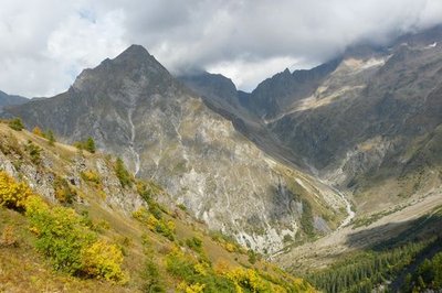
Col de la Muzelle versant sud depuis le sentier des Echarennes - Marion Digier - PNE  Panorama
Vantage point overlooking the Courbe glacier
As the path leads onto the ridge, a panorama opens up before you, stretching from the ridges of L'Arcanier to the west to the Pic des Marmes to the east. Between the Col de la Muzelle and the Peak des Marmes, in the distance you can make out the comma shape of the Courbe glacier. This glacier is one of 27 key glaciers monitored by the Parc National to assess their evolution. Photo-observation monitoring is carried out on this site at 3-yearly intervals. For other glaciers like the Glacier Blanc in Vallouise, much more detailed monitoring operations are carried out every year.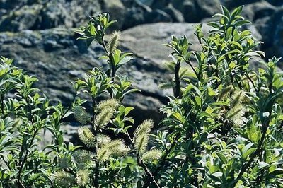
Saule glauque et soyeux - Bernard Nicollet - PNE FloraSilky or Alpine grey willow
On the screes, on either side of the path leading to the Pré Chrétien vantage point, thickets of willow can be seen. They are bluish-green in colour and are silky to the touch. It is quite easy to recognise this willow, although it is a protected species native to the Alps. It only grows on north-facing slopes of crystalline massifs, in relatively bare combes and ravines and screes.
Forecast
Altimetric profile
Sensitive areas
Golden eagle
- Impacted practices:
- Aerial, , Vertical
- Sensitivity periods:
- JanFebMarAprMayJunJulAug
- Contact:
- Parc National des Écrins
Julien Charron
julien.charron@ecrins-parcnational.fr
Recommandations
Bivouac area for hikers 500 m upstream from the village of Valsenestre. Camping is forbidden by local decree in the rest of the Valjouffrey area.

Information desks

Maison du Parc du Valbonnais
Place du Docteur Eyraud, 38740 Entraigues
Reception, information, temporary exhibition room, reading room and video-projection on demand. Shop: products and works of the Park. Free admission. All animations of the Park are free unless otherwise stated.
Transport
Bus from La Mure to Entraigues (Transisere - line 4120). Change at "Entraigues Place" for the local Valjouffrey service (local bus for 8 passengers) to Le Désert-en-Valjouffrey.
Access and parking
At Entraigues, take the D117 towards "Valjouffrey". Before the Chapelle-en-Valjouffrey bridge, follow the road going up to the left. The village of Valsenestre is at the end of the road.
Parking :
Source

Report a problem or an error
If you have found an error on this page or if you have noticed any problems during your hike, please report them to us here: