Chemin de la Durance
You are plunged into nature from your very first steps along the path, passing close to agricultural fields offering unobstructed views of the landscape. The highlight of this trail is the Herbonne plateau, also known as the glacial rock. Your explorations continue as you make your way to the Chapelle St-James and the Durance.
Important information
Dans le Parc national des Écrins, les sentiers sont généralement praticables de la mi-juin à fin septembre.
Toutefois, les périodes d'accessibilité des itinéraires et les dates de pose des passerelles varient d’une année à l’autre en fonction de l’enneigement, des dégâts survenus en hiver et des conditions météorologiques. Par ailleurs, l’état des sentiers n’est pas contrôlé quotidiennement et peut évoluer rapidement après un évènement météorologique (orage, crue...). Il est nécessaire de se renseigner auprès des maisons du parc national et des offices de tourisme du territoire avant votre sortie. Pendant la randonnée, en cas de passage dégradé ou dangereux, faites demi-tour et signalez-le.
Description
From the car park, turn right. Follow the road-side and turn left towards Les Baumes.
- Go under the Les Eygas bridge, and then follow the path on the left heading towards Rabioux. From the path, join a track and continue past the houses. At the next crossroads at « Serre des Gayes », go right towards « Le Rabioux ». When you reach the fields lower down, follow the path leading uphill. Continue to head towards Rabioux and go past the interpretation trail ("sentier d'interprétation"). As you emerge from the forest, where the track reaches the fields turn left at the intersection.
- After a few metres, take the road on the right. From here, head towards Le Rabioux.
- Go along the road-side and then, at the Herbonne plateau, take the track on the left and carry on towards the chapel of Saint James. Just before this, follow the path running downhill to the left towards Le Rabioux. For the return stretch, go across the Pont de Eygas.
- Departure : Former SNCF railway station, Châteauroux-les-Alpes
- Arrival : Former SNCF railway station, Châteauroux-les-Alpes
- Towns crossed : Châteauroux-les-Alpes
3 points of interest
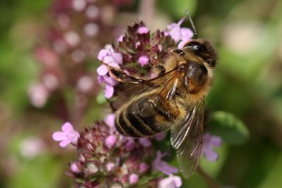
Abeille domestique - Corail Marc - PNE  Fauna
FaunaThe honey bee
The honey bee is also known as the mouche à miel, or honey fly. It lives in colonies formed by a complex structure of social castes. There is a queen and workers which collect pollen on the hairy receptacles located on the back of their hind legs, forming a sort of pollen «basket». It is through this work that the honey bee is able to make honey, which is its food. Vital for plant pollination, the bee is capable of visiting up to 250 flowers in one hour.
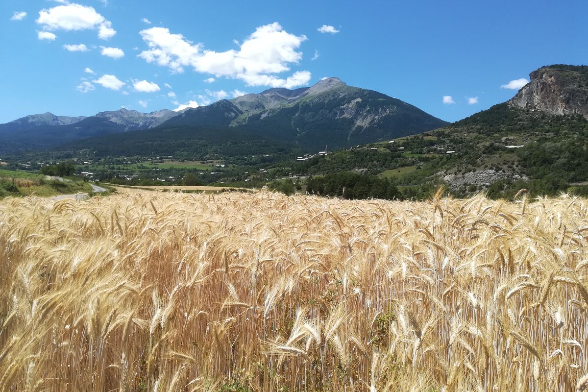
Terasses Fluvioglaciaire du plateau d'Herbonne vue de loin - Pascal Saulay - PNE  Geology and geography
The Herbonne plateau
This plateau is representative of glaciofluvial terraces. They form a tabular promontory, bounded by vertical walls formed in the cemented glaciofluvial materials, at the foot of which the Le Rabioux mountain stream flows on one side and the Durance on the other. This glacial rock is a typical formation of the Haute-Durance valley, similar to the Roc d'Embrun or that of Mont-Dauphine. Its formation dates back to one of the last ice ages (100,000 years ago). At that time, the Durance glacier occupied the entire valley. Today, on its sedimentary rock base, the Roc is covered by vegetation which is highly characteristic of steppe grasslands.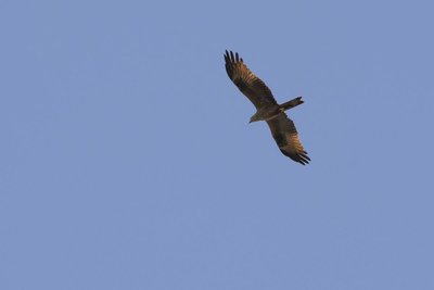
Milan Royal en vol - Mireille Coulon - PNE FaunaRed kite
The red kite is a medium-sized bird of prey with a wingspan of up to 1.6 metres. In flight, the red kite can easily be recognised by its slender silhouette and its deeply forked tail. It has contrasting russet-brown and white plumage. Its diet is a relatively eclectic, made up of rodents, reptiles and invertebrates. It is also a willing scavenger. It is for this reason that red kites can sometimes be seen in large number near landfill sites, and often in the company of black kites.
Forecast
Altimetric profile
Sensitive areas
Short-toed snake eagle
- Impacted practices:
- Aerial,
- Sensitivity periods:
- MarAprMayJunJulAugSep
- Contact:
- Parc National des Écrins
Julien Charron
julien.charron@ecrins-parcnational.fr
Information desks

Maison du Parc de l'Embrunais
102 rue Saint-Irénée, 05380 Châteauroux-les-Alpes
Information, documentation, exhibition, screenings, products and books of the Park. Accessible to people with reduced mobility. Free admission. All animations of the Park are free unless otherwise stated.
Transport
Public transport: www.pacamobilite.fr
Consider car-sharing: www.blablacar.fr
Access and parking
From Embrun, on the D94 main road, take the "Chateauroux-les-Alpes - Les Écrins" exit and park outside the former SNCF train station, at « Les Peschiers ».
Parking :
Accessibility
- Emergency number :
- 114
More information
Source

Report a problem or an error
If you have found an error on this page or if you have noticed any problems during your hike, please report them to us here: